Partly cloudy with falling temperatures for Chicago area Tuesday
A dry cold front will march through the region on Tuesday, creating cooler air and changing the airflow near the lakefront.
Watch CBS News
A dry cold front will march through the region on Tuesday, creating cooler air and changing the airflow near the lakefront.
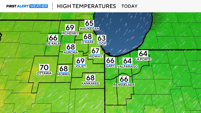
This week's highs will be in the 60s, and some areas may reach the 70s for the first time this year.
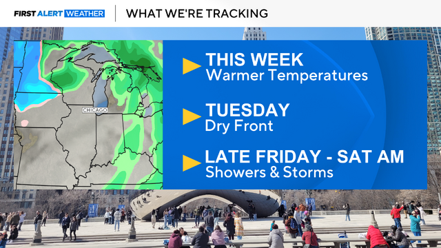
The week ahead looks great, but a front will bring rain by Friday night/Saturday.
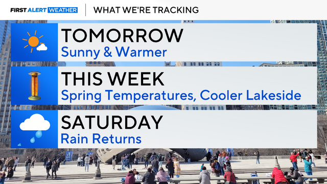
The only downside is losing an hour of sleep as we "spring forward" at 2 a.m.

Rain and snow showers taper off tonight as high pressure moves into our area.

A warming trend begins this weekend.

Wet snow is likely Friday. With temperatures hovering in the middle 30s, rain showers may mix into the picture at times.

A Wind Advisory was in effect until midnight Wednesday night as winds have been gusting 40 to 50 mph.
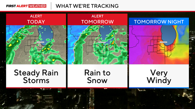
A large storm system will bring wind, rain, thunder, and snow to the Chicago area through Wednesday.
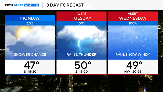
Highs will be near 50 degrees on Monday with chances for a stray shower and mostly sunny skies.

Rainfall totals could add up to more than 2 inches over the course of those 48 hours.
Any early morning flurries will move out of our area with increasing sunshine this afternoon.

Morning wind chill temperatures drop to the single-digits early Saturday, then high temperatures remain below freezing.

Meteorologist David Yeomans has the latest First Alert Weather forecast.

Meteorologist David Yeomans has the latest First Alert Weather forecast.
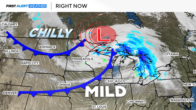
A Wind Advisory for Friday with gusts to 45 mph is in effect.
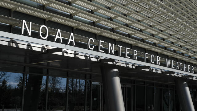
Some 880 employees of the National Oceanic and Atmospheric Administration were laid off on Thursday, a congressional source told CBS News.
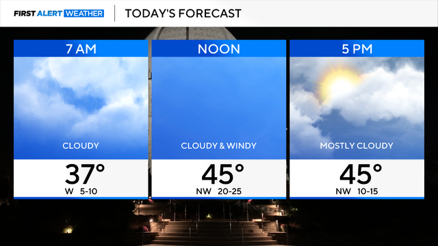
It will be slightly cooler on Thursday, but temperatures remain above the norm in the middle 40s.
Rain will be mostly light, though some downpours and thunderstorms are possible, especially south of Chicago.
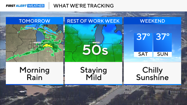
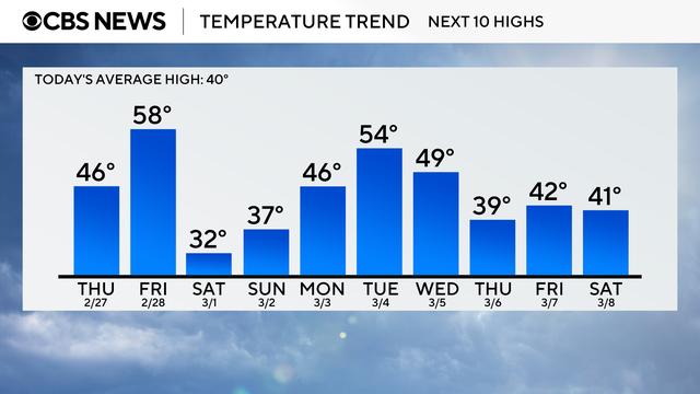
Temperatures remain very mild throughout the work-week with highs in the 50s and 40s.
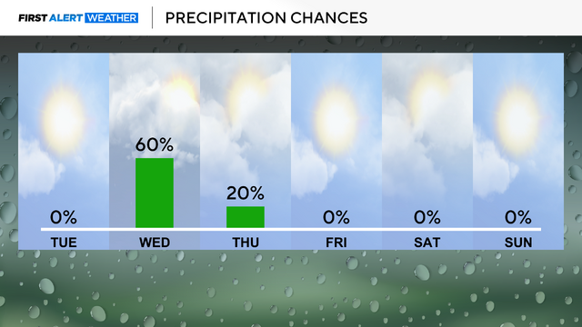
Throughout the rest of the workweek, highs will be approaching the upper 40s and lower 50s.

Highs on Monday reach the 50s, which is nearly 10 to 15 degrees above normal.

With these mild temperatures, expect the snowpack to continue to melt away.

Snow on the ground in Chicago will soon be gone as temperatures climb into the 40s for the next several days. Meteorologist Kylee Miller has the First Alert Weather forecast.
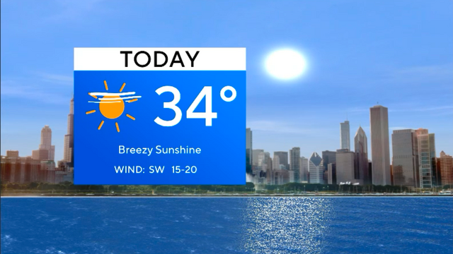
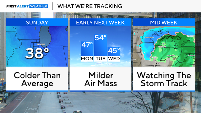
High temperatures will stay in the 40s for highs for much of the week, with some opportunities for rain shower activity.