
Potential Salmonella Contamination Prompts Barber Foods Recall
Barber Foods is recalling nearly 2 million pounds of frozen chicken products that may be contaminated with Salmonella.
Watch CBS News
Barber Foods is recalling nearly 2 million pounds of frozen chicken products that may be contaminated with Salmonella.

A cruise ship that had been stranded in Boston Harbor since the Fourth of July departed for Halifax on Sunday.

No other city in North America reminds visitors of Paris and European culture than Montreal, less than an hour drive from the U.S.-Canadian border.

One of three Afghan military officers detained after fleeing a U.S. training exercise to avoid returning to Afghanistan has been allowed to make a refugee claim in Canada.

Terrorism North Of The Border
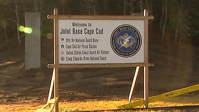
An immigration judge set bond at $25,000 Wednesday for one of three Afghan military officers who face deportation after taking off from a Massachusetts training exercise last month to seek asylum.

Canada blanked Sweden for hockey gold.

Krug "just kind of hung around" while on vacation in Mexico and only recently started watching the Olympic games upon his return, adding, "It looks like a lot of fun and I'm looking forward to the game tomorrow." He of course is not referring to Finland vs. Sweden

Michael Felger has never been one to make predictions, but he's very confident in his pick in the men's hockey semifinals this Friday at noon between Team USA and Canada.
Team USA knocked off the Czech Republic 5-2 to advance to the Semifinal round in Olympic Hockey play.

It was the United States' first gold medal win in Olympic ice dancing history, but our neighbors to the north think the judges got it wrong.

Patrice Bergeron again showed that he's more than just a defensive wiz as he scored two goals and added an assist in the Bruins' 7-2 shellacking of the Ottawa Senators at TD Garden.

Canada has a lot of horses, but Dave Goucher of the Bruins Radio Network says to look for Finland to make some noise based on their goaltending and past success in this tournament.

The day after Christmas is always so anticlimactic.

A mother in Manitoba, Canada was charged a $10 fee after she sent them to daycare with a lunch that included roast beef, potatoes, carrots, an orange and milk. The reason? The dayare said it didn't include any grains as required by the provincial Early Learning and Child Care department. The daycare gave her kids Ritz crackers and sent home a note saying she would be charged a fine of $5 per child.

Gov. Deval Patrick is heading out of town again, this time to visit his daughter and grandson in California.

A Canadian man, in town for a conference on the treatment of sexual abusers, was arrested Friday and charged with sexually assaulting a woman in Northboro.

A Canadian astronaut has provided a glimpse of Boston from a very different perspective.


Bright sunshine for Saturday with light NNE winds with highs climbing into the mid-upper 30's.

A nice, but cool start to the week with sunny to partly sunny skies today. Temperatures have started off near 32 and will be climbing into the lwr to mid 40's this afternoon with a lighter westerly wind.
Despite a cold frontal passage today, the immediate post-frontal air mass will be summer-like with high temperatures reaching the lwr-middle 70's in many locations, with the exception of the Cape and Islands where winds off the water will keep temperatures closer to 70. Average highs this time of year are around 60 degrees, so we'll be 15 degrees above normal to start the weekend! Southwest winds will be breezy at 10-20mph.
Today, the feel of fall returns with a wind shift back to the NW. Early morning showers along with the front have pushed of the coast with rapidly clearing skies following in for the morning hours into the afternoon as skies.Skies will become mostly sunny with a chilly breeze from Canada which will help to keep temps about 15-20 degrees cooler than yesterday...so don't forget the warmer clothes.
Clouds will be in place through about 10 or 11 AM...before a sharp clearing line will be working towards the coast by lunchtime. Temps have been cooling behind the front this morning into the 50's and Lwr 60's. Once the sunshine comes out in full this afternoon, temps will give another run towards 70-72 degrees, but will start to fall later in the day with the lowering sun angles and breezy NW winds pushing in the much cooler air from Canada which will settle in tonight.

The FDA said that as of Sunday, it had not found any "confirmed positive sample results for product testing for Cyclospora."

A first-of-its kind rugby fundraiser was held Sunday at the Irish Cultural Center in Canton to benefit children with epilepsy.
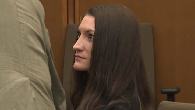
Lindsay Clancy, the mother charged with killing her three children in Duxbury, Massachusetts in 2023, is scheduled to start her murder trial Monday in Plymouth Superior Court.
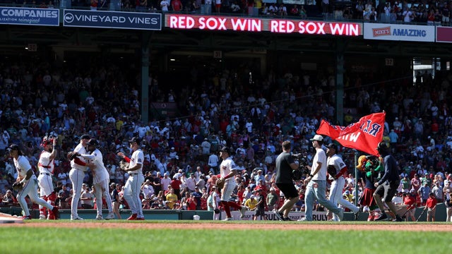
The only thing hotter than the Italian sausages and franks on the grills outside Fenway Park is the Red Sox themselves.

The Boston Red Sox have now won 13 games in a row after completing a 4-game sweep of the Tampa Bay Rays at Fenway Park.
Lindsay Clancy, the mother charged with killing her three children in Duxbury, Massachusetts in 2023, is scheduled to start her murder trial Monday in Plymouth Superior Court.
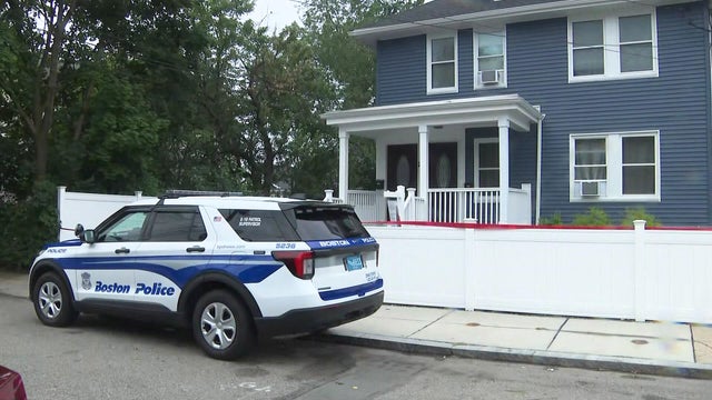
Boston police are looking into the discovery of a dead body at a property in Mattapan that's owned by Rep. Ayanna Pressley's husband.
The only thing hotter than the Italian sausages and franks on the grills outside Fenway Park is the Red Sox themselves.
The Boston Red Sox have now won 13 games in a row after completing a 4-game sweep of the Tampa Bay Rays at Fenway Park.
A first-of-its kind rugby fundraiser was held Sunday at the Irish Cultural Center in Canton to benefit children with epilepsy.

Taylor Farms said none of its branded salads or kits contain the iceberg lettuce associated with the outbreak.

A lettuce supplier to fast-food giant Taco Bell has been linked to a nationwide cyclosporiasis outbreak that has sickened thousands of people, the CDC said.

Massachusetts is reporting cases of cyclosporiasis, a disease caused by a stomach parasite that can lead to "explosive" diarrhea.

Many people fear that a family history of dementia dooms them to inevitably suffer the condition themselves. But a new tool, the Brain Care Score, shows how lifestyle changes can be beneficial, cutting the risk of dementia.
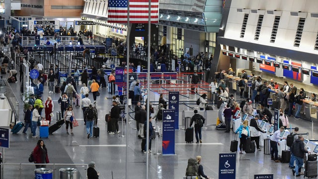
There was a possible measles exposure at Logan Airport in Boston last week, Massachusetts health officials say.

With the Brigham and Women's Hospital nurses strike looming, some parents of newborns in the NICU are sounding the alarm.

A Malden, Massachusetts woman said National Grid took more than $28,000 out of her bank account for a gas bill that she didn't owe.

A Massachusetts family thought their Vrbo stay would be protected after they had to cancel their trip to Hawaii due to severe weather. Now they're out $12,000.

A driver from Southboro, Massachusetts struggled for months to unravel a frustrating mix up with his E-ZPass account.

The gunman who allegedly opened fire on passing cars on Memorial Drive in Cambridge, Massachusetts is 46-year-old Tyler Brown from Boston.

Barney Frank, a Democrat who represented Massachusetts in Congress for 32 years, has died. He was 86 years old.

Both the Trump and Healey administrations are using government websites to blame each other for the shutdown.

Which party stands to take more of the blame from voters for the government shutdown? Here's what a new poll says.

A UNH Survey Center/Granite State poll shows John Sununu crushing Scott Brown by 23 points among likely primary voters in New Hampshire.

Seth Moulton said he's running against Sen. Ed Markey because "our party leaders are clinging to that old playbook."

Breaking Grounds Cafe, a Peabody, Massachusetts coffee shop known for employing people with disabilities, is closing.

The buildings that house the Somerville Theatre and the Capitol Theatre in Arlington, Massachusetts are for sale.

Golden Temple and Party Favors in Brookline are closing after a combined 100 years in business.
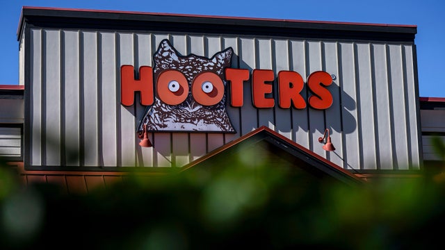
There are no more Hooters restaurants left in Massachusetts.

There's a proposal in Cambridge to limit customers at bars and restaurants to one drink every 30 minutes.

Beauport, the Sleeper-McCann House has become one of New England's most imaginative seaside estates.

Blending clean modern lines with the warmth of a classic seaside retreat, this stunning North Shore coastal home was designed to feel both elevated and inviting.

Set across thirty acres of rolling lawns, wooded trails, and contemporary outdoor art, deCordova Sculpture Park and Museum invites visitors to experience art in the landscape.

James Beard Award-winning chef and restaurateur Karen Akunowicz has become known for her bold, Italian-inspired cooking and unmistakable culinary voice.

Just a short drive from Newport, the Norman Bird Sanctuary spans 300 acres of fields, forests, and coastal trails with sweeping views and more than six miles of hiking paths.
The Boston Red Sox have now won 13 games in a row after completing a 4-game sweep of the Tampa Bay Rays at Fenway Park.

Spain dominated the match, outshooting Argentina 20-3, but couldn't manage a goal in regulation.

The Boston Red Sox rallied for a 7-6 victory over the Tampa Bay Rays Saturday to extend their winning streak to 12 games.

Wilyer Abreu homered twice, All-Star Willson Contreras went deep in his first game back from a five-game suspension, and the Boston Red Sox extended their winning streak to 11 games with a 5-3 victory over the Tampa Bay Rays on Friday night to sweep a doubleheader.

The Boston Red Sox extended their winning streak to 10 games with a 10-0 victory over the Tampa Bay Rays on Friday in the first game of a doubleheader.

After marrying Taylor Swift and Travis Kelce, Adam Sandler went to Nantucket in search of a basketball court.

An injured hiker had to be carried off a New Hampshire mountain on a stretcher, but that didn't stop her from getting engaged.

A seal pup was spotted hanging ten on a boogie board off the cost of Maine this Fourth of July.

Avi Loeb, a Harvard astronomer who has made headlines with his theories about alien encounters, will lead a White House scientific advisory council on UFOs.
Haggis is not on the menu in Boston for the World Cup, despite what Gov. Healey told Scotland supporters in a lighthearted social media video.