First Alert Weather Day declared for Sunday after deadly tornadoes and winds strike North Texas

A dryline to the west was the key trigger for the devastating storm on Saturday. The dryline will also play a role in Sunday's forecast.
The National Weather Service did confirm early Sunday afternoon that an EF-2 tornado did unfold in the Runaway Bay area in Wise County, with peak winds reaching 135 mph. An EF-1 tornado has also been confirmed in the Springtown area of Parker County with estimated peak winds of 105 mph.
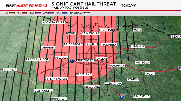
We're now officially issuing a First Alert Weather Day for North Texas through the end of Sunday. The Storm Prediction Center now has a slight risk for some of the same counties that were impacted by the storms Saturday night. A significant tornado threat and a significant hail threat are also possible.
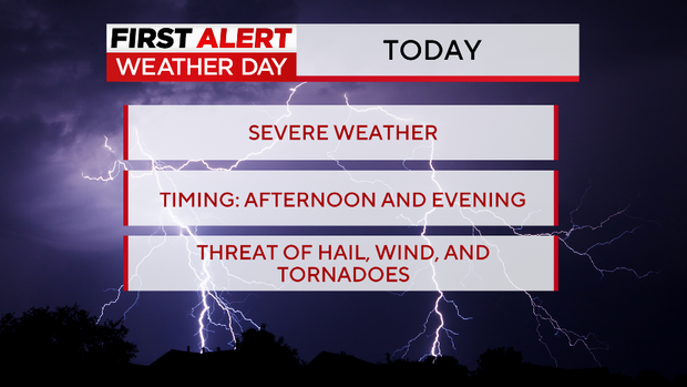
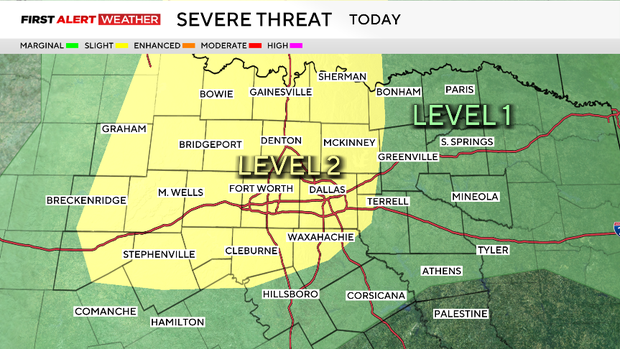
The threat is conditional, meaning that if the cap breaks with any cell that pops up, it will have a strong updraft that may rotate. Hail 2+ inches or larger and strong tornadoes will once again be a possibility. There is also a potential of not much happening.
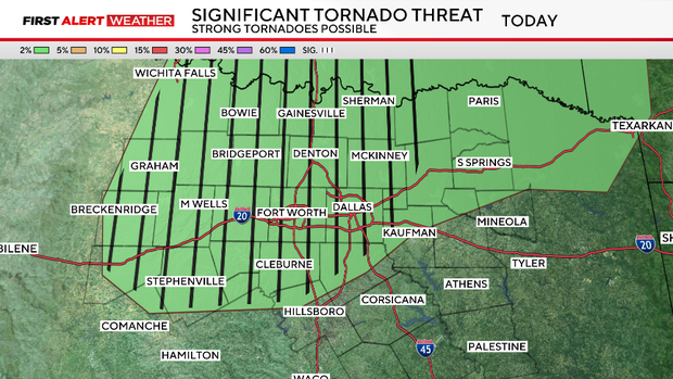
Forecast models did not show much at all in the past 72 hours, but now, they are showing some strong activity popping up in the late afternoon through the evening. This is due to the dryline setup.
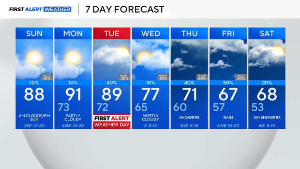
Another First Alert Weather Day is issued on Tuesday as the Storm Prediction Center, SPC, has highlighted most of North Texas under a risk for severe weather, especially counties to the northeast of the metroplex. This is due to a cold front that will swing across the area.

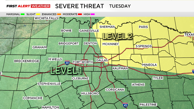
All modes of severe weather will be possible, including damaging winds, hail, flooding, and even a tornado. Now is the time to prepare. Be sure to stay alert and have a safe place as well as a plan in case a severe storm passes through your area.
Throughout the next week, there is a daily shot of rain and storms. The good news is that the front will bring cooler weather and rain to drought-stricken areas to the east.