Cooler temperatures hit North Texas before climbing back into 80s late week

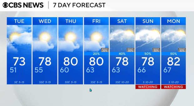
Monday night will be clear and cool with light winds. Temperatures will drop into the 40s and low 50s.
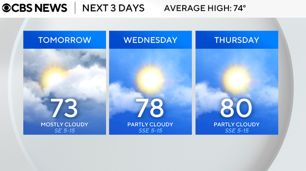
On Tuesday, expect a cloudier day as a weak shortwave moves through the region. While we'll see an increase in mid and high clouds, moisture is limited, so we are not expecting any rain. Highs will still reach the low 70s, making for a mild afternoon despite the extra cloud cover.
We begin to see a shift in the pattern on Wednesday. Winds turn more southerly, allowing moisture to return, and temperatures will start to warm. Highs climb into the upper 70s with a mix of sun and clouds.
Thursday and Friday will be warmer and a bit more humid. Highs will reach the upper 70s to low 80s. On Friday, a few isolated showers or storms may develop, but overall coverage remains low and many areas stay dry.
This weekend, things will turn more active. A stronger system approaching the west will help increase instability and wind shear across the region.
By late Saturday into Sunday, we could see thunderstorms develop, some of which may become strong to severe. This will be our main window to watch for more organized storm activity.
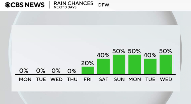
There is the potential for strong to severe storms late Saturday into Sunday.