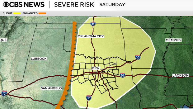
Storm chances return to North Texas this weekend after midweek clearing

Beginning Friday and continuing through Sunday, we'll be watching for the potential of strong to severe thunderstorms. Not everyone will see storms, but this is the time frame where impacts are more likely, especially as the setup becomes more favorable by Sunday.
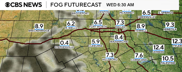
Scattered rain, fog overnight into Wednesday morning
Overnight, rain will become more scattered. Most areas will trend quieter, but we can't rule out a few leftover showers. With all the recent rainfall and plenty of low-level moisture in place, we'll also be watching for patchy fog overnight, especially west of I-35 and south of I-20. Some of that fog could become locally dense, although coverage will be somewhat limited. Temperatures will stay mild overnight, falling into the 50s to low 60s.
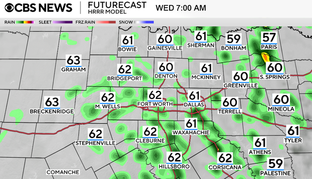
Clouds break Wednesday afternoon
Wednesday will start with a mix of clouds and possibly a few leftover showers. As the disturbance continues to move away, rain chances will gradually shift east, and we should begin to see some breaks in the clouds by the afternoon. With a return to southerly flow, temperatures will rebound nicely into the 70s, making it feel noticeably warmer compared to Tuesday.
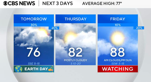
Work week ends warmer and dry before weekend rain chances
Thursday, a quieter and warmer day takes over. Even though Gulf moisture continues to return, a layer of warm air aloft will act like a cap, preventing storm development. That means we stay mostly dry with a mix of clouds and sunshine. Highs will climb into the upper 70s to low 80s, with increasing humidity.
On Friday, a dryline will set up to our west, and with increasing instability and wind shear, a few thunderstorms may develop later in the day, especially north and east of the metroplex. Coverage is still uncertain, so not everyone will see rain, but this marks the beginning of a more active stretch.
As we move from a zonal flow into a more amplified trough pattern, multiple disturbances will move through a warm, moist, and unstable atmosphere. This setup supports daily chances for showers and thunderstorms, particularly during the afternoon and evening hours. Some of these storms could become strong to severe, with the potential for: strong winds, hail and heavy rainfall.
At this point, Sunday looks like a day where a larger portion of North Texas could be impacted, but details on timing and exact locations will become clearer as we get closer. A lot of it depends on how close the dryline sets up.