Expect warm temperatures, high winds before round of storms head for DFW
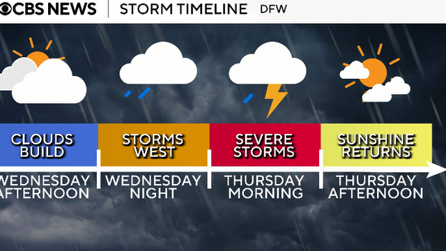
Looking ahead to Wednesday, the day will be dry throughout the day ahead of the first round of storms that move in overnight into Thursday.
Watch CBS News
Looking ahead to Wednesday, the day will be dry throughout the day ahead of the first round of storms that move in overnight into Thursday.
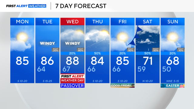
The dry weather will end as the pattern changes, turning unsettled by midweek.

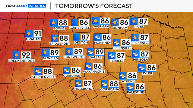
Expect sunny skies, temperatures in the 80s and southerly winds gusting up to 25 mph at times.
Palm Sunday's forecast will be vastly different.
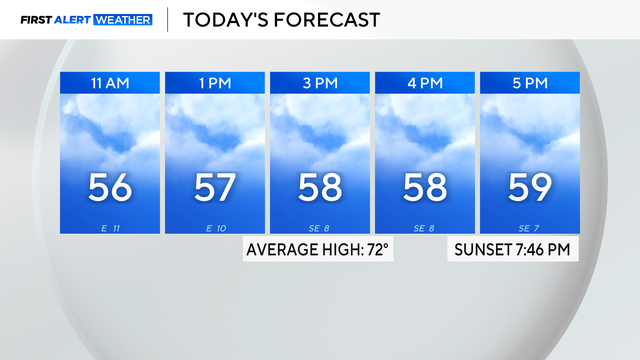
Expect plenty of clouds before the sunshine in the afternoon. It will be breezy at times, with some gusts up to and possibly over 20 mph.
Several states saw record daily temperatures set on Wednesday, as the heat wave that has been scorching the West expands into the central U.S.
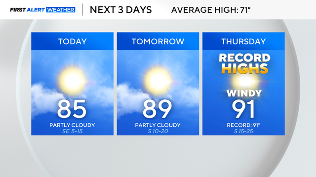
The warmth will continue with highs in the mid-80s by Tuesday afternoon, which will eventually reach the 90s by Thursday.
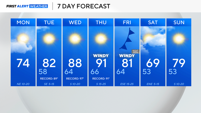
The cooldown will be short-lived as another bridge of high pressure builds in and raises temperatures back into the 90s by Thursday.
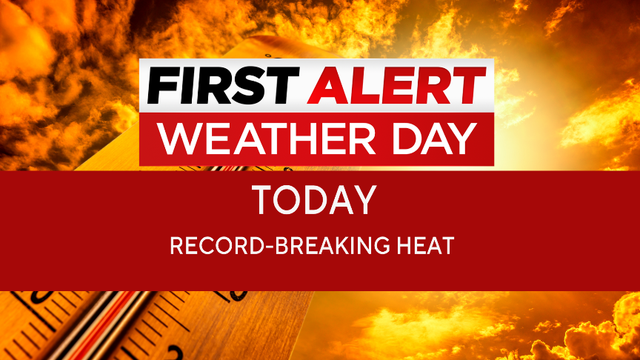
The highs this time of the year should be in the 70s, but Sunday will be around 93 degrees.
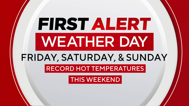
North Texas is bracing for rare early-season heat with record highs and increased fire danger expected through the weekend, followed by only a brief cooldown.

Thursday's temperatures will climb to the upper 80s and low 90s in the afternoon with plenty of sunshine.
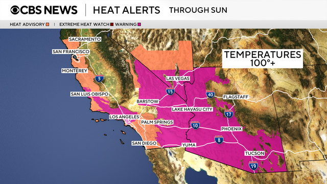
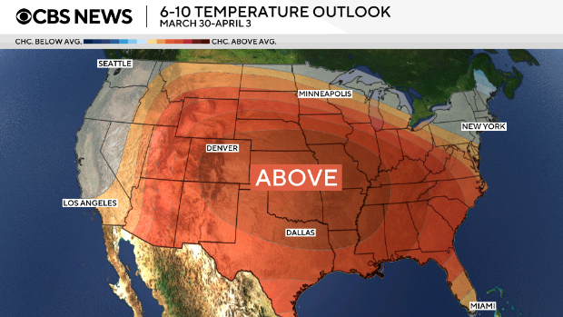
A long-duration heat wave is taking shape over the western half of the U.S. and forecast to stick around in the days ahead.
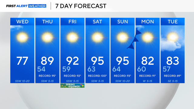
You'll need a light jacket on Wednesday morning, but sunglasses by the afternoon.

North Texas will see a big warm-up with highs rising near 80° on Wednesday, then soaring to near 90° on Thursday.

Powerful storms swept across the eastern half of the country as many airports are also struggling with disruptions from reduced staffing at security checkpoints.
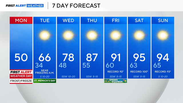
After setting a new record high Sunday of 87°, Monday is over 50° colder than that point.
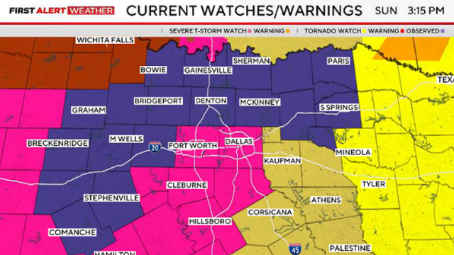
There are currently six watches, warnings, and advisories across North Texas.
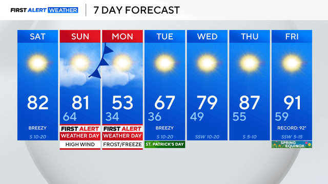
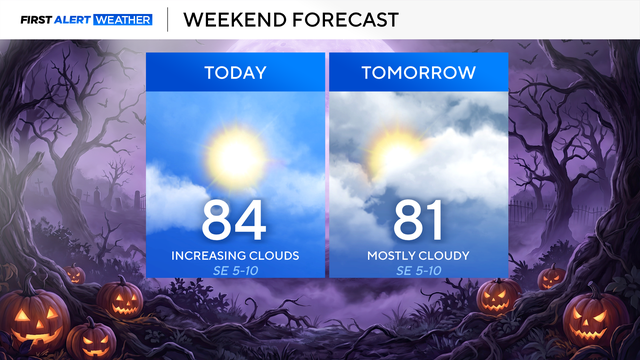
There will be an abundance of sunshine, and temperatures will climb into the low 80s on Saturday afternoon.
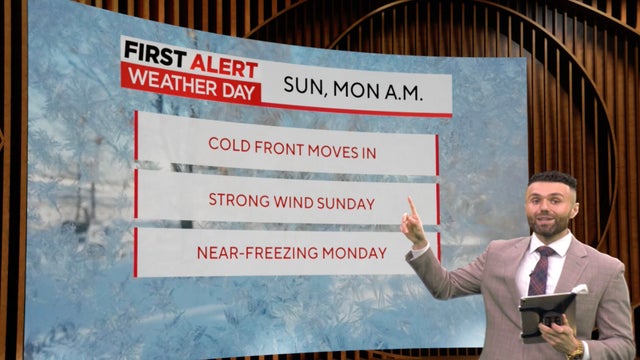
First Alert Weather Days are in place for both Sunday and Monday.

The weekend will be beautiful with highs in the 80s, aside from a windy Sunday, with gusts of up to 40 mph.
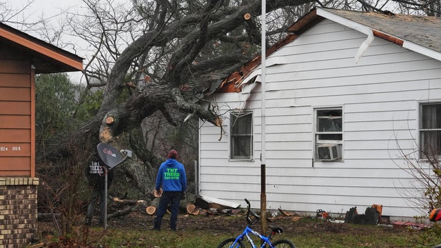
A string of tornadoes touched down in multiple states as severe weather stretched from Texas to Michigan.
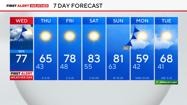
A wind advisory is in effect from 1 p.m. to 6 p.m. Wednesday, March 11.
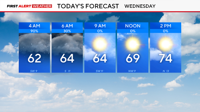
A First Alert Weather Day is in place for Wednesday morning due to the threat of flooding.
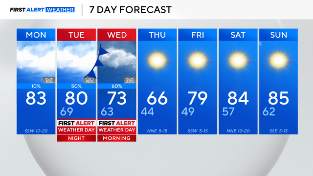
The next system swings through the area on Tuesday, causing the chance of severe weather.
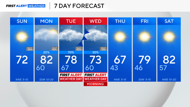
The next big weather maker swings through the area on Tuesday, causing the chance of severe weather.