Storms expected to bring strong winds, heavy rain, flooding to North Texas

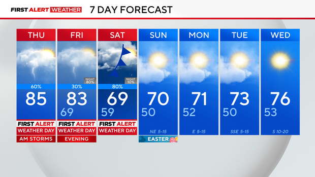
It's a First Alert Weather Day on Thursday morning due to the heavy rain moving across the metroplex, likely impacting part of the morning commute. We are not expecting severe weather this morning. The main threats will be heavy rain, flooding, and ponding on roadways.
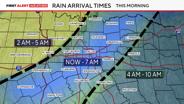
All areas will dry out by midday, and we'll see some clearing with breezy winds on Thursday afternoon. Highs will stay warm in the middle 80s.
After Thursday, our eyes focus on our next round of storms on Friday afternoon. We have another First Alert Weather Day in place for Friday evening, overnight into Saturday.
First Alert Weather Day: Friday into Saturday
On Friday, areas north and west of the metroplex are under a level 2 risk for severe storms, with wind and hail being the main threats.
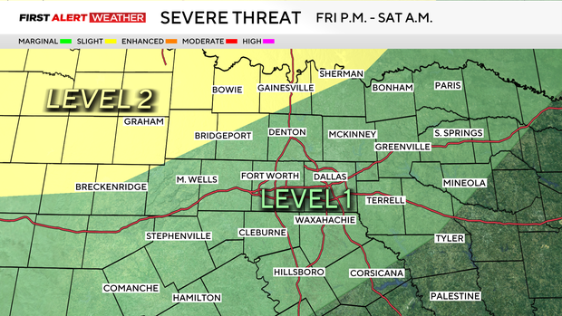
Most of the daytime hours are dry on Friday, but our storm chances ramp up by the afternoon and into the evening. Some of these storms could become strong to severe, with:
- Large hail
- Damaging winds
- Low tornado threat
- Heavy rainfall, which could lead to flooding
By Saturday morning, we will be seeing areas of heavy rain moving through all associated with a cold front; 1-2" of rain will be possible areawide with this round, and the threat for localized flooding will continue.
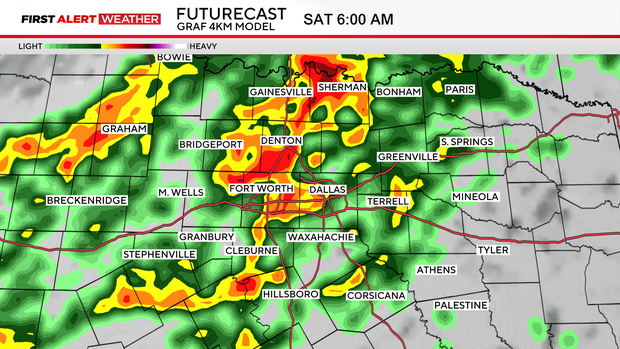
By late afternoon Saturday, we start to dry out and clear out, leaving us with dry and partly cloudy conditions for Easter Sunday
Easter Sunday outlook
Temperatures early Sunday will be in the upper 40s to the 50°, so jackets will be needed for any early church services or Easter egg hunts. Temperatures next week will be more seasonable with highs in the lower to middle 70s and lows in the lower 50s.