Clouds and cool temperatures continue to blanket North Texas before late week warmup and possible storms

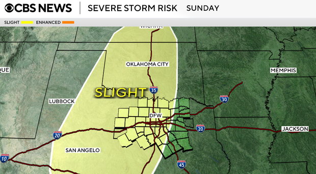
We'll have multiple chances for rain and storms beginning Friday and continuing into early next week as several systems move across the southern Plains. This pattern could support both strong to severe storms and periods of heavy rainfall, with Sunday and Monday being days we'll be watching closely for first alert weather days.
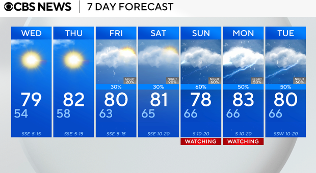
We will have one more cool night on Tuesday with lows falling into the low 50s and upper 40s. Expect partly to mostly cloudy skies.
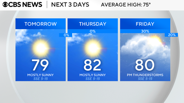
Wednesday will be a similar setup, but a bit warmer. We'll start the day cool, then warm into the upper 70s by the afternoon with tons of sunshine and a southeast wind of 5-10 mph.
On Thursday, temperatures continue to climb, with highs in the low 80s. Skies stay mostly cloudy, and humidity begins to increase.
Our first chance for rain returns on Friday afternoon. Coverage remains limited, with only a few isolated showers or storms possible. Many areas will stay dry. We will see highs near 80F.
This weekend, the pattern turns more unsettled. Storm chances increase Saturday, but Sunday currently looks like the more active day, with higher coverage of showers and thunderstorms.
Some storms could be strong, especially later in the day on Sunday. Saturday will be breezy with highs in the low 80s and Sunday we will see upper 70s in the afternoon.
Monday and Tuesday will also be active weather days with the potential of strong to severe thunderstorms.