Deadly storms sweep North Texas; widespread tornado watch issued until 5 a.m.


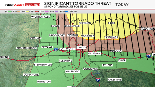
A tornado watch is in effect for much of North Texas until 5 a.m. It includes Collin, Cooke, Dallas, Delta, Denton, Fannin, Grayson, Hopkins, Hunt, Lamar and Rockwall counties.
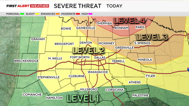
Severe storms will continue for another few hours overnight before diminishing, posing mainly a very large hail threat.
A severe thunderstorm warning has been issued for Dallas, Ellis and Kaufman counties until 2:45 a.m. Two-inch hail and 60 mph wind gusts are possible.
A flash flood warning has been issued for Tarrant County until 4:30 a.m.
A flash flood warning has been issued for southern Dallas County until 4:45 a.m.
Sirens were activated in Haslet, Weatherford, Burleson, Arlington and Fort Worth. Event attendees at Dickies Arena were told to shelter in place in the tunnels.
Storms slam North Texas, leaving behind damage, displaced families
Parker County said one person has died as a result of the storms on Saturday night, south of Springtown. The victim was not identified and Parker County Fire did not release any further information.
Wise County officials said one person has died due to the storm and several structures are destroyed.
There is significant debris from wind over the State Highway 199 stretch from around Ross Road SE, including metal rope and giant trees. Some roads are impassable.
There has been significant damage in Runaway Bay. Winds of EF-2 strength or greater are suspected. Vehicles appear to have been tossed, power lines are down and roofs are missing. At least 20 families are displaced.
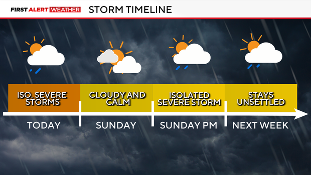
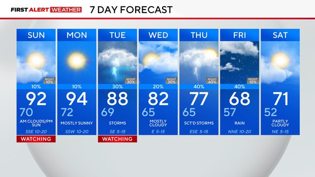
Sunday looks much calmer, still warm and muggy, but with just an isolated shower threat.
Monday will be another hot and humid day, with highs in the middle 90s under mainly sunny skies.
Our storm threats then return on-and-off from Tuesday through Friday, so keep an eye on the forecast with any scheduled outdoor plans.
Stay weather aware always with our CBS News app, just click the weather icon in the top right to find your latest forecast and a live interactive radar.