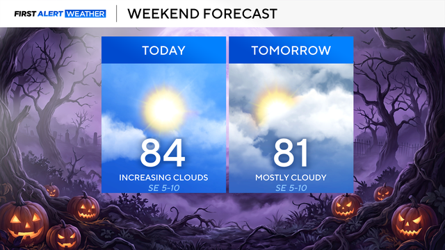
Fall-like temperatures kick off November in North Texas
Temperatures remain fall-like this afternoon, topping out in the upper 60s.
Watch CBS News
Temperatures remain fall-like this afternoon, topping out in the upper 60s.
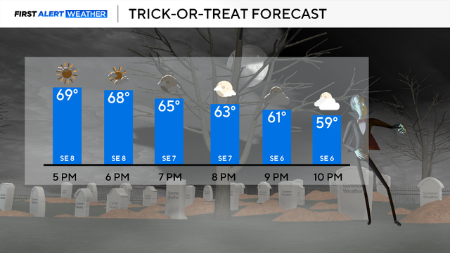
The daytime hours are sunny, but clouds will arrive as the sun is setting and the ghosts and goblins emerge.

High temperatures Thursday afternoon will reach the mid-60s, and winds will be much lighter than they were on Wednesday.

Wind is coming down this evening but the chill sticks around across the weekend. Some rain chances on Saturday.
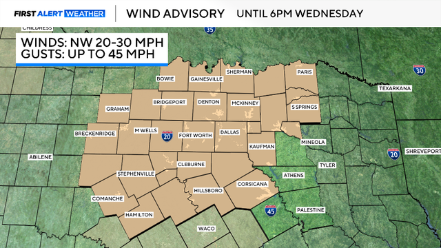
A cold front is on the way and once it arrives, it will bring intense winds.
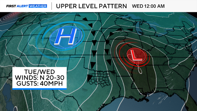
A strong cold front will bring isolated showers, powerful wind gusts, and the coldest air since early April to North Texas this week.

Hurricane Melissa strengthened into a Category 5 storm on Monday, unleashing torrential rain and threatening to bring catastrophic flooding to the northern Caribbean.
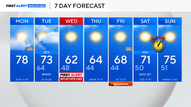
Monday will possibly be one of the warmest days in the next week, then temperatures drop to the 40s midweek.
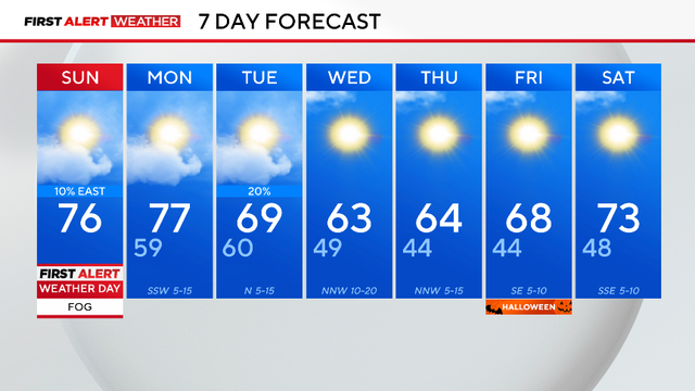
The fog will lift by Saturday afternoon with daytime heating.

DFW Airport was in a deficit of over 3 inches, but thanks to Friday's downpours, October is now near normal precipitation-wise.

This shower activity will carry a much lower severe threat, however, we do have a 1-out-of-5 risk for strong to severe thunderstorms where these cells do develop.
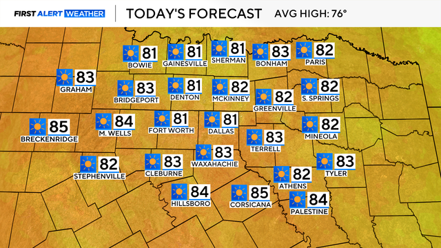
DFW Airport reached 53 degrees Wednesday morning – the coldest since May 4.
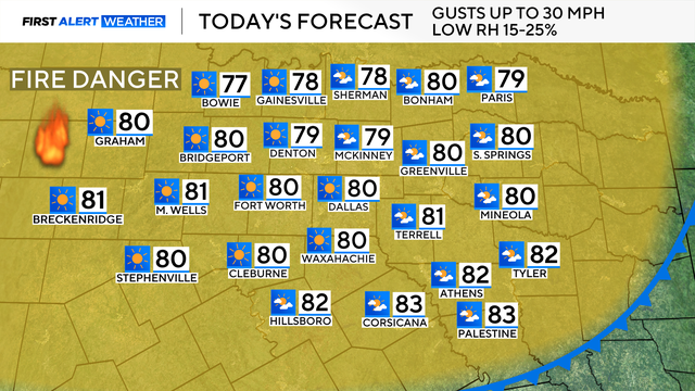
A cold front moved across North Texas this morning, which brought cooler temperatures, a dry airmass and windy conditions.
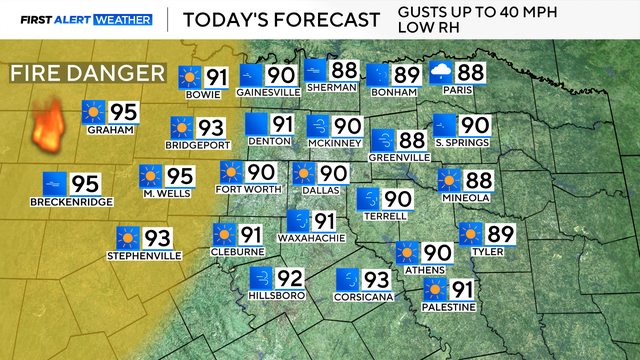
Winds could reach up to 40 mph in some parts of North Texas.
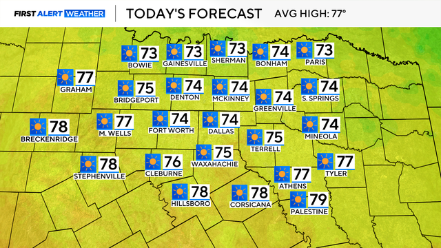
Expect sunny skies, low humidity, a high in the 70s and a slight breeze from the north with gusts up to 20 mph. It will be a fabulous day to enjoy the outdoors.
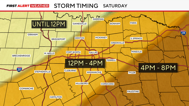
Prediction models are showing scattered storms in DFW between noon and 4 p.m. Saturday.

The First Alert Weather team continues to monitor the cold front arriving in North Texas on Saturday.

North Texans will see abundant sunshine and light winds today with highs near 87 degrees.
Winds will remain light today, with sunny skies, and highs in the upper 80s.
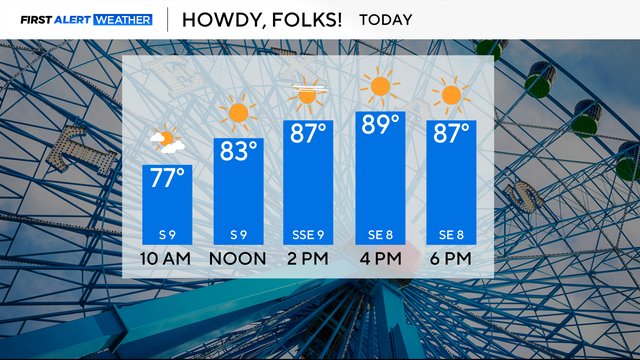
Plan for lots of sunshine and temperatures in the upper 80s on Monday.
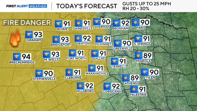
There is elevated fire danger on Sunday for counties along and west of the I-35 corridor due to the relative humidity being around 20 to 30%, with winds gusting up to 25 mph.
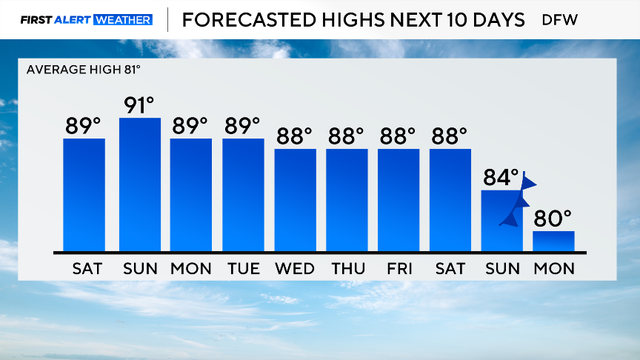
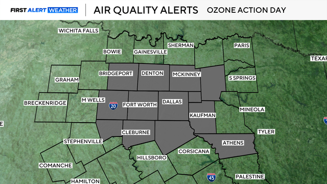
There is an air quality alert Saturday for higher-than-normal ozone levels.

A remarkable run of warm and dry weather continues into this weekend.

No significant changes are in the forecast, with high pressure in control.
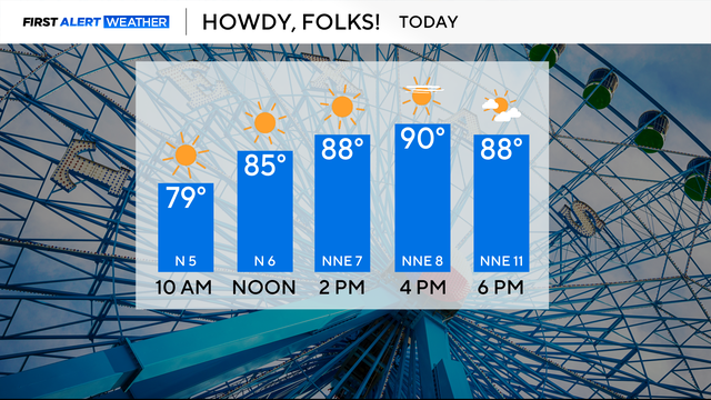
It has been an abnormally warm and dry first week of October.