After round of overnight snow, another winter storm arrives Wednesday night
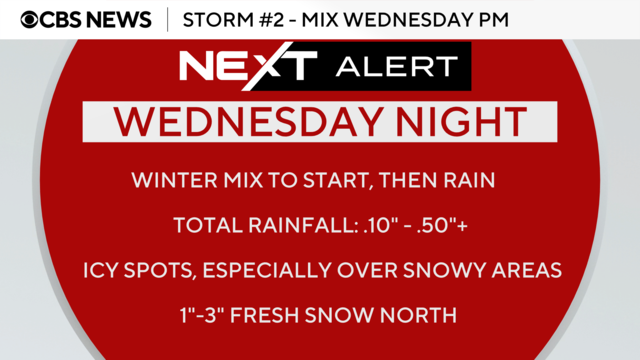
The messy week of weather will continue on Wednesday in the Philadelphia region with a storm that will bring a wintry mix and rain.
Watch CBS News
The messy week of weather will continue on Wednesday in the Philadelphia region with a storm that will bring a wintry mix and rain.
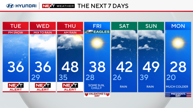
Snow will start falling Tuesday afternoon in the Philadelphia region and the rest of the week will feature two more storms.
Multiple NEXT Weather Alerts are in effect this week because of snow, sleet and rain expected in the Delaware Valley.
After a quiet start to the week, the NEXT Weather team is tracking multiple chances for unsettled, wintry weather and storms across the Delaware Valley.
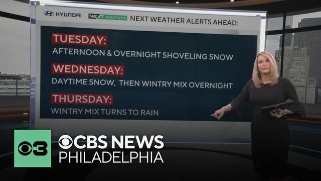
Sunday afternoon will see highs in the 40s with partly cloudy and sunny skies in Philadelphia, perfect weather for watching the Eagles in Super Bowl LIX. Looking ahead to this week, the NEXT Weather team is tracking multiple chances for snow and a wintry mix.
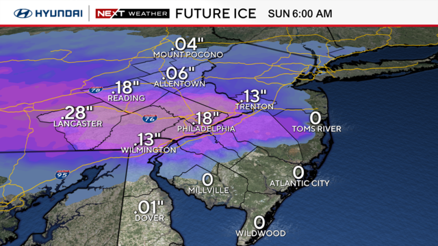
While most of the region doesn't get major snow from this storm, there's a threat of icy roads that you should be aware of.
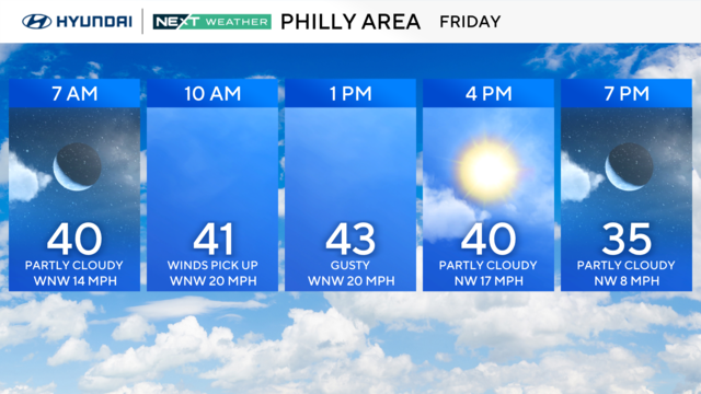
While Friday brings a break in the precipitation, there will be gusty winds, and more winter weather is on the way.
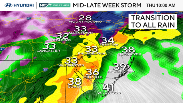
The Philadelphia region's next weather maker will likely affect the roads Thursday morning as rain, snow, freezing rain and sleet will hit the area.
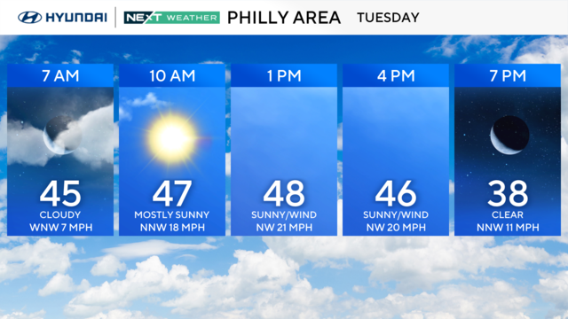
Temperatures will be up and down this week, and the NEXT Weather team is tracking chances for rain, snow, sleet and freezing rain.
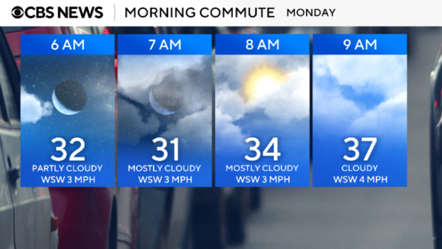
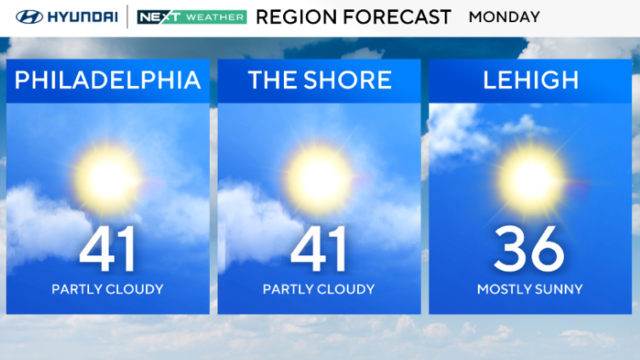
The Philadelphia region will be warm on Monday, but it will also be the start of our seesaw temperatures for the remainder of the week.
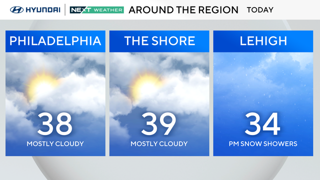
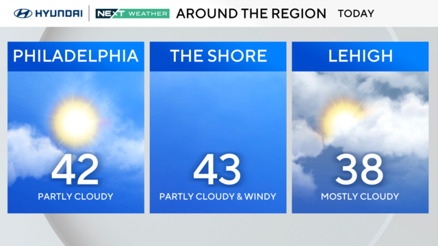
Mostly cloudy skies will meet and greet us on Sunday, with highs hovering near 40 degrees. Here's your Groundhog Day forecast in Philadelphia.
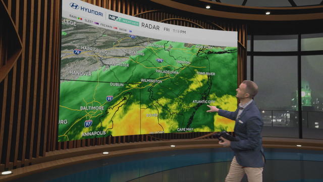
Around a quarter to a half inch of rain fell across the region Friday before the rain cleared out as a cold front swept across the region Friday night into early Saturday morning.
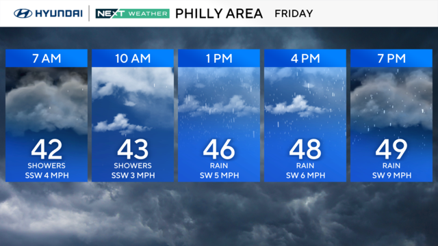
Despite the rain and clouds, temps will top out near 50 on Friday in the Philadelphia region.
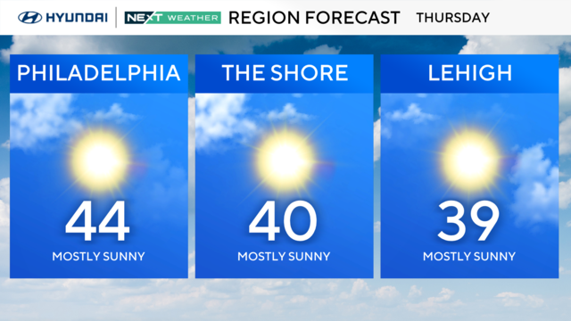
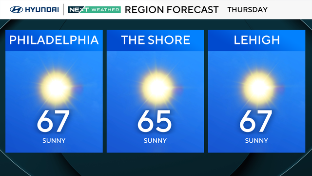
Thursday will be calmer and mostly sunny in the Philadelphia region.
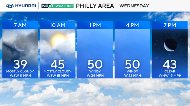
There's over a 30-degree difference in the high temperature between this Wednesday and last around Philadelphia — but wind gusts above 50 mph will make it feel cooler.
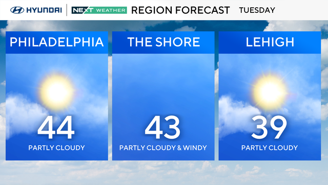
Tuesday will be another day with high temps in the mid-40s and plenty of sunshine in the Philadelphia region.
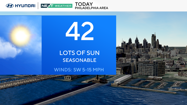
The Philadelphia region will begin the week mild on Monday, and we could even get to the 50s later in the week.
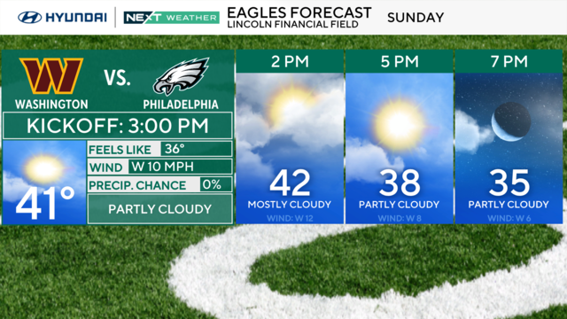
During the Eagles-Commanders NFC championship game, cloud coverage could shift from mostly cloudy, to partly cloudy.
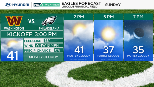
Saturday will be a beautiful day with sunshine but temperatures will be cold, with highs in the 30s across the Philadelphia region.
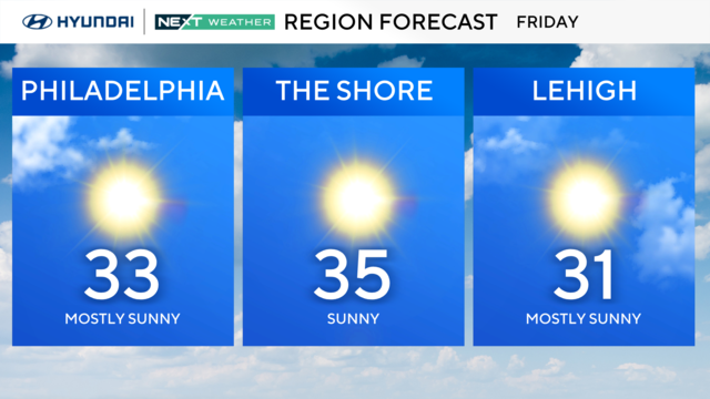
Philadelphia has been below-freezing since Sunday as the region deals with some of the coldest temperatures in 30 years.
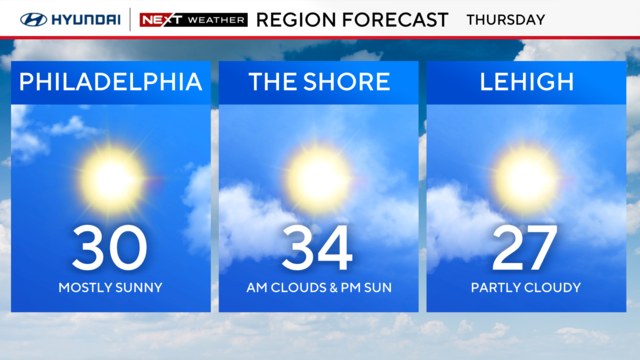
Thursday will be another dangerously cold day in the Philadelphia region, but we're getting closer to getting above the freezing mark.
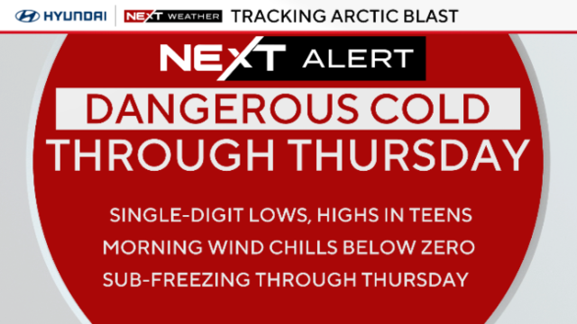
Philadelphia might feel like minus 5 and minus 10 degrees on Wednesday as Arctic air moves through the region.
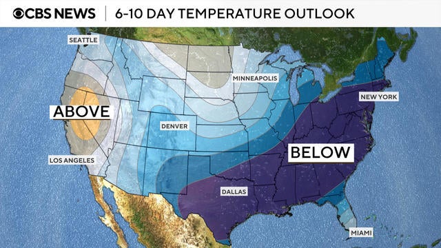
A polar vortex dipping down from Siberia is bringing a cold front with frigid temperatures to millions Americans. See maps of the arctic blast.
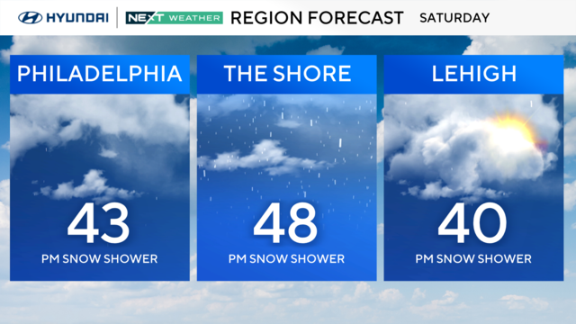
The weekend begins mild with scattered rain showers but plan and prepare for snow ahead with the coldest air since 2018.
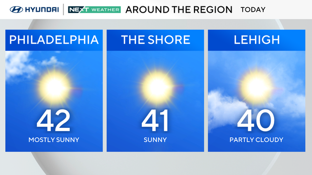
Friday will be in the 40s in the Philadelphia region, but storms are expected in the area this weekend ahead of temperatures dropping below freezing.