Warmer weather in Philadelphia Monday as highs climb into the 50s, colder air returns midweek

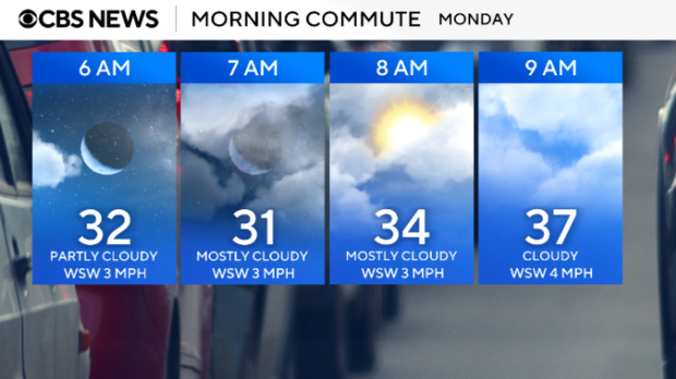
Temperatures start out below freezing Monday morning in Philadelphia and across the Delaware Valley, but later in the day winds will turn to the south and a nice warm-up begins. Highs will reach the low 50s by this afternoon under partly cloudy skies.
On Tuesday, it will also be mild near the 50s with abundant sunshine.
Our seesaw temperatures continue for the remainder of next week as we drop to the 30s on Wednesday accompanied by rain showers or a wintry mix. We'll then reverse course back to the mid-50s on Thursday with steady rain showers throughout the day.
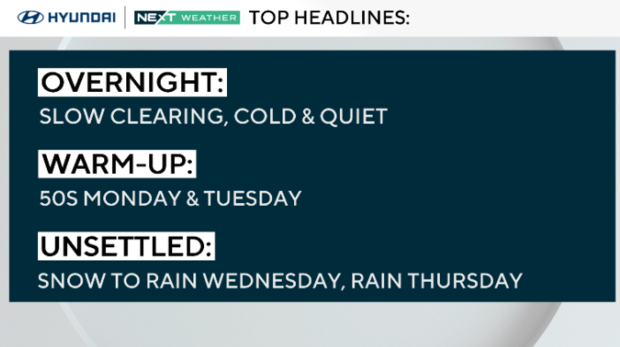
The skies clear on Friday and once again we dip back to the 40s.
We are also keeping an eye on next weekend with the Birds in the Super Bowl.
On Sunday in New Orleans, it will be partly sunny, dry and warm in the 70s, but in Philly, we could be facing rain or snow showers.
Both the American-GFS and EURO-ECMWF long-range models are currently in sync tracking a storm across the greater Philadelphia area. It is still a week away and the forecast will likely change several times, but if you have outdoor party plans or plan to travel to a watch party that day, you'll need to check back here frequently.
The NEXT Weather Team will help you plan and prepare with the most up-to-date game day forecast.
Here's your 7-day forecast:
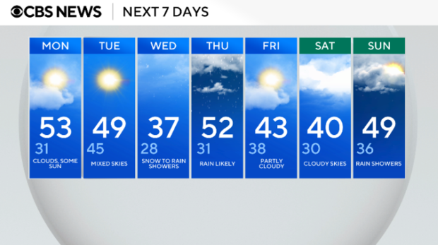
Monday: Clouds, some sun. High 53, low 31.
Tuesday: Mixed skies. High 49, low 45.
Wednesday: Snow to rain showers. High 37, low 28.
Thursday: Rain likely. High 52, low 31.
Friday: Partly cloudy. High 43, low 38.
Saturday: Cloudy skies. High 40, Low 30.
Sunday: Rain showers. High 49, Low 36.
Get the latest weather info on the CBS News Philadelphia app.


