Above-freezing high temperatures continue in Philadelphia area
Seasonable temperatures continue Wednesday and Thursday in the Philadelphia area.
Watch CBS News
Seasonable temperatures continue Wednesday and Thursday in the Philadelphia area.
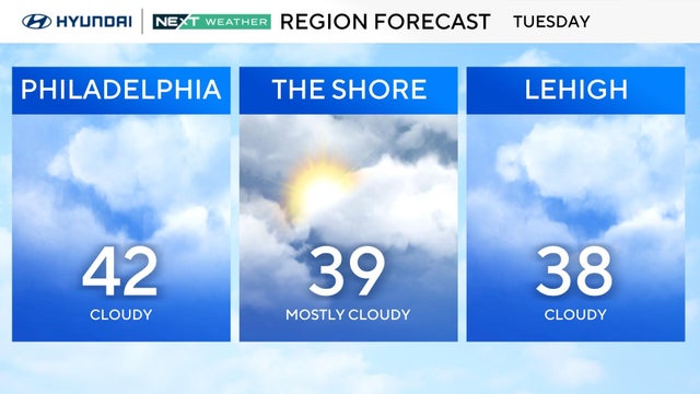
Starting Tuesday, the Delaware Valley will warm above freezing each day to the mid and upper 30s, with low the 40s possible for some.
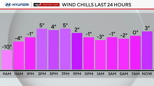
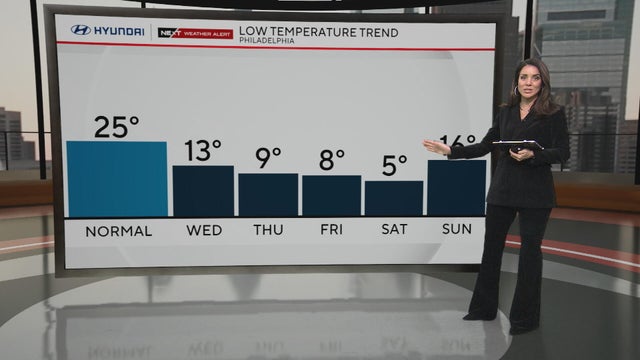
Monday in the Philadelphia region will be mostly sunny, but it will remain dangerously cold with lows in the single digits.
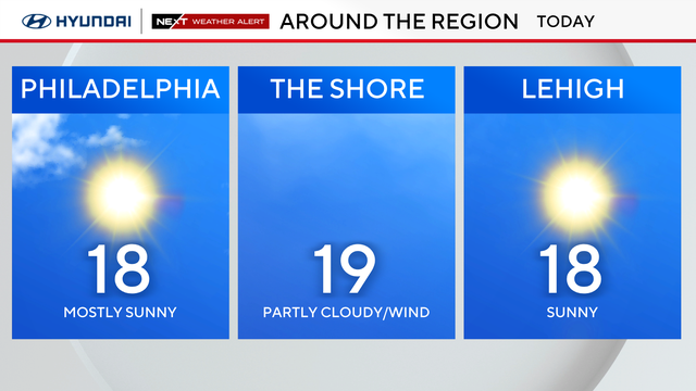
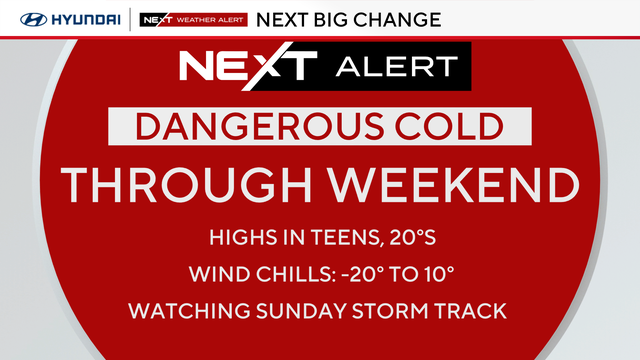
Arctic air remains Sunday as highs only climb into the upper teens. Philadelphia woke up to temps around 5 degrees, the first single-digit low for the city since 2022.
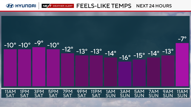
Old man winter is not done with us yet. A dangerously cold night is on tap as subfreezing temperatures return to the Delaware Valley.
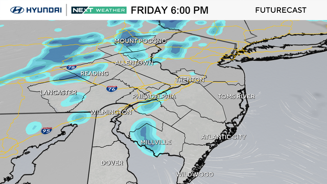
An Arctic cold front will blast through the Philadelphia region overnight Friday into Saturday.
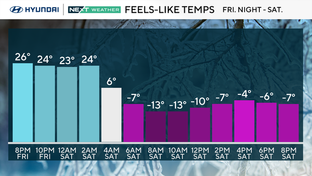
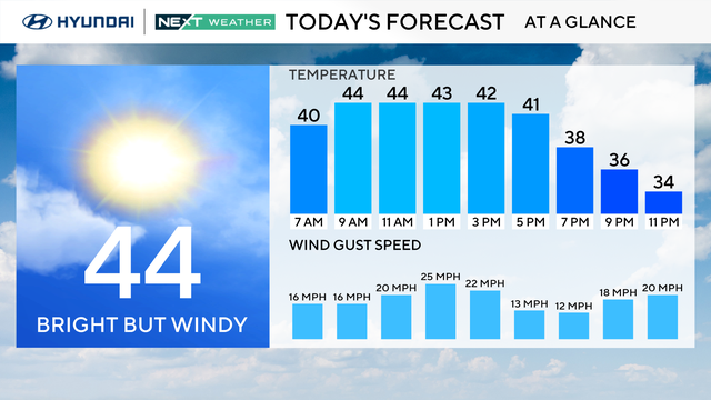
Temperatures will get above freezing for a short period Thursday afternoon before another Arctic blast moves into the Delaware Valley this weekend.
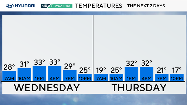
The temperatures Wednesday afternoon in the Philadelphia region will help some of the widespread snow melt.
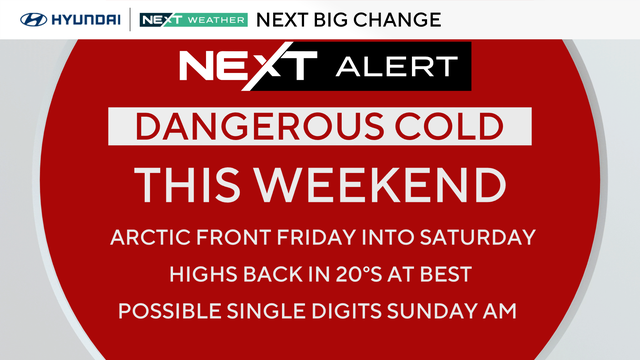
Tuesday is even milder than Monday, with highs in the upper 30s in Philadelphia before a return to the 20s over the weekend.
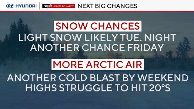
The Philadelphia area officially broke its stretch of subfreezing temperatures Monday, but gusty winds are keeping conditions dangerously cold.
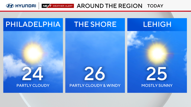
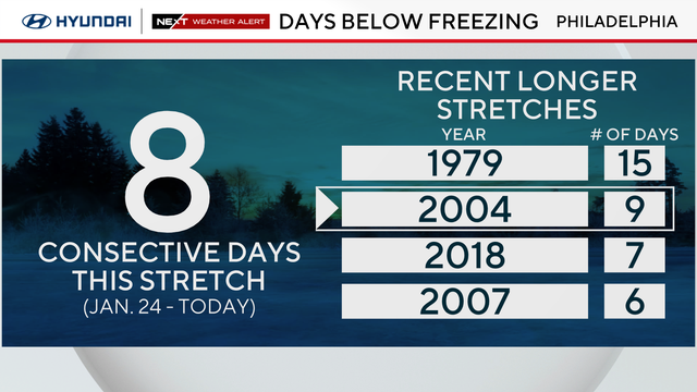
Sunday marks nine consecutive days with a high temperature below freezing, the longest subfreezing stretch since 2004.

Each Groundhog Day, Punxsutawney Phil makes his prediction about a late end to winter weather or early start to spring temperatures. Here's how accurate his forecasts have been over the years.
A "bomb cyclone" looks to avoid our area in terms of significant snow, but could bring coastal wind and flooding impacts.
A coastal storm may brush by the Jersey Shore on Sunday and drop some snow, or potentially miss the Philly area entirely.
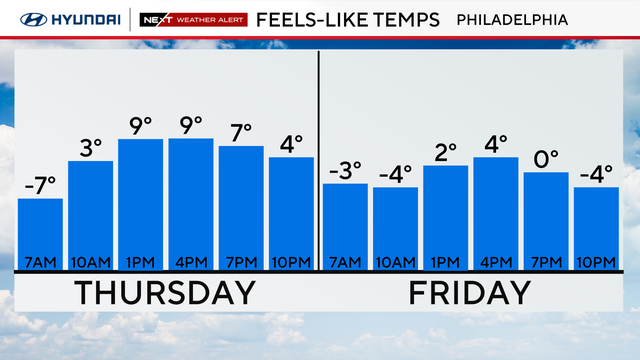
Thursday in the Philadelphia region will be another frigid day with a high of 20 degrees and feels-like temperatures of 9 degrees.
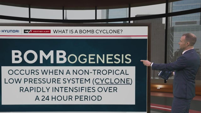
Bomb cyclones are possible year-round, but they are most common along the eastern seaboard of the United States during winter and early spring.
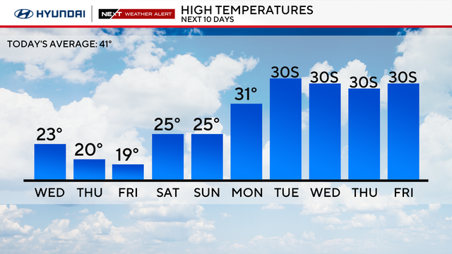
Temperatures will likely not get back above freezing until Tuesday of next week, marking 10 days of subfreezing temps.
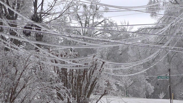
Deaths and power outages were reported across numerous states due to a monster storm across much of the country.
Tuesday in the Philadelphia region will be very cold again, with highs in the low 20s and feels-like temperatures at 10 degrees.
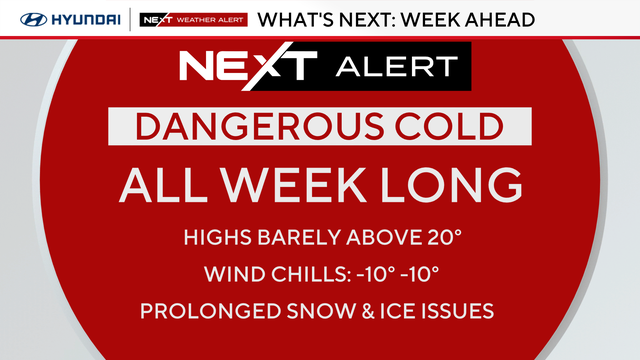
Dangerous cold grips the Philadelphia region all week, meaning the snow that fell on Sunday isn't going anywhere.
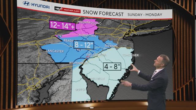
The entire Philadelphia area is under a winter storm warning for heavy snow and sleet through 1 p.m. Monday afternoon.
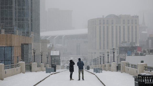
More than 230 million people are under winter storm threats as officials brace for power outages and travel difficulties.
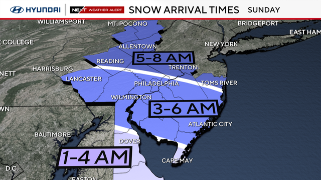
A major winter storm is headed to the Philadelphia region, forecast to bring at least 6 inches to the area. Here's what to know.
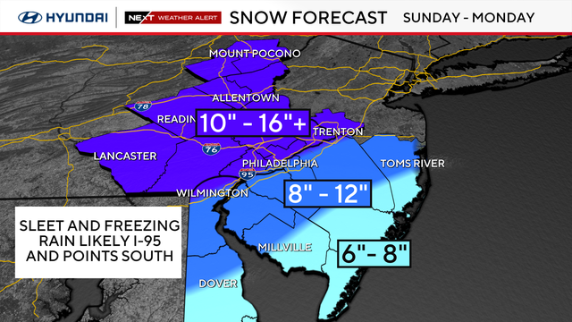
Friday in the Philadelphia region will be another milder day with some sun before a snowstorm arrives this weekend.
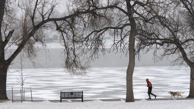
About half the population of the United States is in the path of heavy snow and crippling ice, the National Weather Service said.