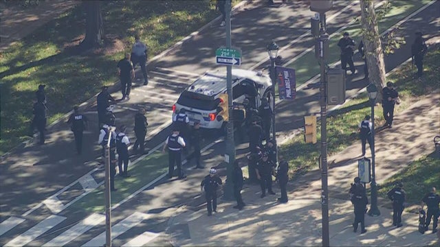
Some airlines dropping change fees ahead of incoming winter storm
Ahead of a major weekend winter storm, many airlines are dropping change fees so travelers can rebook their flights.
Watch CBS News
Ahead of a major weekend winter storm, many airlines are dropping change fees so travelers can rebook their flights.
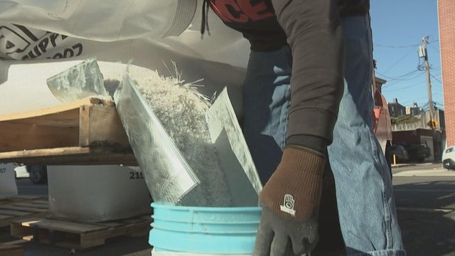
With the Philadelphia region expecting a major snowstorm this weekend, here's the best choice of ice melt to keep you safe.
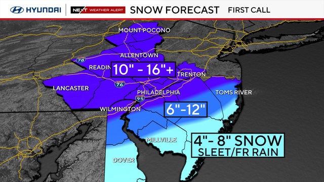
It'll be quiet and mild around Philadelphia for the next two days before a major winter storm could potentially drop a foot of snow around the region this weekend.
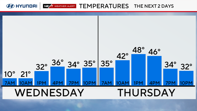
It'll still feel brutally cold in Philadelphia Wednesday, though temps climb slightly back above freezing. Looking to the weekend, the region could see its biggest snowstorm in a decade.
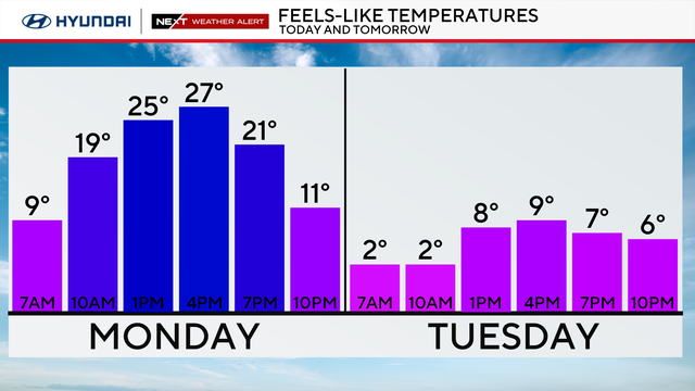
Arctic cold combined with breezy winds will create dangerously cold wind chills Tuesday morning across the entire Philadelphia region.

Snow fell across the Philadelphia region over the weekend as multiple winter storms hit the Delaware Valley.
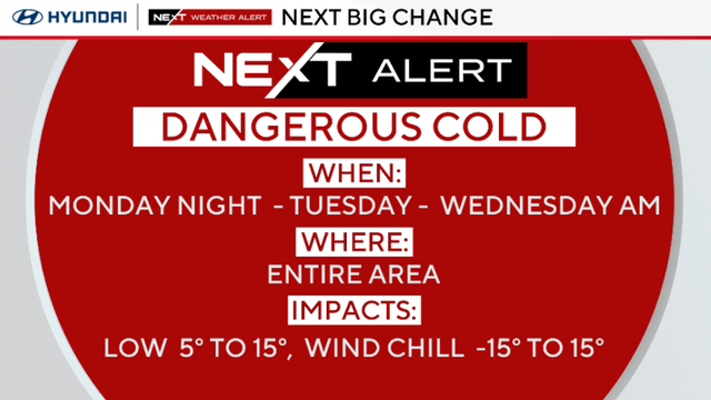
With temperatures dropping overnight across the Philadelphia region, any wet areas will freeze and become slick.

Leave a little extra drive time Sunday as more snow is on the way for the Delaware Valley.
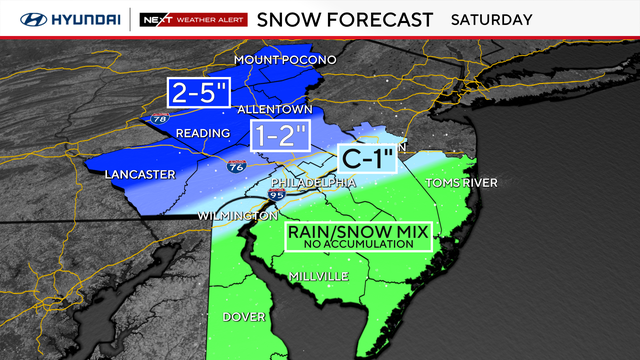
Have your winter gear ready and try to lay down some salt to help melt any of the slushy snow.
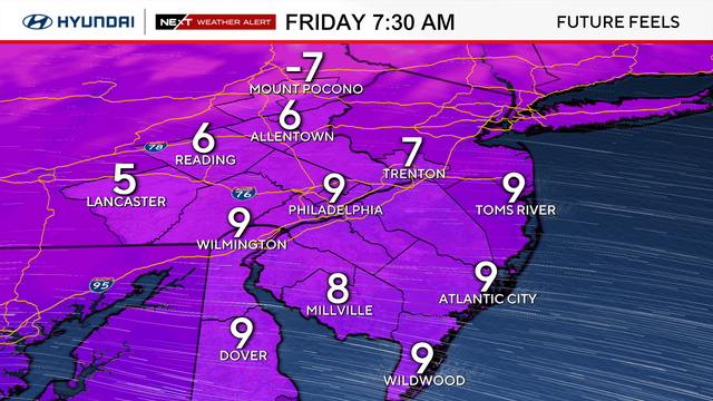
Arctic air is bringing bitter cold to the Philadelphia area Friday, before snow showers Saturday morning.
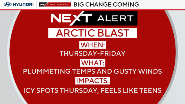
Temperatures will plummet Thursday in the Philadelphia region with winds gusting as high as 30 mph from the northwest.
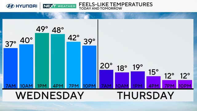
Highs will hit the 50s Wednesday in the Philadelphia region, but we'll have a chance of snow and rain at night.
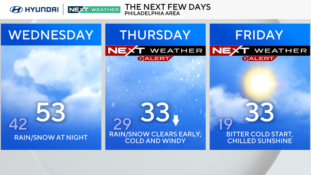
Tuesday in the Philadelphia region will be mild, but we're tracking storms this week that will bring rain and possibly snow.
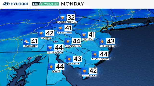
Monday in the Philadelphia region will be seasonably cold with gusty winds around 20-25 mph.
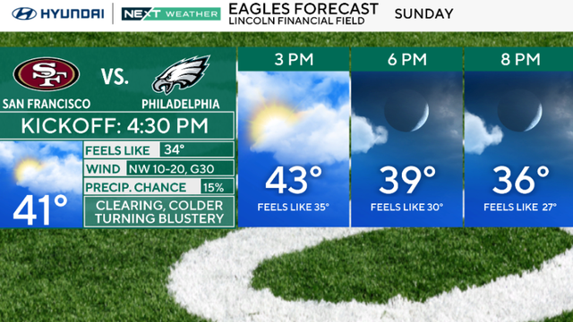
Skies will clear to partly cloudy Sunday, but later today a front to the east may generate isolated snow squalls with brief whiteout conditions and a coating of snow.
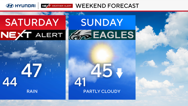
You will need the umbrella all day and a plan on little extra drive time due to wet roads.
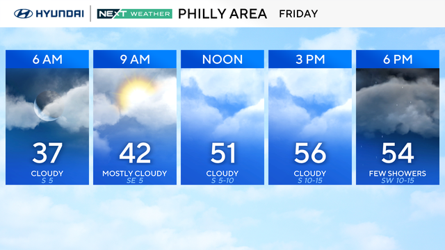
Make sure to keep the umbrella nearby Friday as scattered showers will hit the Philadelphia region.
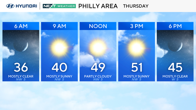
Thursday in the Philadelphia region will start chilly, but only a sweatshirt will be needed once we get into the late morning.
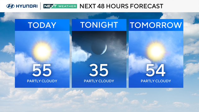
Wednesday in the Philadelphia region will be breezy with gusts up to 25 mph as temperatures will hit the 50s.
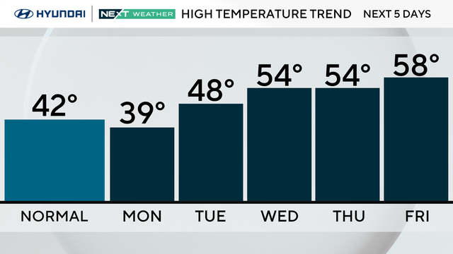
Expect to see more clouds than sun today with high temperatures in the 30s throughout the day before a warmup starts tomorrow.
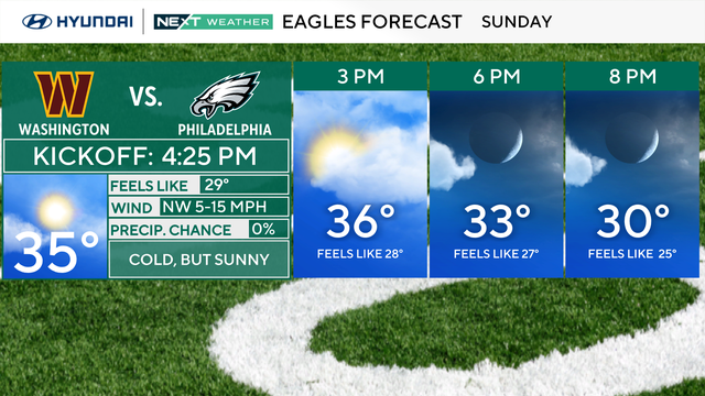
Expect mixed skies, light winds and temperatures in the mid-30s across the Philadelphia area Sunday.

Cold remains the story so the layering needs to continue, especially if you're spending time outside.
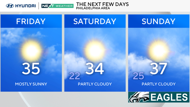
A few light snow showers are possible in the region Friday morning, but should taper off by 7 or 8 a.m.
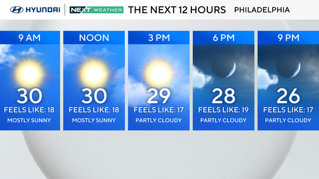
New Year's Day will be cold with a breeze that makes it feel even colder around the Philadelphia region.

Feels-like temperatures are back in the 20s on Wednesday, and a few snow showers are possible on New Year's Eve.