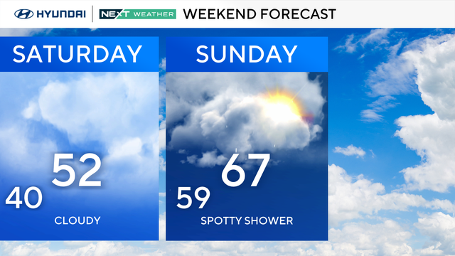
Foggy, damp Saturday before temps warm up around Philly area
Saturday starts out with some fog and could end with showers and rumbles of thunder in the Philly area.
Watch CBS News
Saturday starts out with some fog and could end with showers and rumbles of thunder in the Philly area.
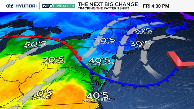
Dreary and damp conditions will persist for yet another day on Friday in the Philadelphia region.
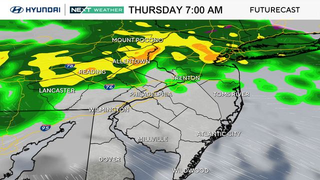
Keep the umbrella nearby again Thursday, as off-and-on showers will blanket the Philadelphia area.
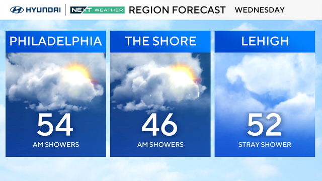
On-and-off showers will continue throughout the day Wednesday, but on the plus side, high temperatures will climb into the 40s and 50s.
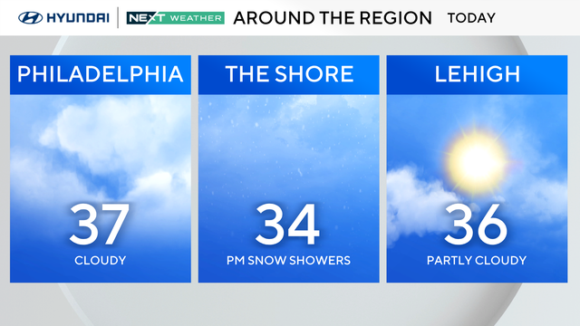
After the freezing rain in the city ended Tuesday morning, the rest of the day will still be cold, cloudy and rainy.
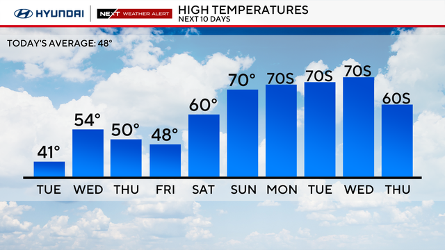
Temperatures will only reach the 30s on Monday around the Delaware Valley, but by midweek, it'll feel more like spring with highs in the 50s and 60s.
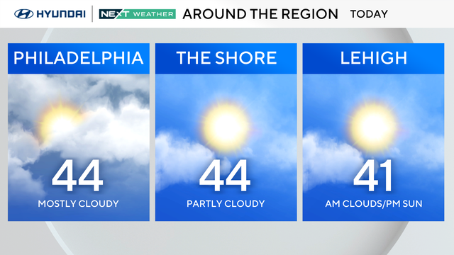
Some late-day sunshine is possible Sunday, but another blast of Arctic air pushes in this evening. Temperatures Monday morning will feel like the teens and low 20s.
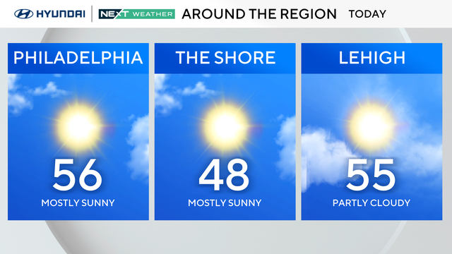
Expect temps in the mid-upper 50s with tons of sunshine on Saturday with a very nice spring feel to it.
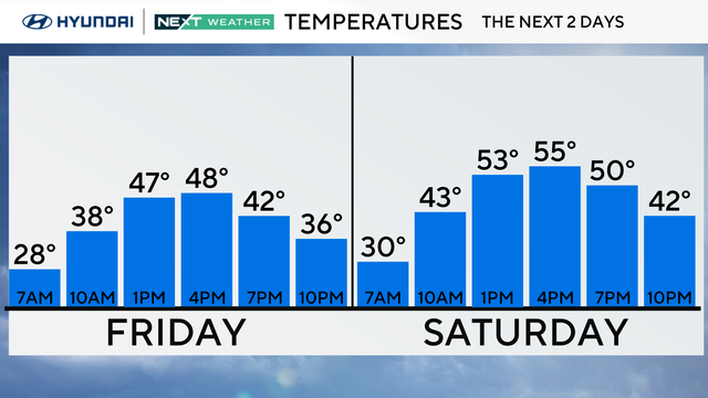
Friday starts below freezing in the Philadelphia region, but it will be sunny once we hit the afternoon as the temperatures will be warmer this weekend.
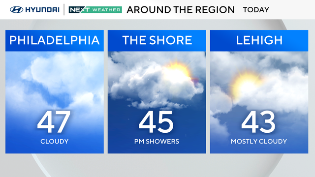
Thursday starts cool before temperatures reach the 40s, with some rain chances in the southern parts of our area.
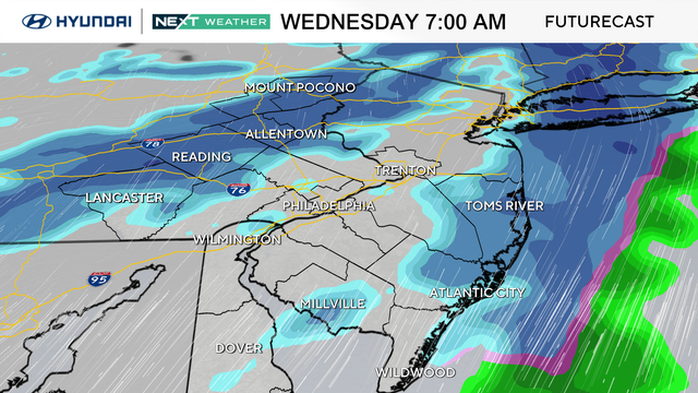
Plan on some morning snow showers around the Philadelphia region for the morning drive Wednesday.
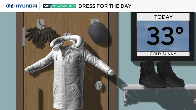
It'll be sunny and bright Tuesday in Philadelphia, but feels-like temperatures will reach the mid-20s at best during the warmest part of the day.
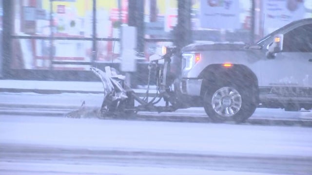
A blizzard dumped snow in the Philadelphia region overnight into Monday, with parts of the region getting nearly 2 feet of snow.
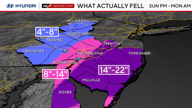
All winter storm and blizzard warnings in the Philadelphia area have been canceled after a major storm dumped over a foot of snow across the Delaware Valley.
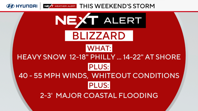
A blizzard warning is in effect for the I-95 corridor, the Poconos and all of New Jersey and Delaware as a potentially record-breaking snow storm bears down on the region.
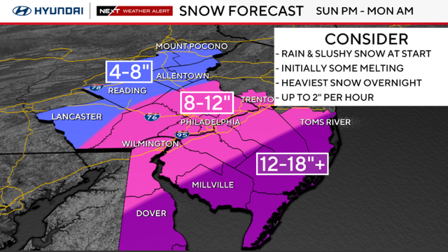
Saturday is dry and mild but Sunday's snow will likely really pick up during the afternoon and evening.
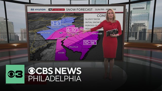
A coastal storm that could "bomb out" and intensify when it arrives could drop 6-10 inches of snow around Philadelphia and even more at the Jersey Shore. Jan Carabeo has the latest headlines on how our region is preparing for the storm, and NEXT Weather Meteorologist Tammie Souza has the latest forecast.
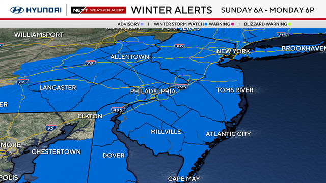
We've issued a NEXT Weather Alert for Sunday into Monday as we track the possibility of a wintry mix and snow.
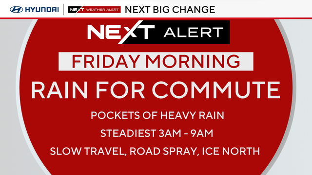
Thursday will be cloudy and cool thanks to a breeze from the east. Looking to the weekend, the NEXT Weather team is tracking the chance for more snow Sunday night.
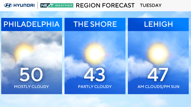
Expect temperatures to stay around 45 degrees this week in the Philadelphia region, which will significantly help melt the remaining snowpack.
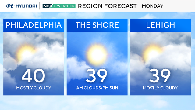
Temperatures in the Philadelphia area will stay above freezing for much of the week.
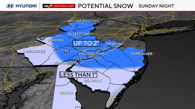
A NEXT Weather Alert is in effect as light rain and slushy snow move into the Delaware Valley Sunday afternoon into early Monday morning.
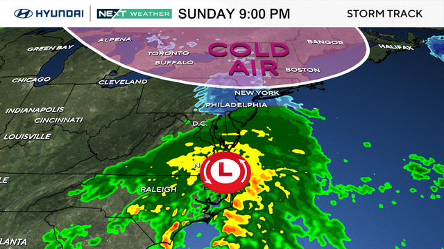
After a wonderful Valentine's Day, we could see rain changing to snow, or a wintry mix, in parts of the Philly area Sunday night.
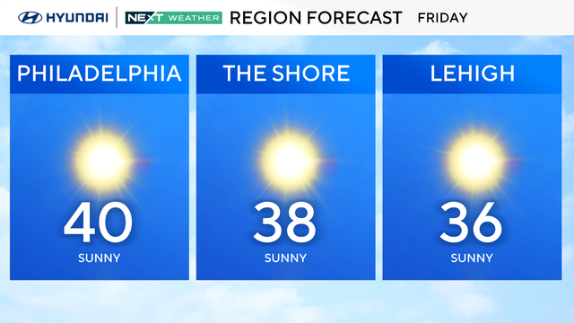
Mild Friday ahead of a mostly sunny Valentine weekend with a slight chance of snow on Sunday.
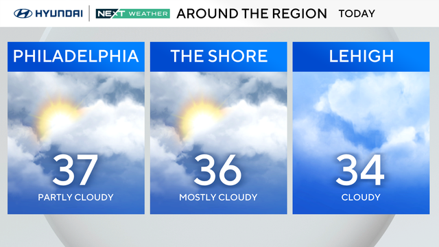
After a taste of more seasonable conditions yesterday with highs in the middle 40s, cooler air sneaks back into the Philadelphia region Thursday.