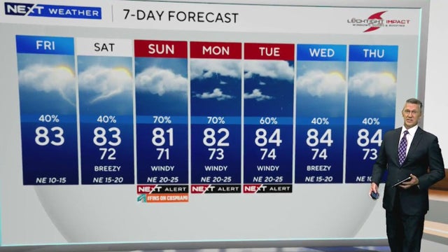
Drier, cooler weather brings a taste of fall to South Florida this week
All flood advisories and warnings have expired, but the entire area remains under a Level 1 Flash Flood threat
Watch CBS News
All flood advisories and warnings have expired, but the entire area remains under a Level 1 Flash Flood threat
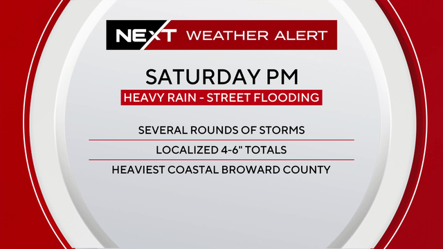
A cold front interacting with deep tropical moisture will bring widespread showers and thunderstorms, with the greatest impacts favored along the east coast metro areas.

Gov. Ron DeSantis said Tuesday that all areas able to receive power should be reconnected by day's end, and he announced $27 million in grants for rural areas.
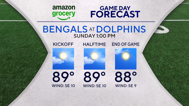
Expect minimal chances for rainfall.
Saturday and Sunday morning, we will see the highest of the king tides for this cycle.
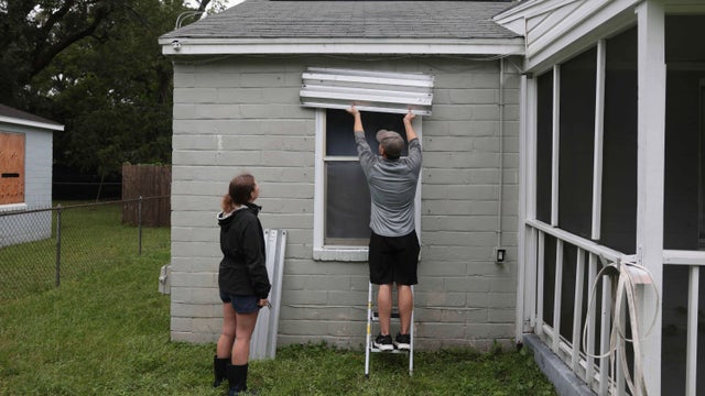
Hurricane Isaias strengthened into a major Category 3 hurricane with winds of 120 mph hours ahead of a potential Florida landfall.

Free sand for sandbags was offered at eight locations, and a Pensacola hardware store sold out of generators before noon Thursday.
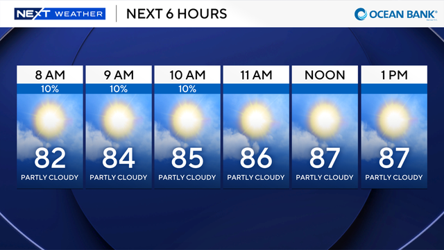
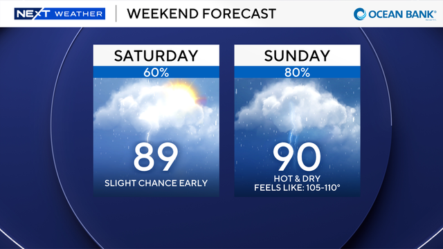
The combination of sun and high humidity will create some triple-digit feels-like temperatures, mostly in our Glades border communities.
If you were looking to cool down with a swim in the ocean, you'll need to skip that today.
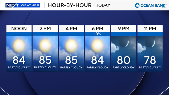
However, stay on the sand this weekend as we will see a high risk of rip currents.
The tropical moisture that's been feeding the heavy rainstorms over the last week retreats.
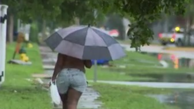
A city truck blocked a flooded residential street near Tam O'Shanter Boulevard, trapping at least 1 resident outside her home.
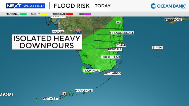
The Weather Prediction Center has issued a Level 1 Marginal risk of flash flooding from Pompano Beach south to Key West.
The Fall Equinox, the official start of astronomical fall, is on Tuesday. But it will still feel like summer in South Florida.
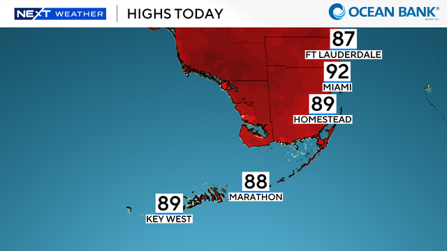
It's a perfect morning and early afternoon on our beaches.
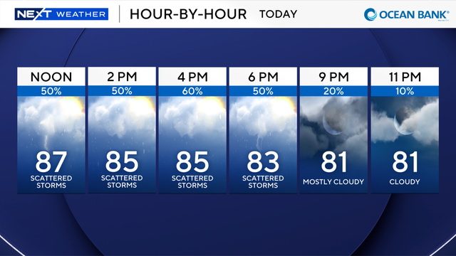
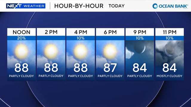
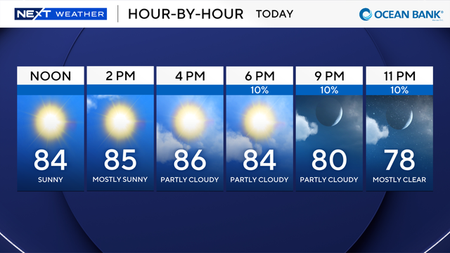
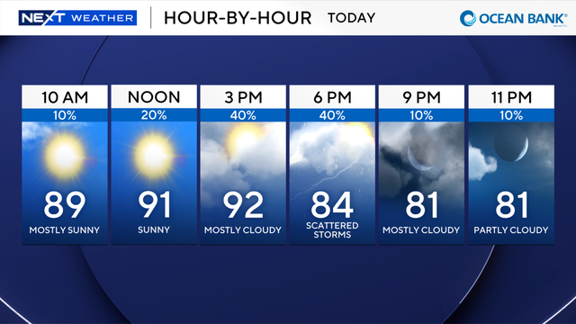
Most of the rain is shifting away from the morning hours and to the mid-to-late afternoon and into the early evening hours.
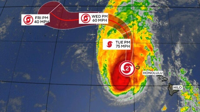
Hurricane Lowell was skirting western Hawaii, bringing damaging winds, heavy rain and punishing waves, the National Hurricane Center said.
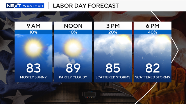
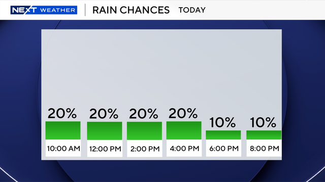
Scattered showers will roll through both Miami-Dade and Broward counties starting at noon and running through the early evening hours.
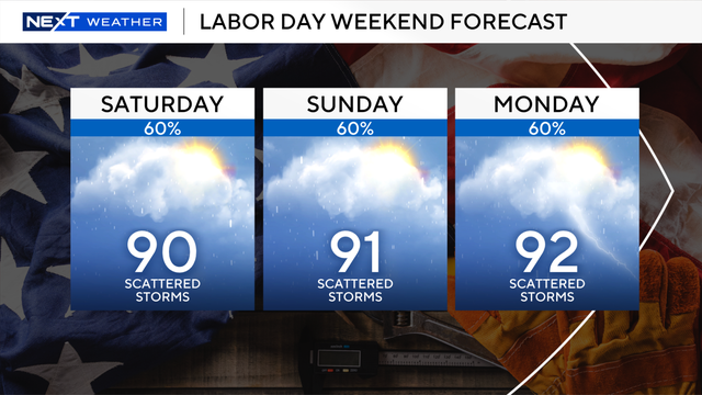
Our rainy season has returned with a vengeance.
The NEXT Weather Team is tracking the tropics this week as two systems.
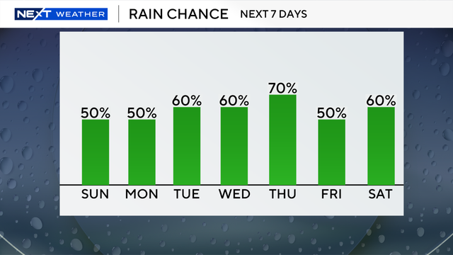
The rainy afternoons will last through next weekend.
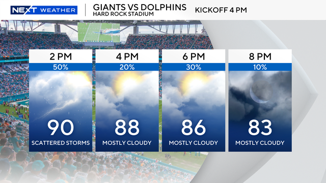
We will see "feels like" temperatures in the triple digits, but they will not last long enough to trigger a heat advisory, according to the National Weather Service.
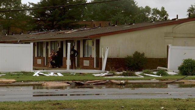
Heavy rain and winds were pounding the Northeast U.S. as storms tore through a beach on Long Island and knocked out power in Delaware's capital city.
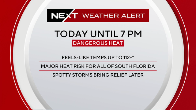
More moisture could also be seen on Wednesday around South Florida, which will lead to even hotter feels-like temperatures due to the humidity.
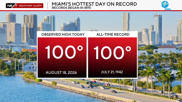
Health officials urged families to stay hydrated and limit time outdoors during the hottest hours on Tuesday afternoon.