Rain in the cards for South Florida this weekend
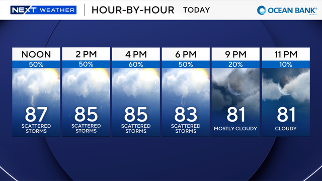
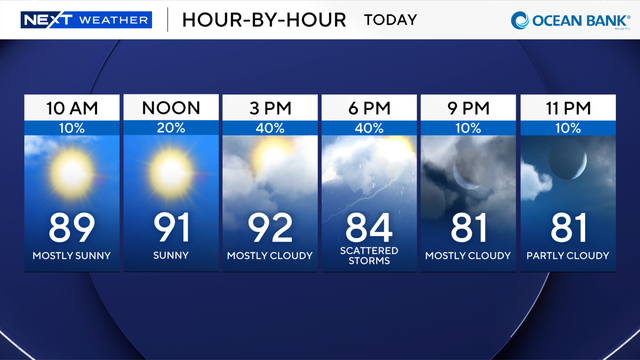
Most of the rain is shifting away from the morning hours and to the mid-to-late afternoon and into the early evening hours.
Watch CBS News
Most of the rain is shifting away from the morning hours and to the mid-to-late afternoon and into the early evening hours.
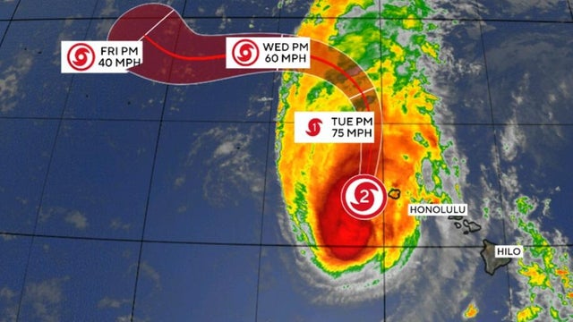
Hurricane Lowell was skirting western Hawaii, bringing damaging winds, heavy rain and punishing waves, the National Hurricane Center said.
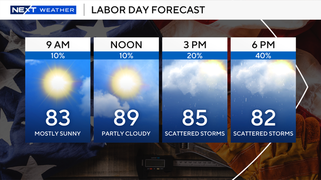
Scattered showers will roll through both Miami-Dade and Broward counties starting at noon and running through the early evening hours.
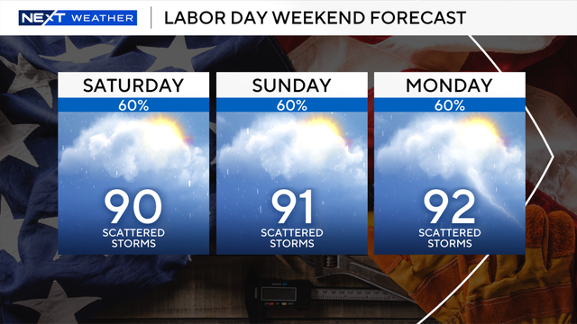
Our rainy season has returned with a vengeance.
The NEXT Weather Team is tracking the tropics this week as two systems.
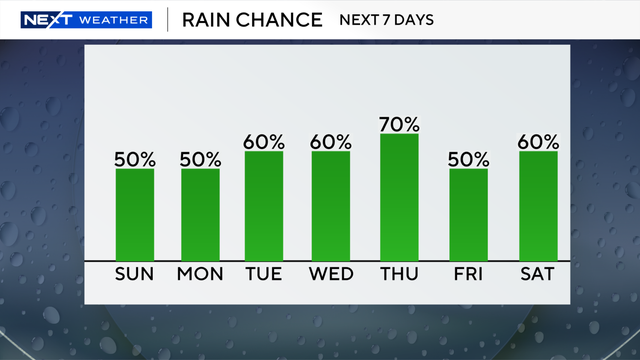
The rainy afternoons will last through next weekend.
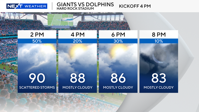
We will see "feels like" temperatures in the triple digits, but they will not last long enough to trigger a heat advisory, according to the National Weather Service.
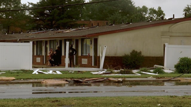
Heavy rain and winds were pounding the Northeast U.S. as storms tore through a beach on Long Island and knocked out power in Delaware's capital city.
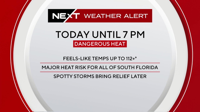
More moisture could also be seen on Wednesday around South Florida, which will lead to even hotter feels-like temperatures due to the humidity.
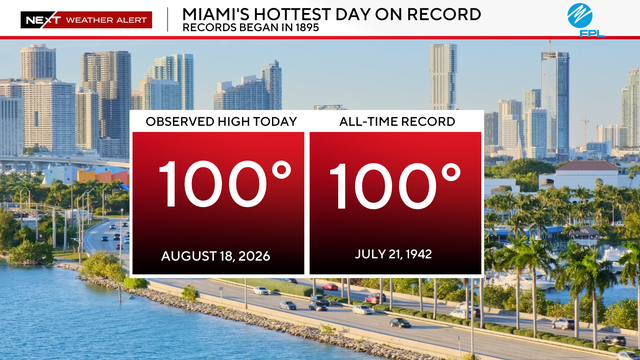
Health officials urged families to stay hydrated and limit time outdoors during the hottest hours on Tuesday afternoon.

We will see little to no relief from rain throughout the day to day due to an influx of Saharan Dust squeezing the moisture out of the atmosphere.

High humidity across the region, combined with the real temperatures, will create triple-digit "feels like" temperatures from Pompano Beach to Key West.

The National Hurricane Center is watching two areas for potential development.

Temperatures will peak in the low 90s from Fort Lauderdale to Key West, but with high humidity, we'll see triple-digit feels-like temperatures.
High wind shear driven by El Niño is the dominant factor holding down storm formation, researchers say.

The tropics remain quiet, with no development expected over the next seven days.

A heat advisory is in effect from 11 a.m. to 6 p.m. for Miami-Dade and Broward counties.

Highs today and Monday will reach the low 90s, with heat index values of 105 to 110 degrees.

Slow-moving storms that impact an area will stabilize the atmosphere for a while, so if you have a downpour in your area, once it ends, the rain will hold off for the next few hours.

University of Miami scientists are working to save an endangered coral species from extinction by bringing them ashore.

A Heat Advisory will be in effect for Broward and Miami-Dade from 11 a.m. until 7 p.m. on Monday.

We're keeping an eye on the tropics as well.

The humidity and that heat will push the "feels like" temperatures into the triple digits across the metroplex and the upper 90s in the Keys.

After a week that has been mostly dry, hot, and hazy, there is a return of significant rain chances across South Florida for Friday afternoon.

A Heat Advisory will be in effect from 11 a.m. until 7 p.m. for metro Broward and Miami-Dade on Thursday, as "feels-like" temperatures could peak at 108.