Sunday in South Florida is cloudy after a rain-soaked Saturday

The NEXT Weather Team is tracking a cloudy day across South Florida with some pop-up showers and storms rolling across the Metroplex.
The cold front that pushed down across the state and triggered the powerful storms and flooding on Saturday night is moving towards the Keys. The heavy downpours created Flash Flood Warnings across Broward County early Sunday morning.
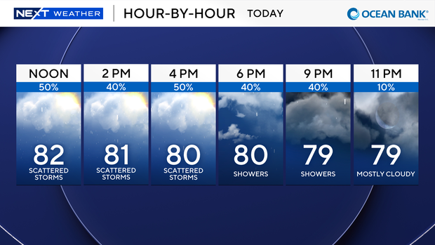
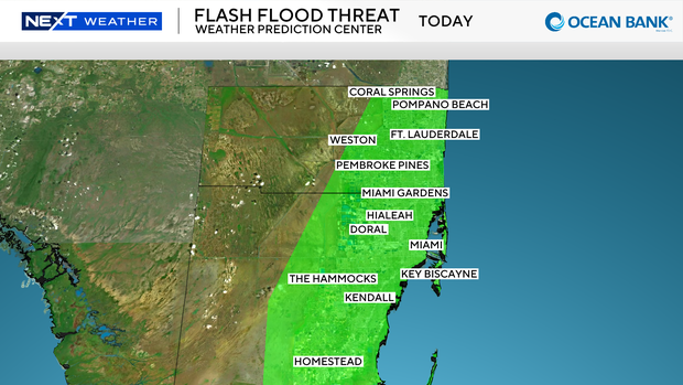
All flood advisories and warnings have expired, but the entire area remains under a Level 1 Flash Flood threat. Northern and coastal areas of Broward County were soaked with 5-6 inches of rain in the last 24 hours.
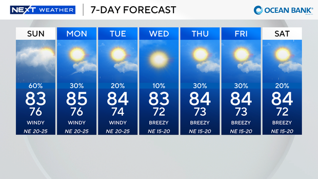
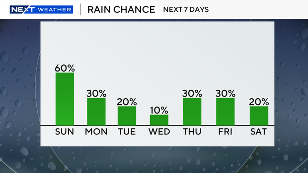
Once the front moves below the Keys, we'll start to dry out and will have lower rain chances for the next week.
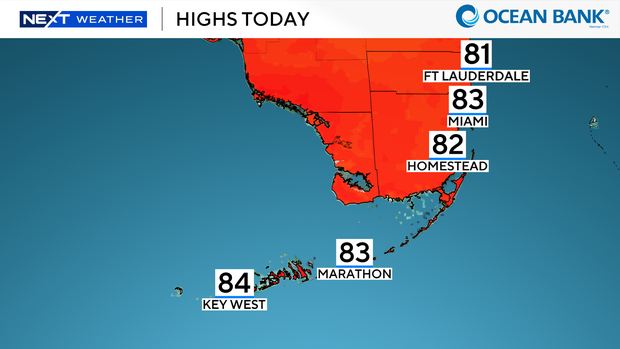
The cold front is also causing windy conditions along the coastline. Gusts of wind from the north and northeast are expected for the next several days. The winds and gusts are creating dangerous conditions on the beaches and waterways.
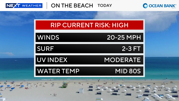
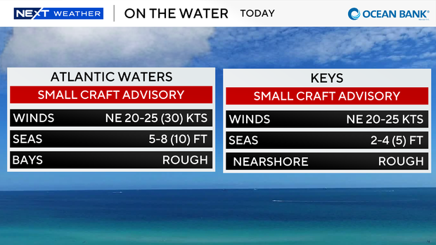
There's a high rip current risk in effect. The winds are generating rough seas, so small boat advisories are in effect for all coastal waterways.
The next seven days look much better with drier and cooler temperatures settling in for the first real brush of "fall" in South Florida.