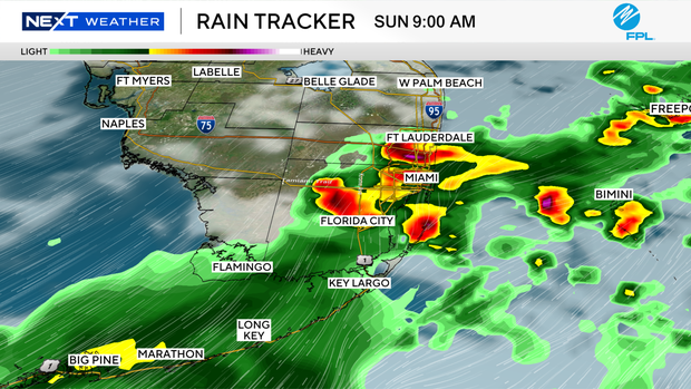
South Florida under a NEXT Weather Alert Saturday evening for heavy rain

The NEXT Weather Team has issued a NEXT Weather Alert for Saturday evening as heavy rainfall and localized flooding become increasingly likely across South Florida.
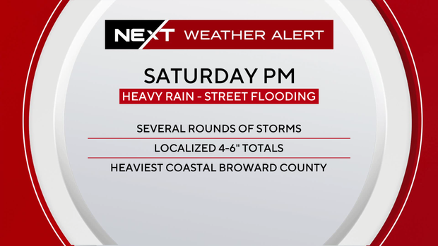
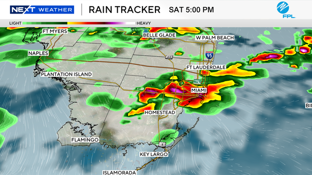
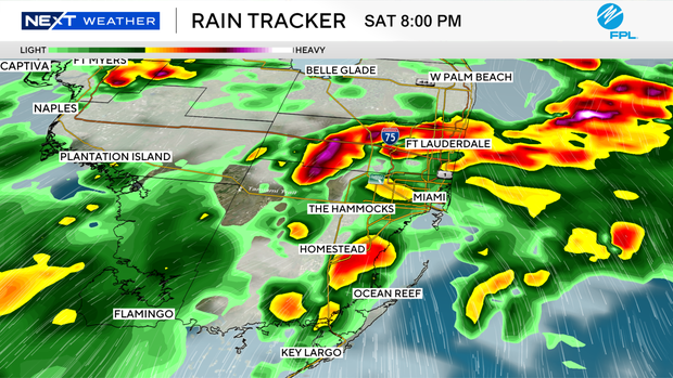
A cold front interacting with deep tropical moisture will bring widespread showers and thunderstorms, with the greatest impacts favored along the east coast metro areas.
Coastal Broward County may be particularly vulnerable to street flooding for two reasons:
- High-resolution forecast models suggest this area could be more favorable for training or backbuilding thunderstorms, allowing repeated rounds of heavy rainfall over the same locations and increasing the potential for significant rainfall accumulations.
- Recent heavy rainfall has left soils saturated in some areas (or close to it), limiting their ability to absorb much additional rainfall. As a result, it may take less rain than usual (or less than in other parts of our market) to overwhelm drainage systems and cause street flooding, especially in low-lying and poorly drained neighborhoods.
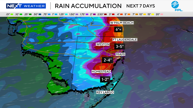
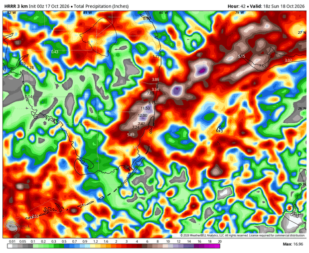
A slight flood risk (level 2 of 4) for excessive rainfall is now highlighted across the east coast metro areas on Saturday, including coastal Miami-Dade, Broward, and Palm Beach counties. The greatest risk of significant street flooding would be from early afternoon to late evening, with periods of heavy rain potentially continuing into Sunday morning.
Widespread 1-3" across the region through Sunday, with localized totals of 5-6 inches possible. It is very possible to see a very localized maximum rainfall total of 7-8" should a hyper-focused band of storms materialize and continue to build over the same neighborhood for a prolonged period.
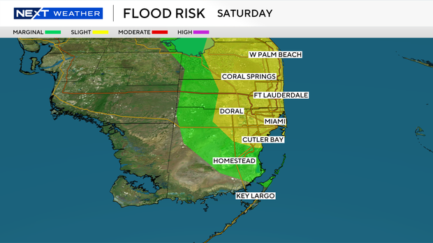
Broward County, east of I-95, from Wilton Manors north to Deerfield Beach and into Palm Beach, is the most vulnerable area, followed by all areas east of I-95 for coastal Broward down through Miami-Dade.
Windy weather develops behind the front with northeast winds of 20-25 mph, gusting to 35 mph on land, and potentially gale force winds over water. Atlantic seas will be building 12-15 feet late Sunday. A small craft advisory begins Saturday night with hazardous boating conditions likely much of next week.
Additional showers and storms are possible for Sunday, with a marginal risk for excessive street flooding (level 1 of 4). Rain chances significantly decrease late Sunday as the front clears our area to the south.