
Showers linger around North Texas Friday morning
As we move through this Friday, don't put away your rain gear just yet.
Watch CBS News
As we move through this Friday, don't put away your rain gear just yet.

Heads up! CBS News Texas meteorologists have issued a weather alert for today. Parts of North Texas could see a few strong storms.

Be ready for on-and-off rain and storms throughout the day Thursday!
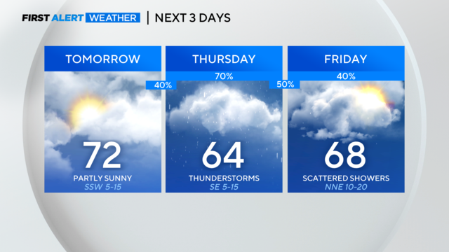
Rain picks up Wednesday night through Friday.

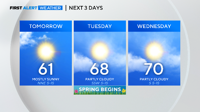
Tuesday starts out cold before temperatures reach near 70 degrees.

A few spots to the north and east could be dealing with wind chills in the upper 20s by 7 a.m.

The kids will want an extra layer heading off to school this morning with temperatures in the upper 40s and low 50s.
Storms are possible again this coming Thursday.
As we see the trees and flower beds starting to turn green, we've welcomed this warm and wet start to March.

We'll likely see mostly cloudy skies this morning, but later today, scattered rain and storms will likely develop.
Heavy rain still will be an issue into Friday.

Tonight, we'll see increasing clouds. An isolated shower or storm is possible. Low temperatures will be in the upper 60s.
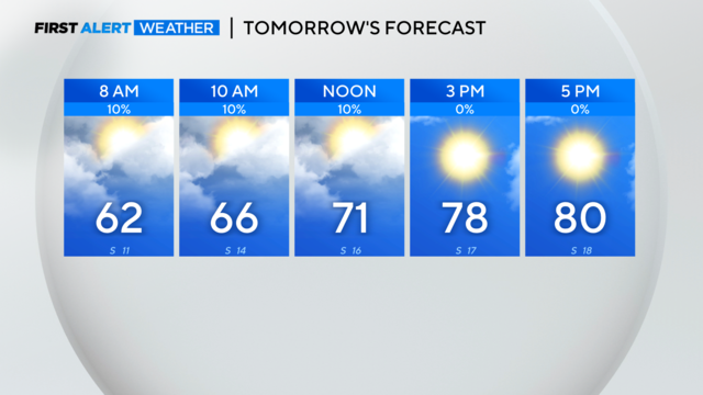
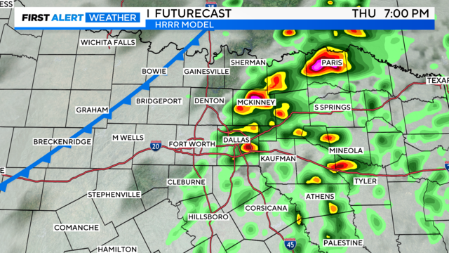
Strong/severe storms are possible Thursday & into early Friday morning.

As we move through this Tuesday, expect warm, breezy weather.

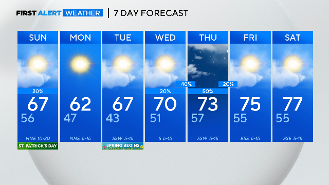
We'll see calm, warmer weather on Tuesday and Wednesday. Severe storms are possible Thursday.

A few sprinkles or light rain showers are possible, but we're not expecting a washout.
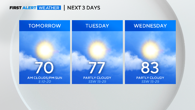
Our spring pattern continues with a mid-week warmup ahead of the next strong cold front.
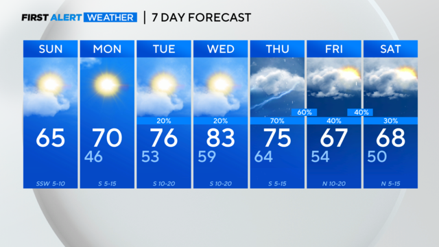
Spring Break weather rolls into DFW with highs in the mid-60s. Showers later this week.
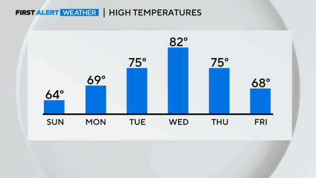
Warming trend begins Sunday, while next chance for strong storms expected Thursday.
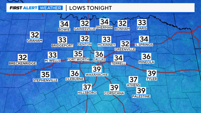
Temperatures will be close to freezing in some spots on Sunday morning.
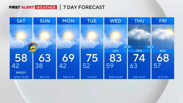
Get ready for a noticeable cooldown into Saturday. Along with gusty northwest winds, temps will be in the 30s and low 40s.
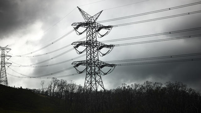
Oncor says teams are prepared and will continue to monitor all weather developments and potential impacts.
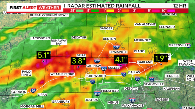
Strong storms approach from the west overnight and the flooding threat continues across the metroplex.
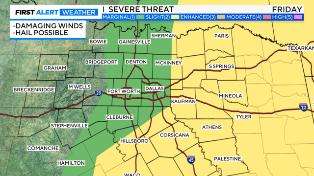
Heavy rain, large hail and gusty winds are all possible.

Cold front on Friday to bring a big cool down into the weekend.