Chilly mornings ahead as spring officially begins

NORTH TEXAS — We have had generous rain so far this March. We're halfway through and already in the top 20 wettest March in the 125-year history. Today makes a 4-day run of wet weather.

A cold front went through Sunday. There will be a few clouds and light rain in our southern counties this evening before clearing overnight. It will be a nice start to the work week with much drier air in place and a little bit of a breeze. I'd go with a jacket in the morning.

I'd certainly have the coat ready for the start of Spring. Just look at the feeks-like temperatures that morning, in the 30s!

We are getting a good round of rain every week. The next one arrives overnight Wednesday with storms in the forecast Thursday. We'll keep you posted on the severe threat, right now it is too early to tell. But we could have wet roads for both the morning and evening commute.

Rain should be gone by the Friday morning commute. It's the third wettest start to March on record. It could be another good rain from this system.

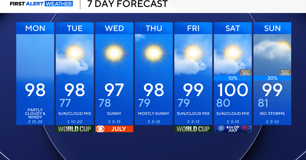
Here is your 7-day. No freezes and no 80s, just typical early Spring temperatures. Sunday could be interesting, we are expecting dryline storms coming in from the West. This could be another severe threat. The First Alert Weather team is keeping you posted.