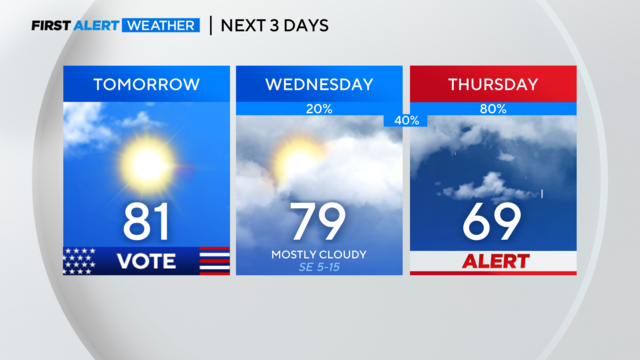
Warm weather continues for North Texas ahead of rain, possible storms later in the week
North Texas can expect mainly dry conditions tonight with a low chance for an isolated storm. Clouds return Wednesday with strong storms possible on Thursday.
Watch CBS News
North Texas can expect mainly dry conditions tonight with a low chance for an isolated storm. Clouds return Wednesday with strong storms possible on Thursday.

A weak cold front will push through the area tomorrow, and highs will sink into the mid-70s by Wednesday.

The calendar says March, but the temperatures say May.
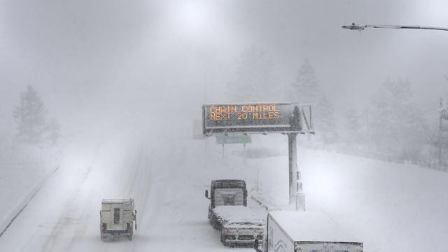
A powerful blizzard is dumping snow in the Sierra Nevada as gusty winds and heavy rain hit lower elevations.

Very warm days start Saturday and stick around for most of the week ahead.

Most of us will see rain throughout the afternoon, with high temperatures in the lower 50s.

Temperatures will have dropped to the 30s to 40s when you wake up on Wednesday morning.

Much cooler weather is moving in overnight.
Not only will Wednesday be much cooler, but it'll be windy. Wednesday morning could have wind chills in the upper 20s for some and 30s for most others.

As we move through this Monday, breezy southwest winds will push our high temperatures into the low 90s, likely shattering our record high of 90 degrees set back in 1917.

The last weekend of meteorological winter was the warmest weekend of winter, and it is only getting warmer.

It's a no-brainer, when the weather is as nice as it was on Saturday, you head to the park with your family. But for allergy sufferers just stepping outside can be a struggle.

"Participant safety is our first priority," said Heidi Swartz, Cowtown executive director.

Later in the week, we will return to winter temperatures.

It will be a good zoo or botanical garden weekend because our high temps warm into the mid-70s to the mid-80s.
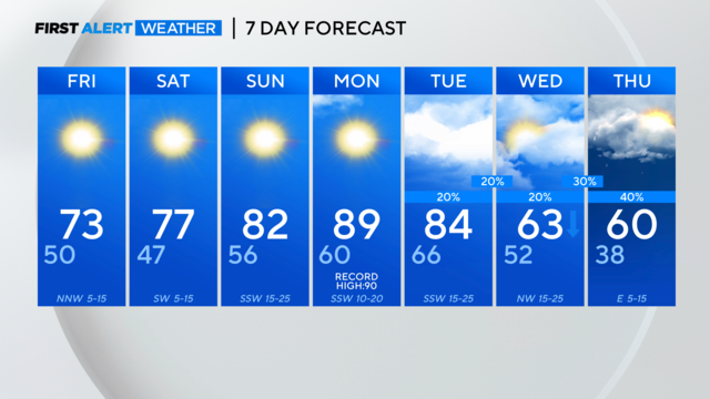
Friday we can expect cooler temperatures ahead of a warm and dry weekend.

Mild temperatures will continue.

Tuesday is the warmest day of winter and there are more days like this on the way in the week ahead.

Winds could gust to 20-25 mph at times.
A dry cold front is expected on Thursday but no cold air behind it. We'll finally have a very warm and dry weekend.
As we move through this Monday, high temperatures will be in the mid 60s under sunny skies.
It will not be freezing Monday morning but still, expect a chill in the air with enough wind to produce a wind chill near freezing.
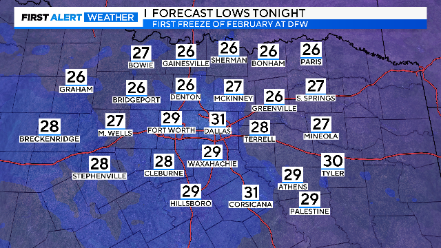
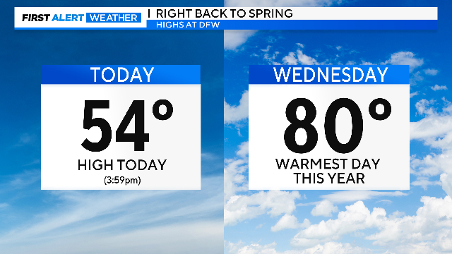
We'll have our first freeze in over 3 weeks tonight. Then we climb out of the cold and right back to spring!

We started VERY warm this morning. By lunch hour, we were in the 70s. We won't see temperatures that warm again until next week.

More clouds are on the way Thursday and Friday ahead of a strong cold front.