KDKA-TV Morning Forecast (7/3)
Get the latest weather forecast from KDKA-TV First Alert Meteorologist Ron Smiley!
Watch CBS News
Get the latest weather forecast from KDKA-TV First Alert Meteorologist Ron Smiley!

Thursday is expected to be the hottest day of the week with "feels-like" temperatures forecasted to climb over 100 degrees.
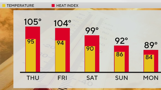
Thursday is expected to be the hottest day of the week with temperatures expected to reach 95 degrees.

Temperatures in the Pittsburgh area are expected to be in the 90s for multiple days this week.

A heat wave is bearing down on western Pennsylvania with high temperatures and "feels like" temperatures expected to be near 100 degrees.

The hottest temperatures of 2026 are expected this week with heat indexes forecasted to be near 100 degrees.
The heat is on in the Pittsburgh area this week. Here's how high the temperatures will get.
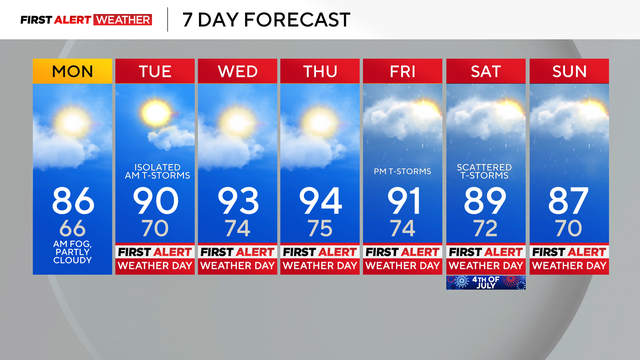
The hottest daytime temperatures of the week are expected on Wednesday and Thursday.

Heavy winds, storms, and rain are all possible in the Pittsburgh area on Thursday.

The Pittsburgh area was hit hard by severe weather on Sunday evening, with the National Weather Service issuing multiple tornado warnings.

The chance for strong to severe thunderstorms will kick up in the afternoon and evening after 2 p.m. on Sunday.

Get the latest weather forecast from KDKA-TV First Alert Meteorologist Mary Ours!

We will likely see our dry streak stretch to 9 before we finally see rain again on Saturday.

Get the latest weather forecast from KDKA-TV First Alert Meteorologist Ron Smiley!

Today is a First Alert Weather Day due to a flood threat.

The National Weather Service said to take steps now to protect tender plants from the cold.

Wednesday is looking like a rainy day.

High temperatures today should be near 70 degrees.

Heavy rain is expected to arrive Wednesday with a chilly end to the week.

Get the latest weather forecast from KDKA-TV First Alert Meteorologist Mary Ours!

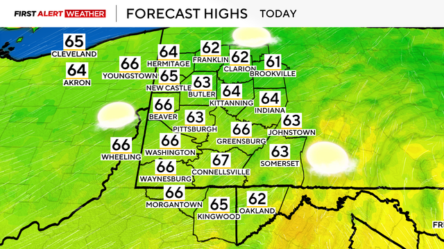
Highs today will hit the mid-60s.

Highs will hit the mid-70s and the weather is looking fantastic
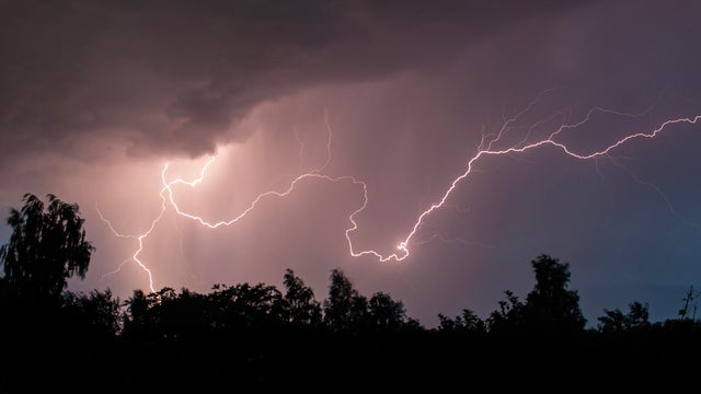
After an active overnight with strong to severe storms, we are left with heavy downpours throughout the morning commute and into the afternoon/evening.

Scattered strong to severe storms are possible with damaging winds, hail and an isolated tornado not out of the question.

Today will be mostly cloudy with highs in the upper 60s and a few more showers possible north of I-80 late tonight.