Next Weather: Pleasant Thursday, hot and humid Friday
Thursday will be pleasant one, like Wednesday minus all the wind.
Watch CBS News
Thursday will be pleasant one, like Wednesday minus all the wind.

Even though it's hot outside, most said they would rather it be hot than cold since customers still come out no matter how hot it gets.
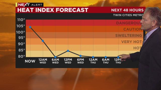
After a dangerously hot and humid Tuesday, Wednesday will be cooler, breezy and less humid.
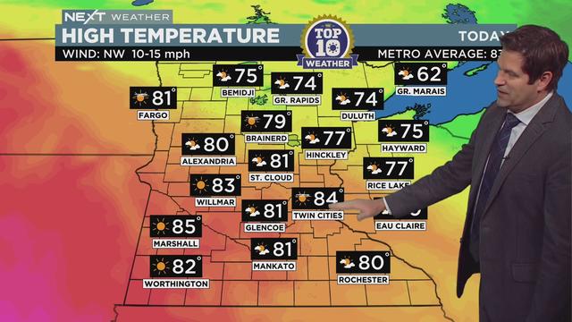
It's a #Top10WxDay to start out the week, but excessive heat is coming our way Tuesday.
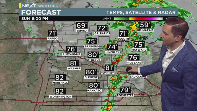
The Next Weather forecast features muggy heat and possible severe storms, but Monday looks amazing enough to be declared a Top 10 Weather Day!
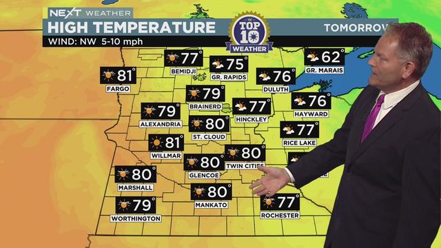
The workweek will wrap up with a couple of pleasant days, including a Top 10 Weather Day on Friday.
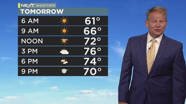
The rest of the work week will be pretty quiet weather-wise, before a return of heat and humidity this weekend.
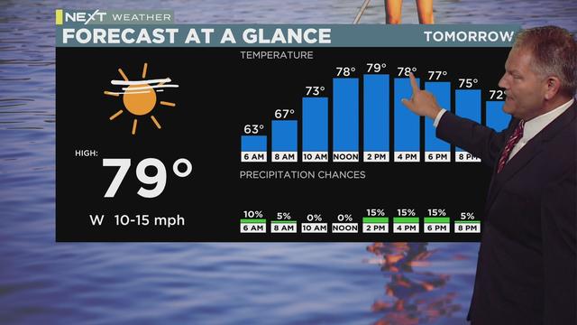
It will be much less humid and a bit breezy Wednesday, with a high temperature of 78 degrees. There could be a few isolated showers.
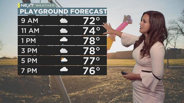
Katie Steiner has the latest weather report.
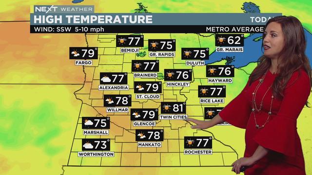
Monday will make for a beautiful start to a week of very pleasant weather.
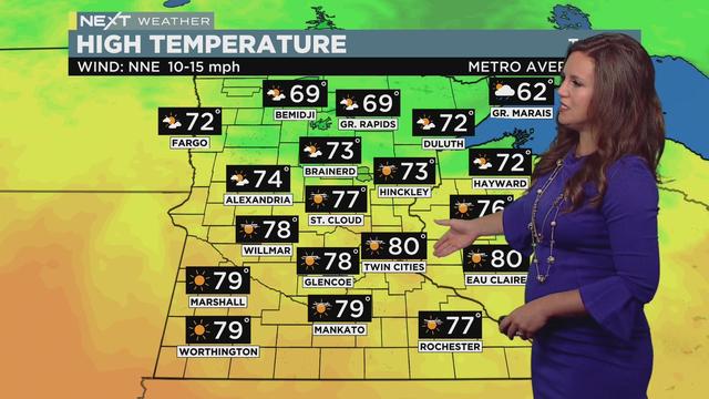
Sunday's shaping up to be a perfect summer day.
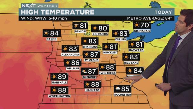
Expect a high of 88 in the Twin Cities, with comfortable humidity levels by the afternoon.
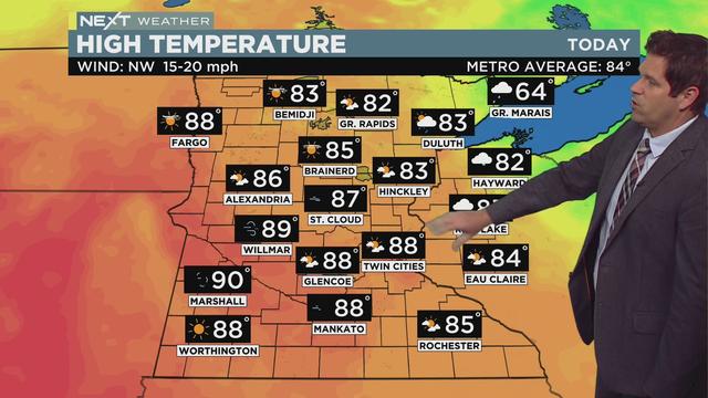
Wednesday will still be a warm one, but humidity levels will fall throughout the day.
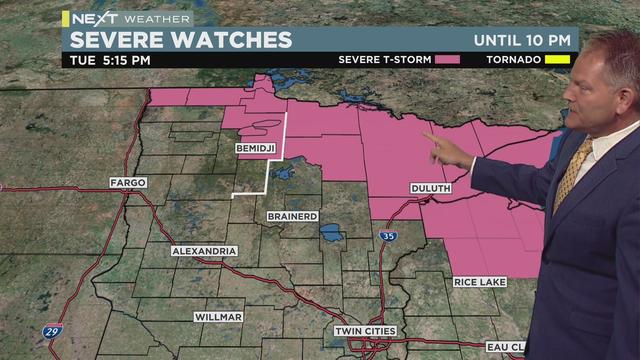
Showers and thunderstorms are possible mainly up north Tuesday evening.
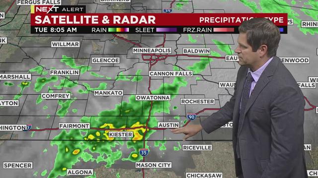
It’s another Next Weather Alert day due to the heat, but it’ll be cooler than yesterday.
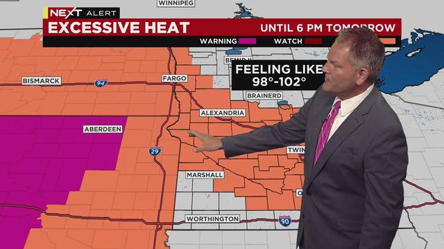
Chris Shaffer has the latest Next Weather report on a day of excessive heat.
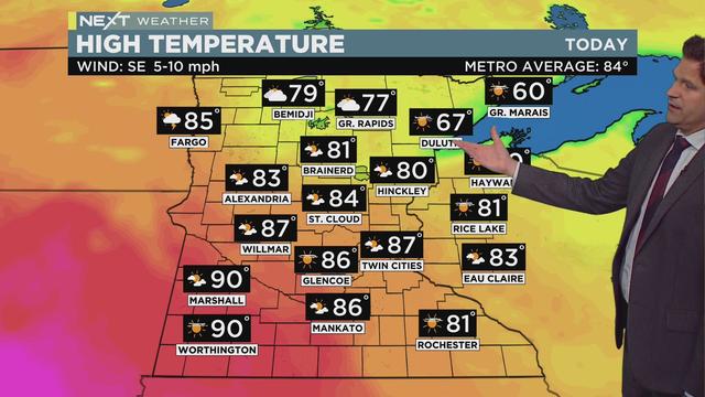
Storms will enter from the west in the afternoon, likely reaching the Twin Cities after sunset.
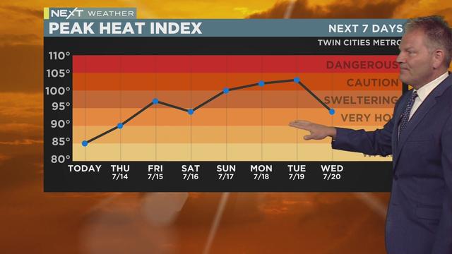
Thursday starts out comfortable. But clouds, temperatures and humidity will build as the day rolls on.
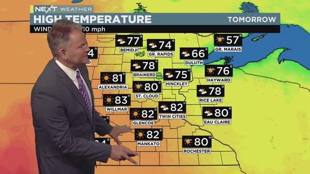
After a stormy Tuesday night, the Next Weather factor should be welcomed news for most.
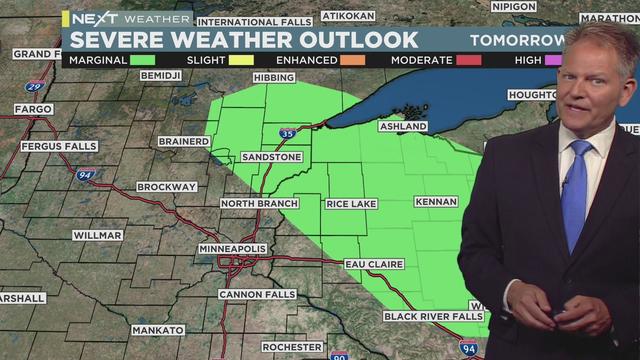
Tuesday will be less humid than Monday, and will bring yet another chance for rain and a marginal risk for severe storms northeast of the Twin Cities.
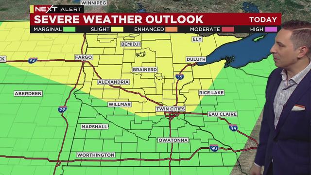
Sunday is a Next Weather Alert day due to the potential for a couple of rounds of severe weather.

You might spot some funnel clouds in Minnesota on Thursday, but the National Weather Service says not to worry.
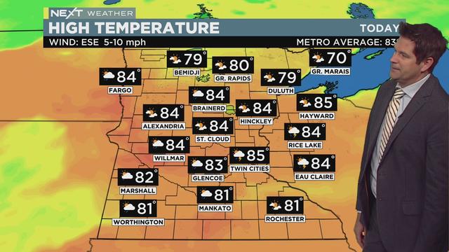
Dew points are already in the upper 60s in many parts of Minnesota Thursday morning.
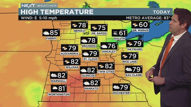
Wednesday will be slightly cooler than the day before, but it will still be very humid in the Twin Cities.
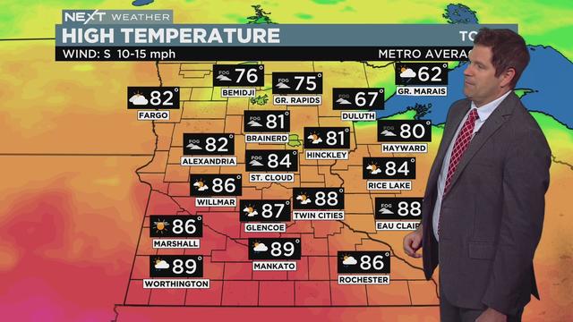
Several severe thunderstorm warnings have been issued in southwest Minnesota Thursday afternoon.