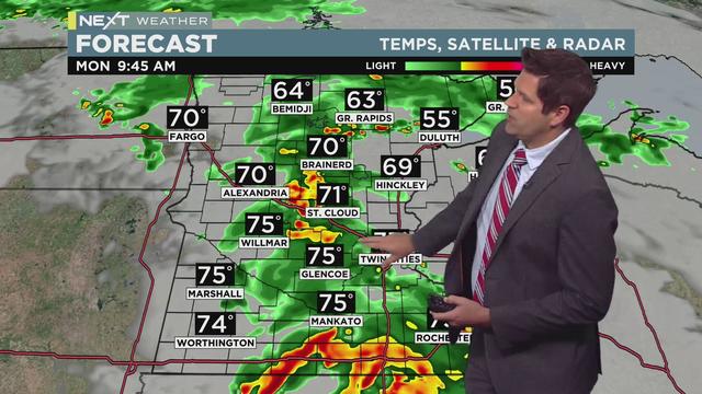
Next Weather: After stormy start, skies will clear for July 4 fireworks
The July Fourth holiday is starting out stormy, but things should clear up in time for evening cookouts and fireworks shows.
Watch CBS News
The July Fourth holiday is starting out stormy, but things should clear up in time for evening cookouts and fireworks shows.
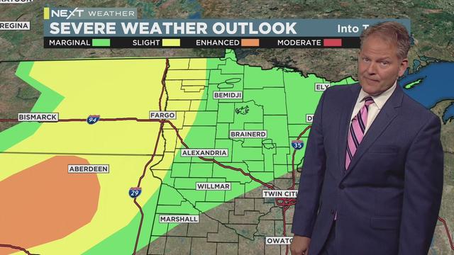
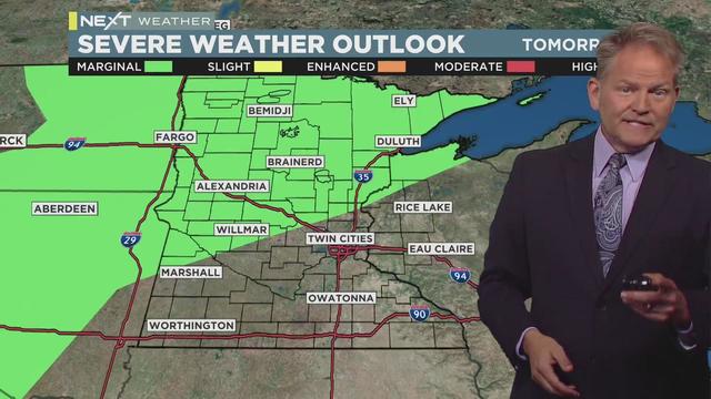
Severe storms rumbling over the Dakotas are expected to move into western Minnesota late Wednesday night through early Thursday morning.
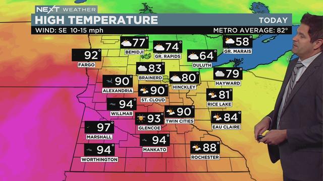
Riley O'Connor has the latest forecast.
It will be hot Wednesday, with another shot at 90 degrees, and the wind will get stronger as the day progresses.
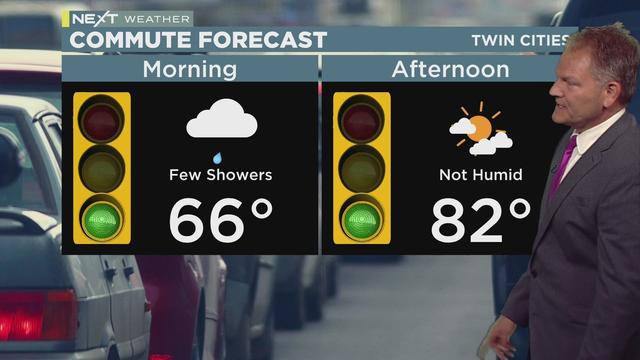
Storms are possible on Tuesday, with rainfall and a few rumbles of thunder likely early on.
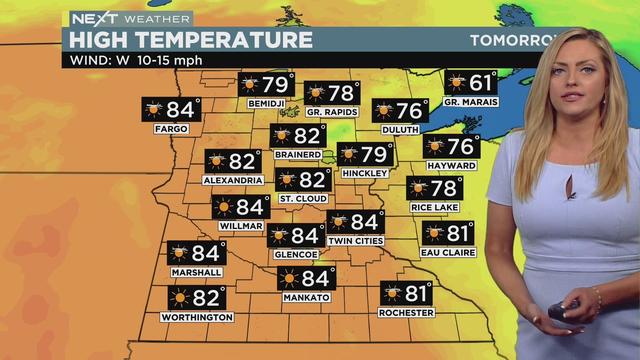
Monday will be mostly sunny with a high of 84, which is about 9-degrees warmer than Sunday.
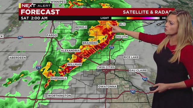
Forecasters say the storm line is expected to drift toward central Minnesota in the overnight hours, weakening as it pushes deeper into the state. Still, a severe thunderstorm watch is in effect until 3 a.m. Saturday for a large swath of Minnesota, stretching from Marshall in the southwest to Ely in the Arrowhead.
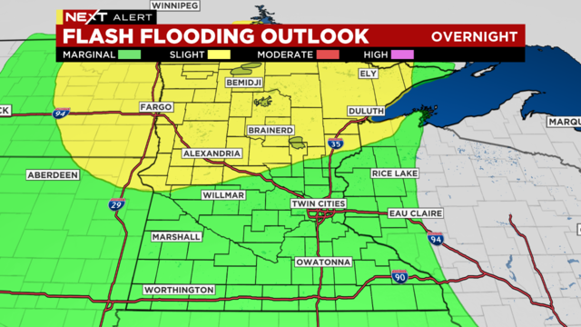
Severe thunderstorms developed Thursday evening over parts of north-central and northeastern Minnesota, dropping quarter-sized hail and heavy downpours.
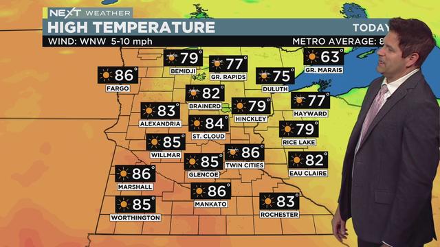
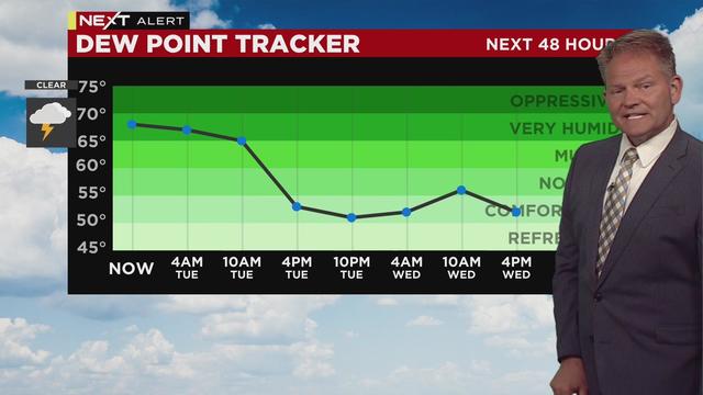
Wednesday will be comfortable with low humidity, but the break from the heat will be brief as temperatures jump back up on Thursday.
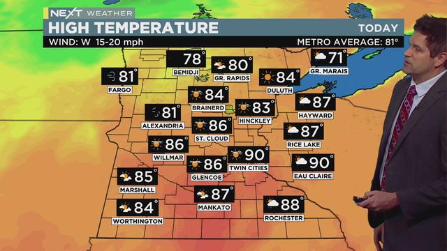
While Tuesday won't be as hot and humid as the past couple of days, temperatures will still be well above average.
Monday was the first time in four years that we got into the triple digits, and it was the warmest day in nearly a decade.
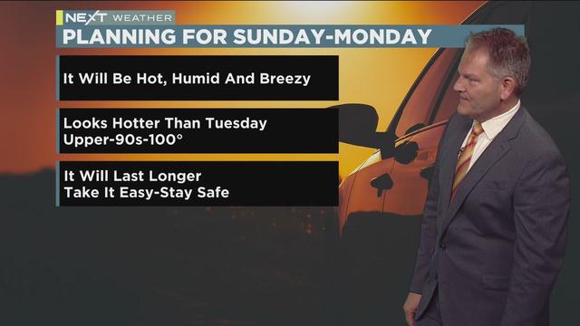
Fathers, and everyone else for that matter, should really take it easy this Father's Day.
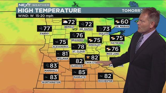
The Twin Cities will be storm-free for the next several days, but not free from dangerous heat and humidity.
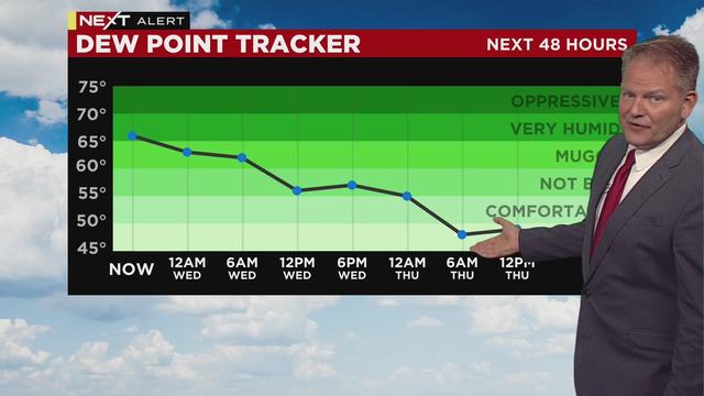
After enduring the hottest day so far this year in the Twin Cities, Wednesday will be far less oppressive.
In Minnesota, weather can be all over the place. Here at WCCO, we want to give you what you need to prepare for what's happening next.