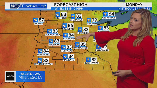
Pleasant Monday, with return to 90s midweek
The heat is back on this week, but not nearly as brutal as last week.
Watch CBS News
The heat is back on this week, but not nearly as brutal as last week.
Meteorologist Joseph Dames has the latest forecast.

As Minnesota weathers extreme heat this week, more of the state is now experiencing severe drought conditions.
An air quality alert remains in effect for parts of Minnesota Monday, and dangerous heat is in store later in the week.
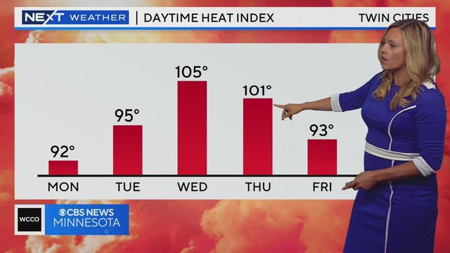
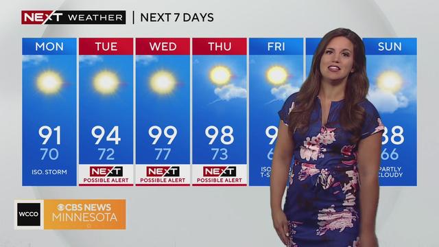
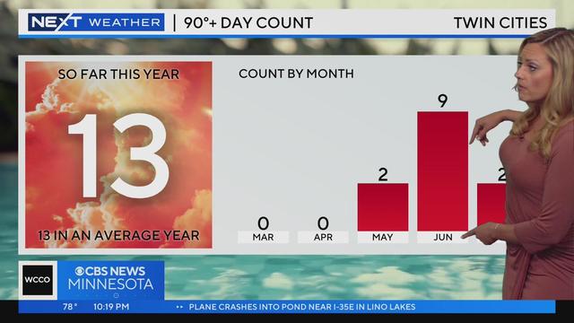
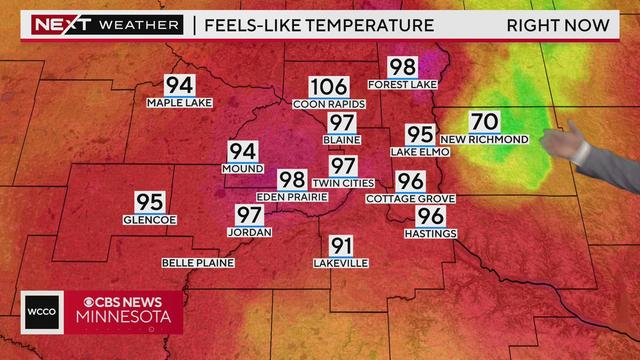
Temperatures will soar this week, with highs above 90 Monday through Friday and a couple of days close to 100.
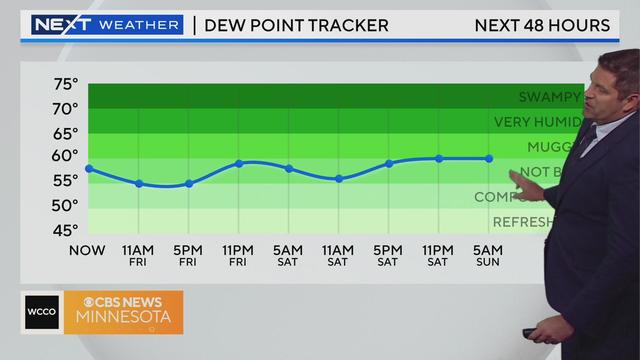
Meteorologist Riley O'Connor has the latest forecast.
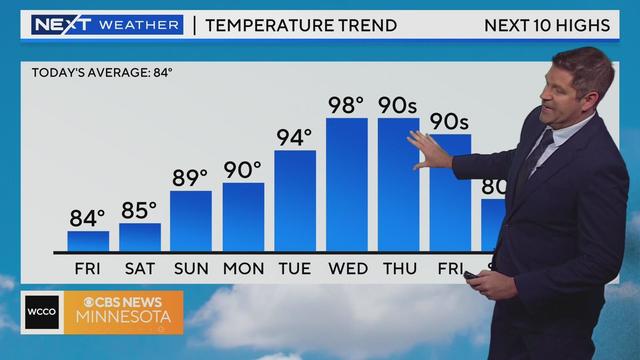
Friday will be slightly warmer, with a chance for some isolated evening storms.

Wednesday's storms caused plenty of damage and dysfunction, including the shutdown of a western Wisconsin Walmart after hail smashed through the roof.
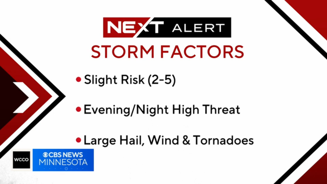
Meteorologist Joseph Dames has the latest forecast.
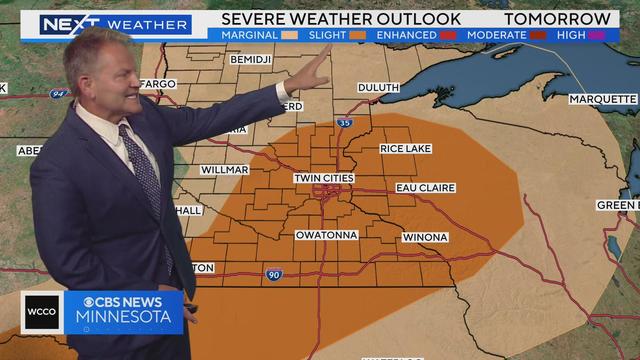
Some storms in western Minnesota could bring rain in the early morning hours on Wednesday.
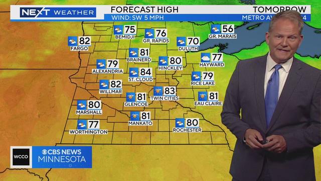
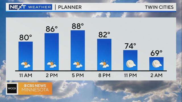
Monday will be the last of a string of cool, quiet and comfortable days, as the heat is set to move back in.
After a hazy weekend, air quality in Minnesota is improving.

On Saturday afternoon, Minneapolis ranks alongside Doha, Qatar; Lahore, Pakistan; Dubai, United Arab Emirates; and Kampala, Uganda among the cities worldwide with the unhealthiest air.
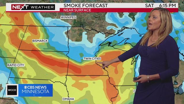
The alert has now been extended until Sunday, due to lingering smoke. As of 4 p.m., the AQI was still hovering around 150, which is the line between code orange and code red.
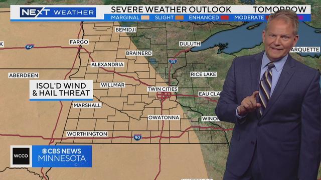
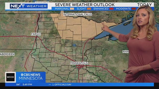
There will be a marginal risk of severe weather late in the day Thursday for a wide swath of Minnesota.
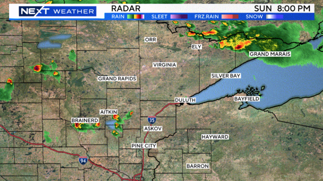
Scattered showers are moving across Minnesota from west to east Tuesday.
A severe thunderstorm watch remains in effect until midnight Tuesday in southeastern Minnesota.
Meteorologist Lisa Meadows has the latest forecast.
Sunday and Monday will bring warmer weather, while the rest of the week will offer a few chances of rain.
Meteorologist Lisa Meadows has the latest forecast.
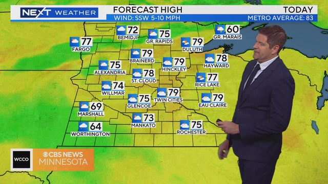
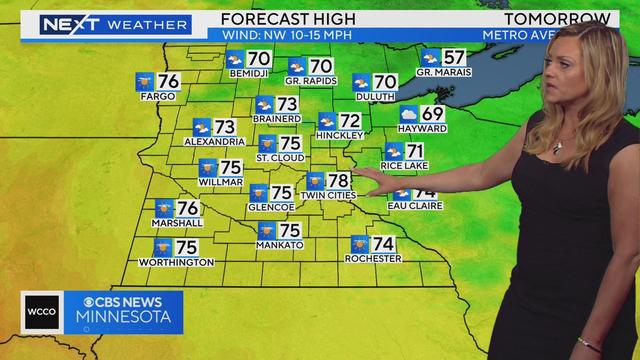
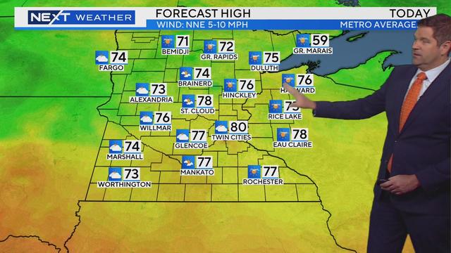
Friday will be warmer with a high of 78 in the metro, and the clouds will increase throughout the day.
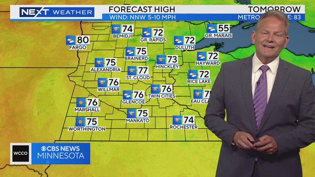
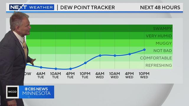
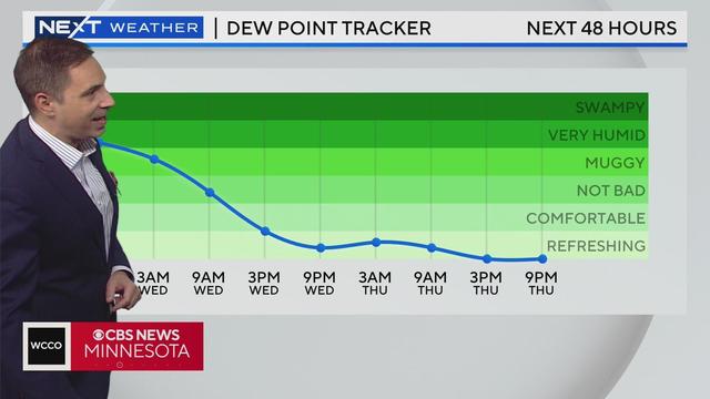
Highs will be in the upper 70s, along with very comfortable dew points, light wind, and good air quality.
Thunderstorms that hit the Twin Cities Tuesday morning have led to a cooler evening than originally thought – lowering the threat for severe weather significantly Tuesday evening.
Meteorologist Mike Augustyniak has the latest forecast.
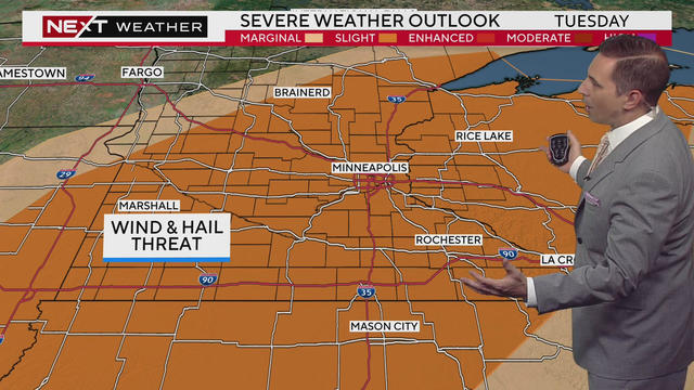
We are in the midst of back-to-back NEXT Weather Alert days, as we prepare for scattered severe thunderstorms Tuesday that will impact fireworks plans.