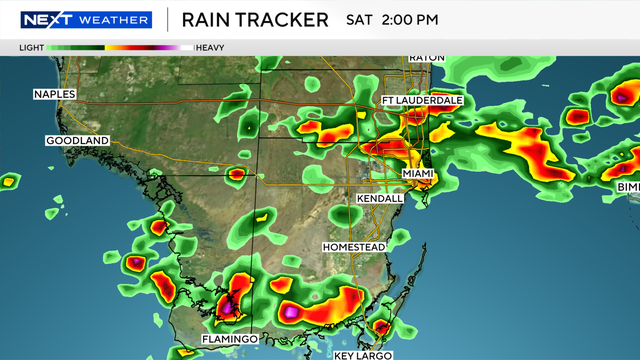
Pop-up storms expected across South Florida Saturday afternoon, evening
The NEXT Weather Team is tracking two rounds of pop-up storms across South Florida this afternoon and early evening hours.
Watch CBS News
The NEXT Weather Team is tracking two rounds of pop-up storms across South Florida this afternoon and early evening hours.
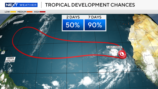
The NEXT Weather team is monitoring an area of low pressure that is looking better defined as it approaches the Cabo Verde Islands Sunday night.
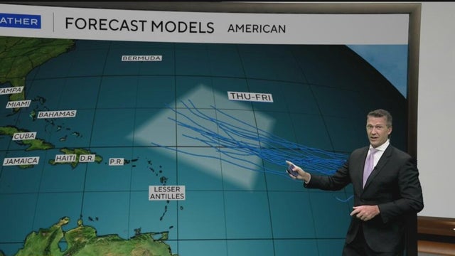
A disturbance that brought widespread rain to the area Saturday has moved into the Gulf and will continue to move away from the area Sunday and Monday.
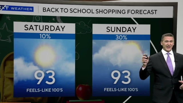
A few showers are possible mainly over the interior later this afternoon
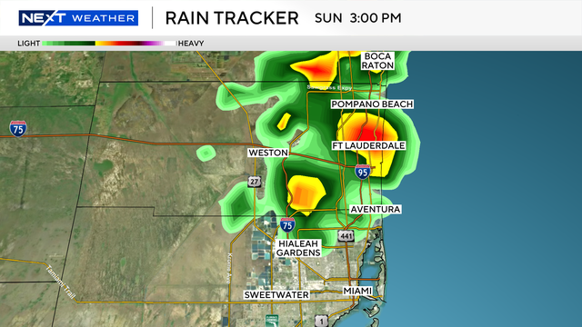
The NEXT Weather team is tracking a rainy afternoon across northern Miami-Dade and most of Broward Counties for Sunday.
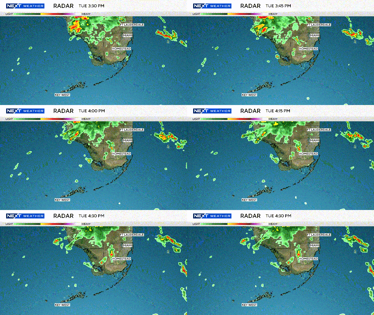
The NEXT Weather team says weather models are trending wetter, raising concerns about a one-to two-day rain event.
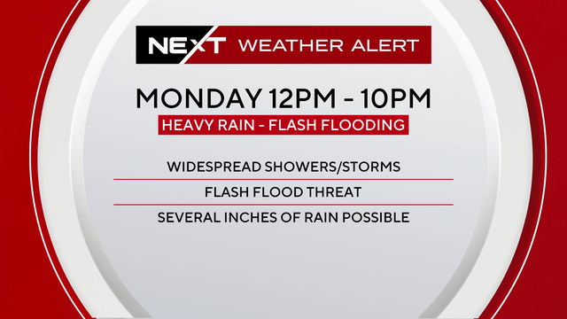
Monday and Tuesday are NEXT Weather Alert Days for South Florida as a weather pattern of storms drops heavy rainfall in the afternoons.
While some people are ready, others are not so much.
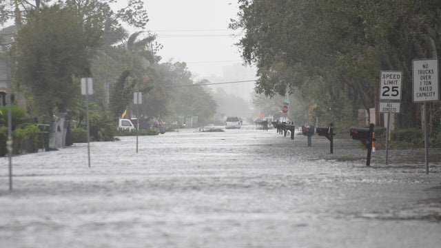
"Storm surge" is defined as the abnormal water level that rises above the typical tide during a tropical event.
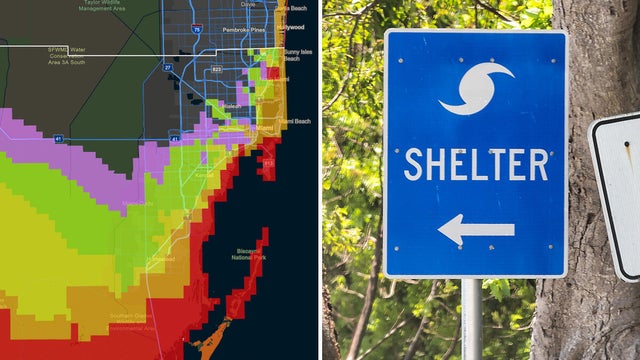
When a watch or warning is issued during hurricane season, you need to know the difference, regardless of what the threat or hazard is.
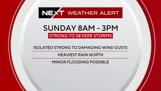
The NEXT Weather team has issued a NEXT Weather Alert Day for Sunday and Monday.
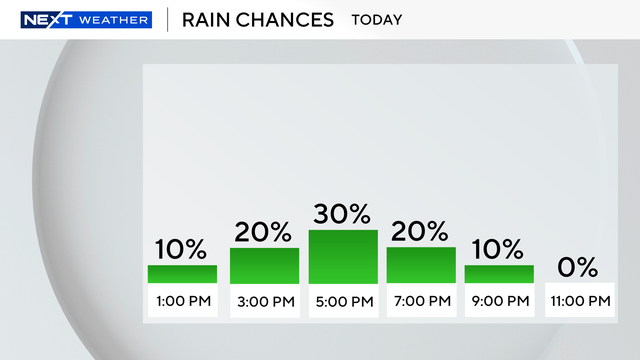
The NEXT Weather Team is tracking another hot and humid day across South Florida with the potential for a few scattered afternoon storms to end the workweek.
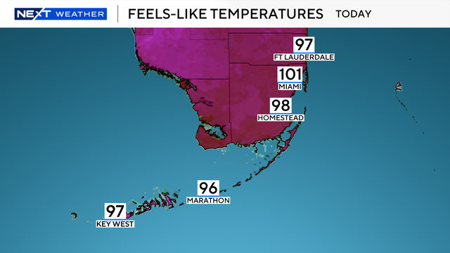
While nothing severe is expected, you'll want to keep an umbrella nearby as scattered showers will continue through the midday hours, said NEXT Weather Meteorologist Shane Hinton.
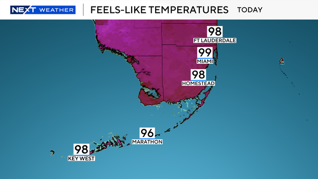
NEXT Weather Meteorologist Shane Hinton said these showers will be hit-or-miss through the morning as temperatures begin in the lower 80s.
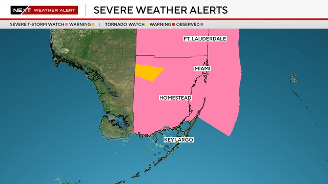
Broward and Miami-Dade counties were under a Severe Thunderstorm Watch until 9 p.m. Monday
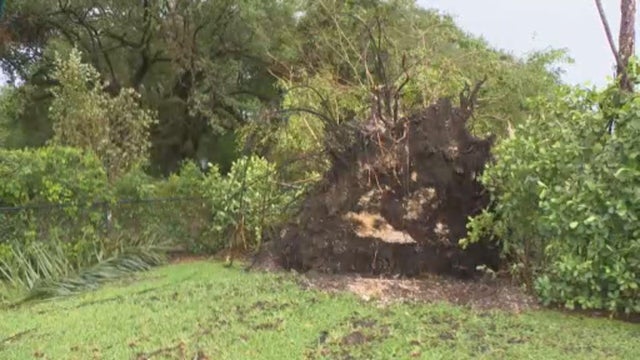
South Florida is under a NEXT Weather Alert because of showers and storms for both afternoons.
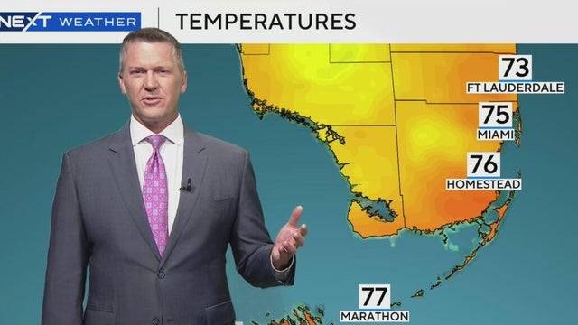
There's a 30% chance of rain this week.
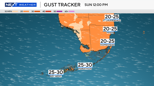
Easter Sunday will see a gusty breeze throughout much of the day. The wind will be coming right off the ocean and pushing through the metro areas and the Keys with gusts near 30 mph.
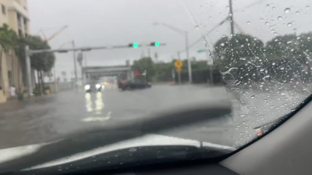
Two low-end weather threats, damaging winds and flash flooding, are forecast to develop as a cold front moves across the region.
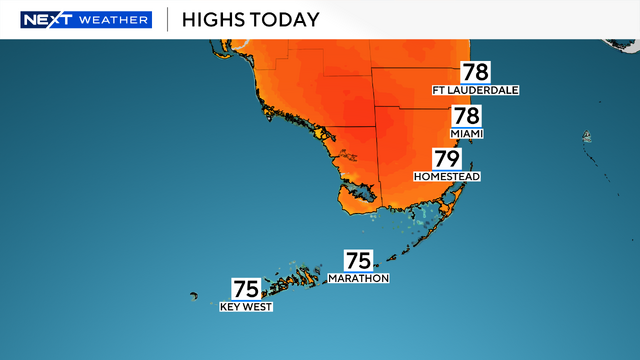
Dressing in layers is key since South Florida will warm up in the afternoon as highs climb to the upper 70s with pleasant sunshine.
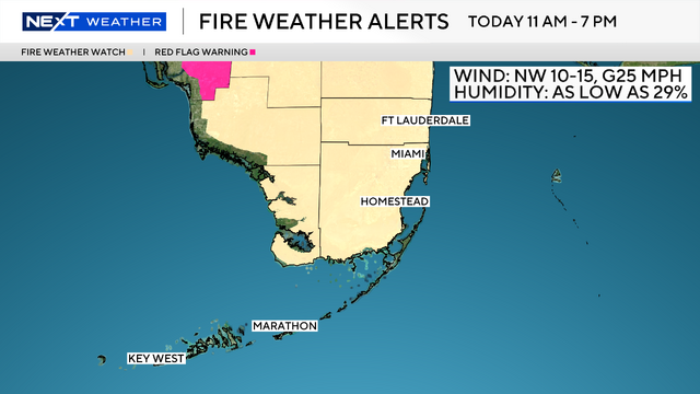
The combination of wind and dry air will lead to a fire weather watch for South Florida on Thursday from 11 a.m. to 7 p.m.
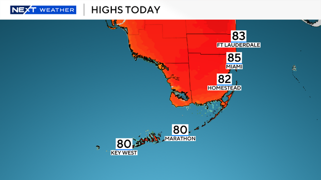
A warm and windy day ahead as a few showers have moved in across parts of South Florida Wednesday morning.
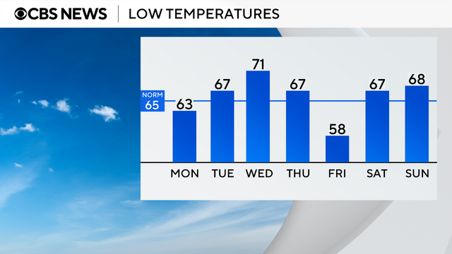
Another beautiful day is in store across South Florida to round out the weekend.
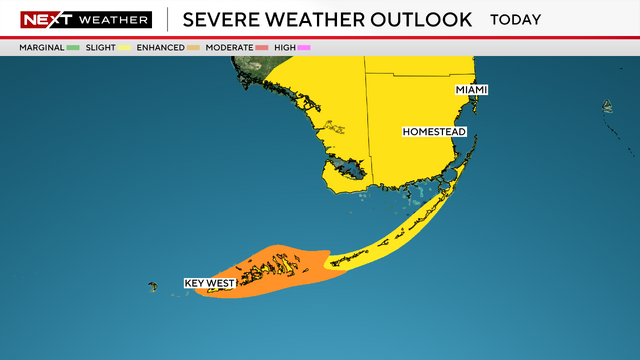
An area of low pressure moved through the Gulf towards South Florida.
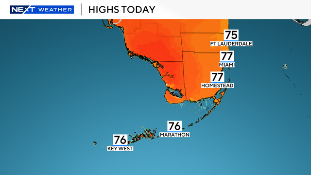
The NEXT Weather team is tracking a mild and mostly quiet Sunday as comfortable morning temperatures give way to a mild and partly sunny afternoon.