Chicago First Alert Weather: Temperature climb continues
Get ready for the 90s.
Watch CBS News
Get ready for the 90s.

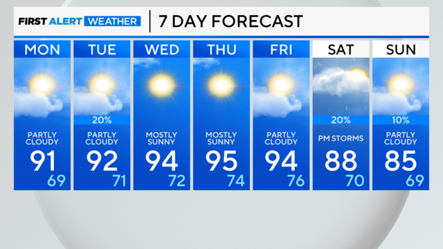
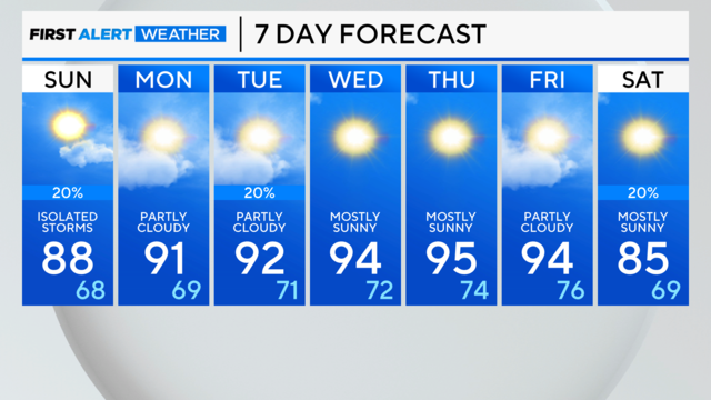
Highs stay n the 90s all week, with few rain chances.
Saturday night brings a few lingering storms as they wrap up, then mostly clear skies. Low temperatures will reach 65 degrees.
Temperatures are expected to rise over the next week with just a couple of rain chances in the forecast.
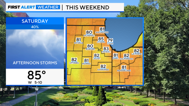
According to CBS 2 Meteorologist Mary Kay Kleist, an upper-level disturbance moves in Saturday, sparking afternoon showers and thunderstorms. These will taper off with sunset.
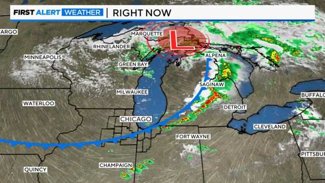
We're still keeping an eye on northwest Indiana for possible storm development over the next hour or so.
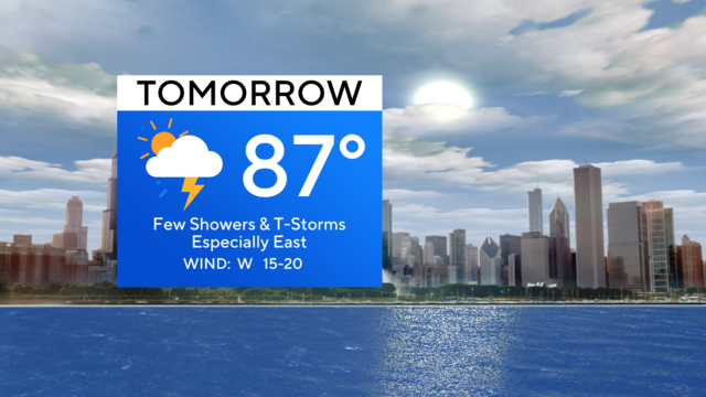
This will lead to a few showers and thunderstorms popping up along and ahead of an approaching cold front.
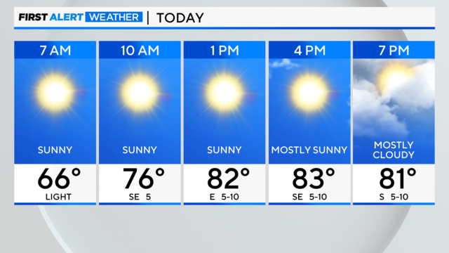
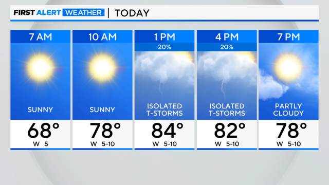
Today will be another quiet day with sunshine and warmer conditions in the middle 80s but 70s near the lake
According to CBS 2 Meteorologist Gerard Jebaily, some scattered rain and thunderstorms are set to arrive late Wednesday night into Thursday morning.
high pressure will park overhead for the next two days, keeping our weather pattern dry and quiet.
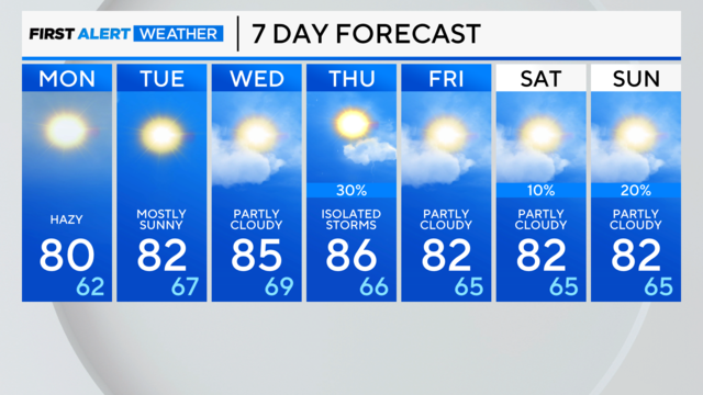
A few showers and storms are possible Sunday evening, but otherwise expect dry conditions through midweek.
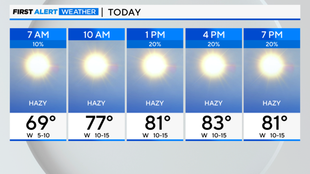
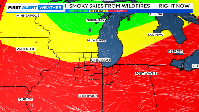
The biggest topic of today will be the return of wildfire smoke and hazy conditions for much of today.
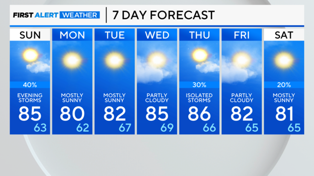
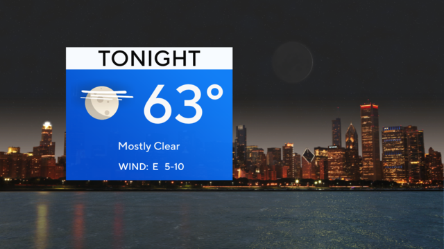
Expect Saturday night to be mostly clear with a low temperature of 66 degrees.
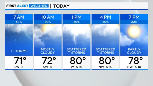
the severe threat of storms remains low.
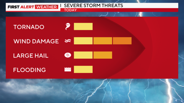
According to CBS 2 Meteorologist Mary Kay Kleist, we have crossed the 90-degree mark at the lakefront due to the dominant west/southwest wind flow.
An unsettled pattern is expected through the weekend with scattered storm chances.
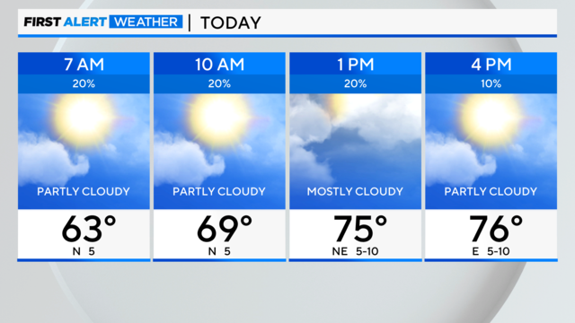
The best chance for storms will be isolated in nature and late in the day.
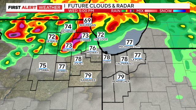
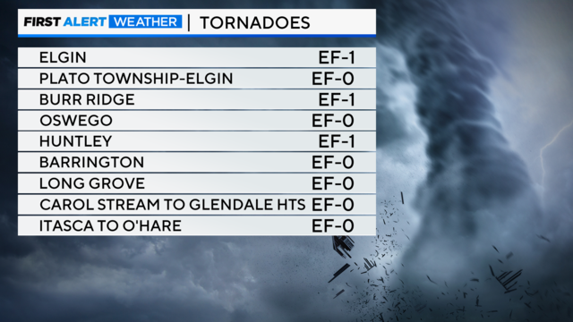
There's a possibility for strong tornadoes late this afternoon into the evening, especially between Rockford and Chicago, and points northward along the Wisconsin state line.
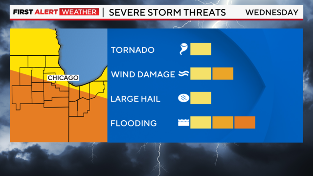
The late morning through early afternoon timeframe has the highest rain potential, according to CBS 2 Meteorologist Mary Kay Kleist.
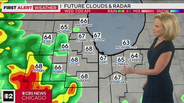
CBS 2 Meteorologist Mary Kay Kleist has the 5 p.m. forecast for Tuesday, July 11, 2023.
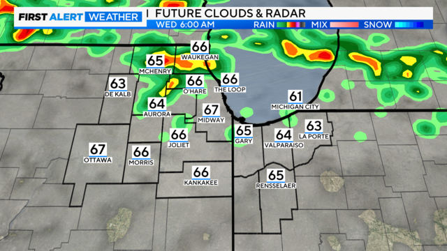
Scattered storm chances increase after midnight, and especially by daybreak Wednesday.
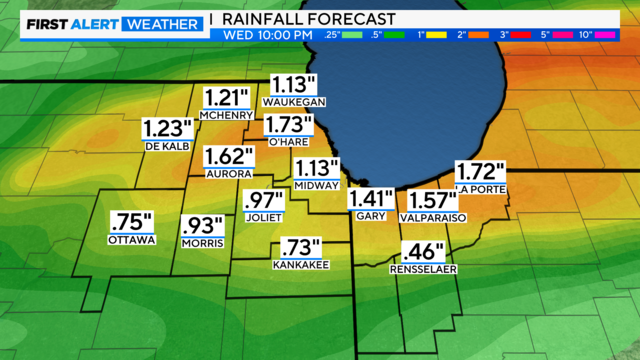
The highest storm chance will be on Wednesday where the storm threat is slightly elevated, especially south of I-80.
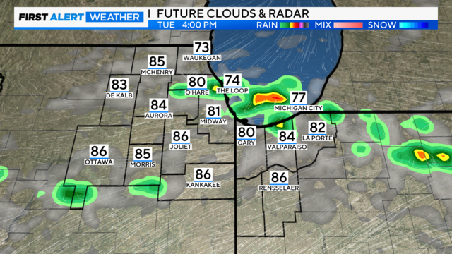
Temperatures on Tuesday will reach the middle 80s before the cool front crosses our area.
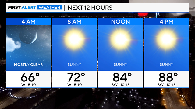
Temperatures will be near 90 degrees Monday.
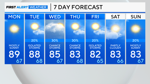
Sunday night brings mostly clear skies and a low temperature of 65 degrees.