First Alert Weather: Sunshine with return of summer temps
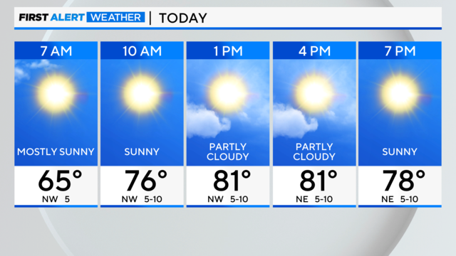
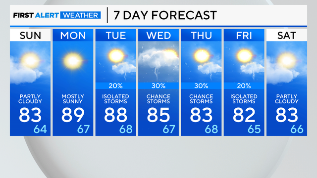
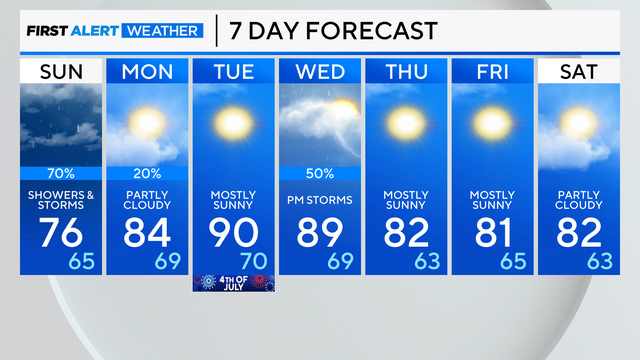
Summer temperatures continue through next week.
Watch CBS News
Summer temperatures continue through next week.
Saturday night brings mostly clear skies and a low temperature of 62 degrees.
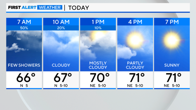
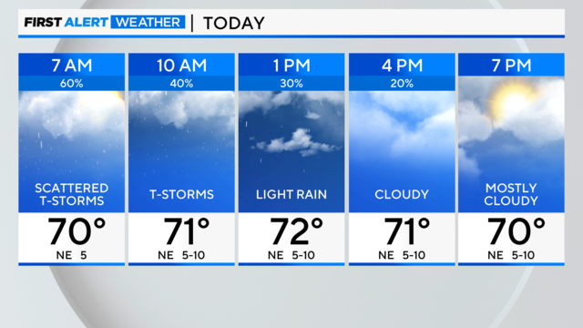
We start the morning with some rain but things start to clear up for the rest of your day.
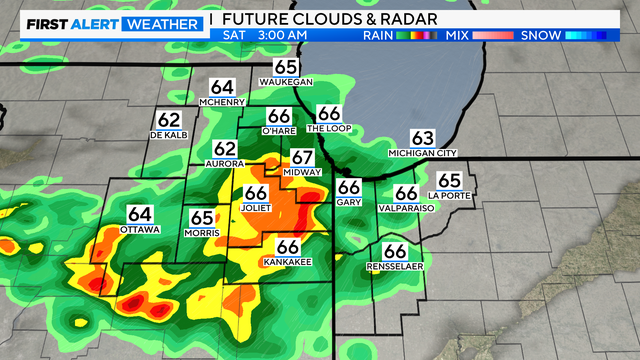
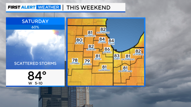
Rain chances will linger into Saturday morning. Rainfall amounts will be around one-quarter to half of an inch.

Smoke from the Canadian wildfires, Fourth of July fireworks, heavy rain, and even the NASCAR Street Race could all have had an impact.
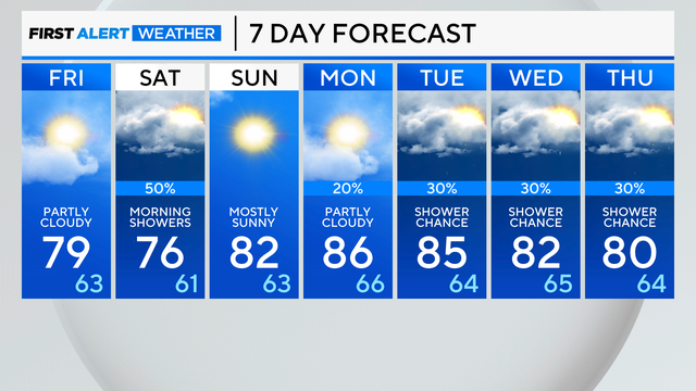
Rain chances increase Friday evening, and will be with us through Saturday morning.
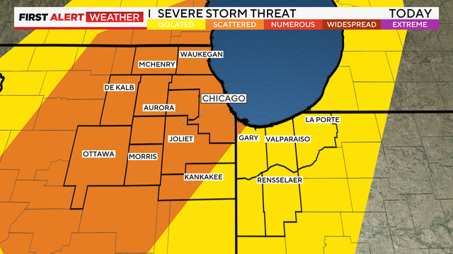
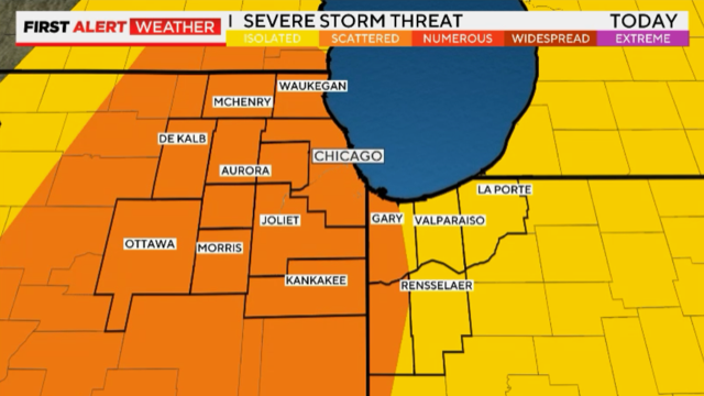
A few storms could be strong or severe, producing hail and damaging winds.
We also have an Air Quality Alert for the area due to high ozone levels.
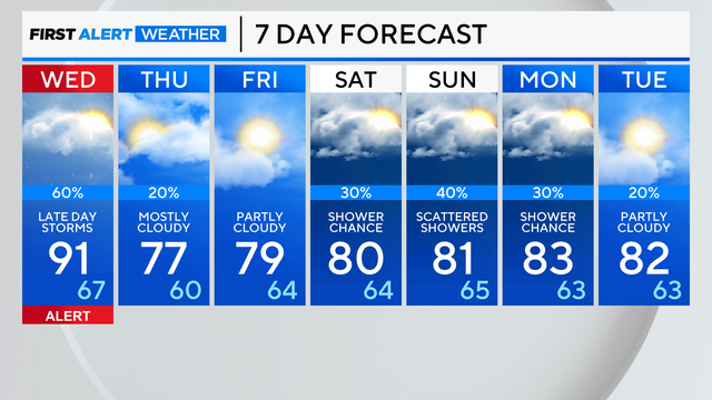
A cold front will approach the area by late in the day on Wednesday, and will be the focus for scattered thunderstorms, especially after 4 p.m.
It will be mainly dry for most of Tuesday, but afternoon heating may trigger a few showers or storms.
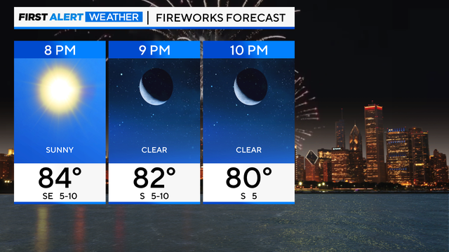
The rain won't dampen your upcoming Fourth of July plans as drier and hotter weather is ahead.
The severe threat is minimal but is not zero. Areas south of Chicago have a higher threat of strong storms.
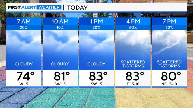
A showery and stormy pattern for the next couple of days
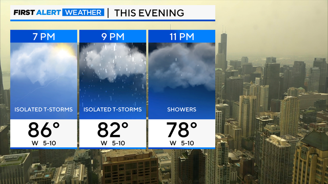
Scattered showers are possible after midnight.
The weekend features cooler temperatures lakeside with passing showers and thunderstorms.
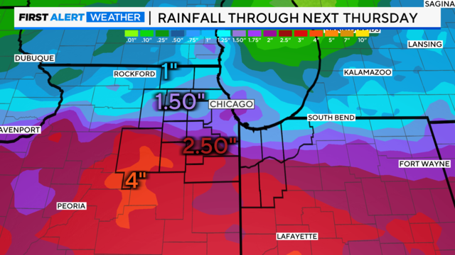
According to CBS 2 Chief Meteorologist Albert Ramon, a brief heavy thunderstorm is possible before 9:00 p.m., but mainly along the Wisconsin/Illinois state line.
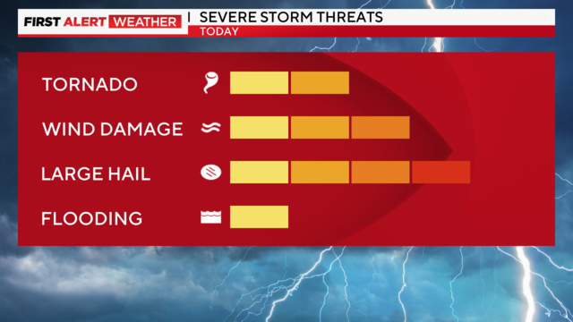
There is also an Air Quality Alert until midnight.
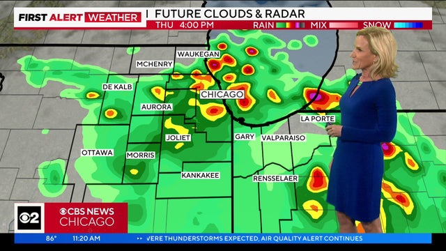
Mary Kay Kleist tells you what to expect this afternoon.
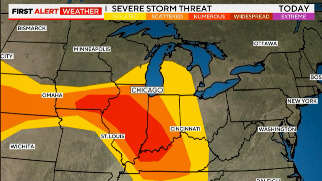
Severe weather is on the way amid lingering air quality concerns
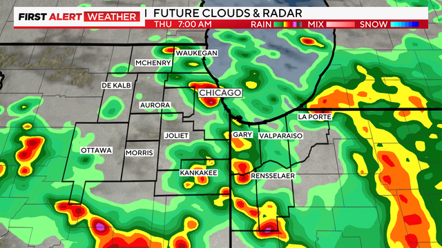
Storms could form by daybreak on Thursday. The strongest storms may bring hail and damaging winds.
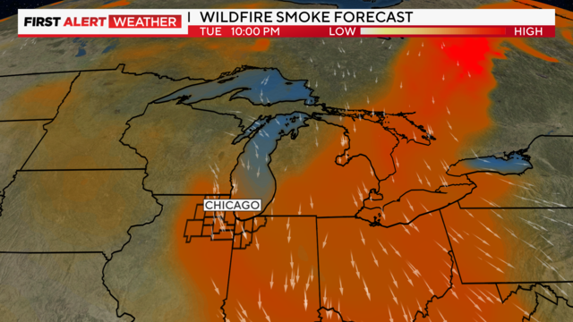
Wildfire smoke from Canada and high ozone levels have combined to create "very unhealthy" air quality throughout Chicagoland.
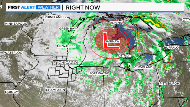
According to CBS Meteorologist Mary Kay Kleist, an isolated thunderstorm is possible.
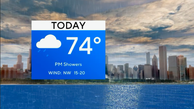
Showers and storms arrive by Monday afternoon and evening.
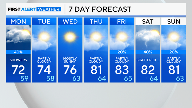
Expect Sunday night to be windy with a few stray showers.
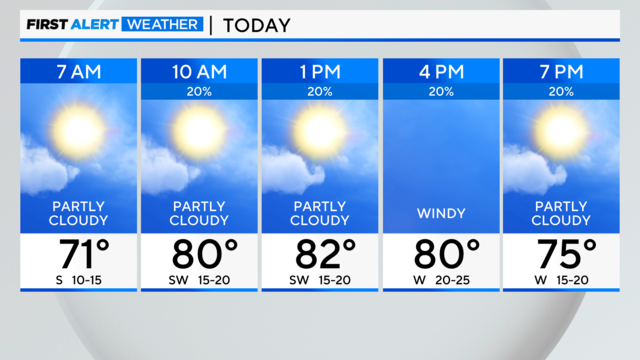
A break before a chance of showers and storms develops midday and afternoon.