Excessive Heat, Red Flag Warnings extended through Sunday before Monday cold front
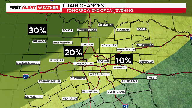
There is a small chance of rain on Monday with the cold front coming through.
Watch CBS News
There is a small chance of rain on Monday with the cold front coming through.
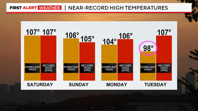
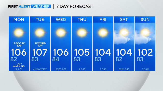
A weak front could knock temps down early next week.

An Excessive Heat Warning remains in effect for North Texas through 8 p.m. Saturday.

Weather Alerts are now posted from today through Sunday for the hot weather.

You may get even hotter when you see your power bill after more than two weeks of triple-digit temperatures.

Your CBS News Texas First Alert Weather Team is keeping an eye on the dangerous heat and our major grass fire concerns.
Winds pick up overnight increasing the fire spread risk.

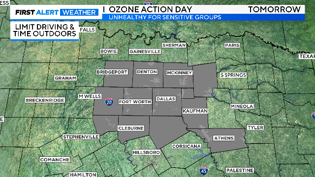
With this heat and drought, a Red Flag Warning comes back into play for most of North Texas.
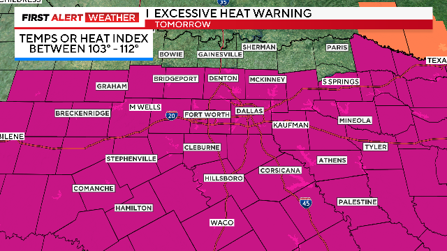
The Excessive Heat Warning continues Monday; however, it does not include the Red River counties.

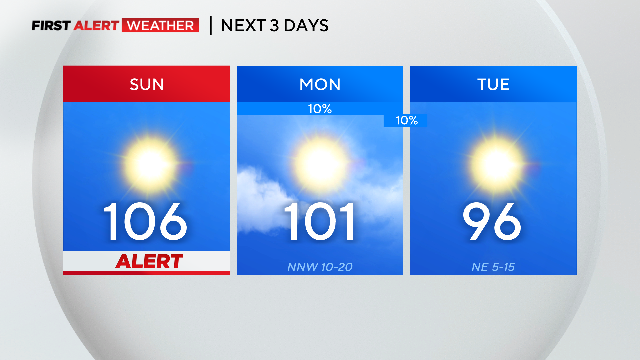
While temperatures once again top out around 107 degrees in DFW, a few morning showers are ongoing for our areas along the Red River.
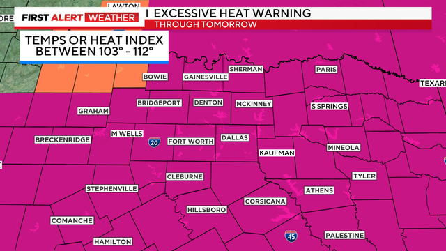
There is a Weather Alert for both days this weekend: Drink plenty of water, no direct sun on your skin, and take breaks in the shade or indoors.

An excessive heat warning will last through 8:00 p.m. with high temperatures near 106 degrees, feeling up to 110.

An excessive heat warning has been extended until 8:00 p.m. Wednesday evening as it will feel like 103-110 degrees. And it isn't just North Texas under a heat alert, they extend north into Kansas, Missouri and east into Mississippi.

An Excessive Heat Warning is in place for all of North Texas until 8 p.m. Wednesday as it will feel like 105 to 112 degrees.

Monday marked the area's 23rd triple-digit day this year, and the eigth triple-digit day in a row.

At about its halfway point, the record-breaking hot and extreme summer of 2023 is both unprecedented and unsurprising.
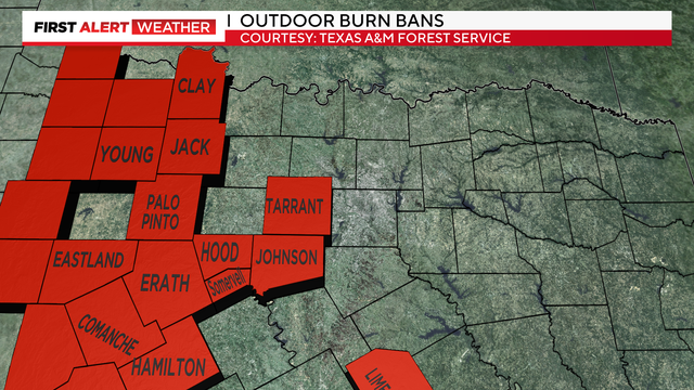
This will be another week of elevated fire risk. The burn bans are in place.
The run of 100° days continues. So far, six days in a row is the longest streak of the summer.
No heat alerts have been posted at this time. Still, it will be sunny and hot Friday with high temperatures around 101 degrees, so please continue to practice heat safety.
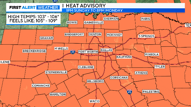
High temperatures Wednesday will be between 102 and 106 degrees.

A Heat Advisory is in effect for parts of North Texas, including the DFW Metroplex, until 9 p.m. Wednesday.
Low 70s are expected for Sunday morning. It could at least tie for the coldest morning we'll get this July.
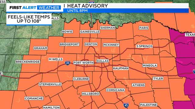
A heat advisory is in effect for North Texas until 8:00 p.m. Friday Feels-like temperatures could get as high as 108 degrees or so through the afternoon.
For the first time this work week, there is no Excessive Heat Warning for the next day. Because of some additional cloud cover and a slight reduction in dewpoints, there is a Heat Advisory in place Friday.

An excessive heat warning remains in effect for North Texas until 8:00 p.m. Thursday evening. High temperatures will be at or above 105 degrees and feels-like temperatures will be at or above 110 degrees.