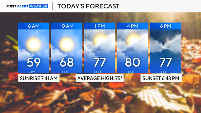
Quiet night in North Texas after severe storms, hail, and strong winds
Friday is the pick of the week with partly cloudy skies and highs in the lower 80s.
Watch CBS News
Friday is the pick of the week with partly cloudy skies and highs in the lower 80s.

Storms will likely impact our area between 2 p.m. and 9 p.m.
Severe storms are possible Wednesday and Thursday.

Severe weather is possible Wednesday afternoon and evening.

Highs will warm into the upper 80s by the afternoon. Tonight, temperatures will be in the low 70s under mostly clear skies.
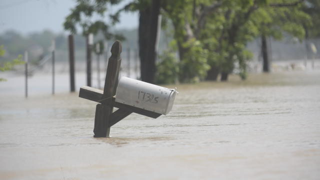
Tornadoes touched down Monday evening in rural Oklahoma as large hail pelted parts of Kansas.

High temps are forecast to warm near 90° both Tuesday and Wednesday ahead of a cold front.

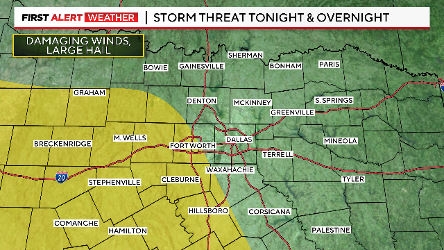
We're watching the CAP in our atmosphere. If it breaks this afternoon, we could see a few storms that could be strong to marginally severe, especially north of I-20.
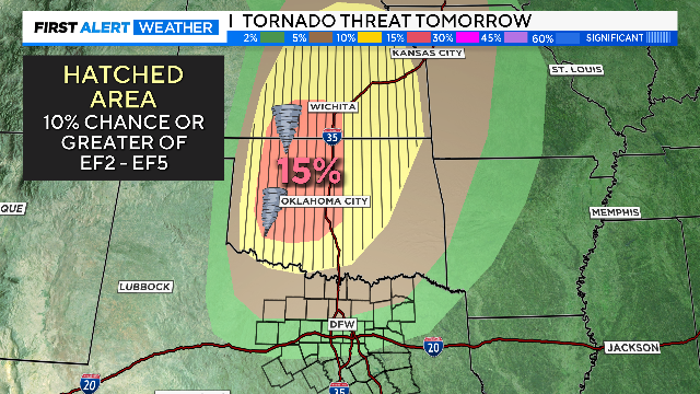
There is a small risk of severe weather Monday afternoon. These storms could produce very large hail if they develop.
Flood Watch will remain in effect until 1 p.m. Sunday.
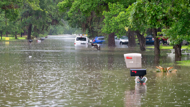
The U.S. Coast Guard said they had medevaced an hours-old baby from Cleveland, Texas, amid the floodwaters.

Severe storm chances increase this evening.
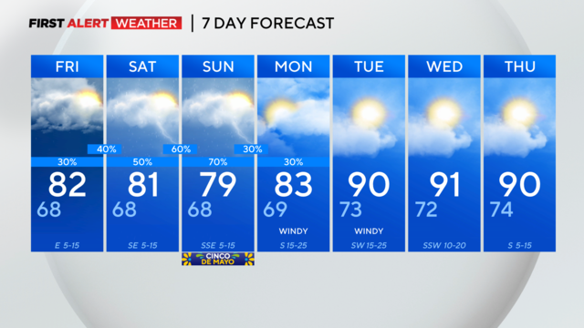
Scattered storms could continue into Friday morning.

As we move through this Thursday morning, showers and storms will continue pushing east through North Texas.

Flooding, large hail and damaging winds are all possible.

Several rounds of storms and heavy rain are in store for North Texas over the next five days.
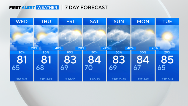
It's storm season in North Texas. CBS News Texas meteorologists are looking at the possibility of severe storms in the metroplex starting Friday afternoon.
Get ready for even more showers and storms this week into your weekend.
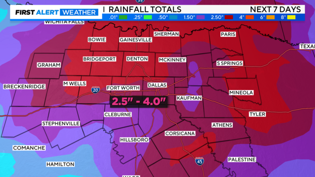
Tuesday, temperatures will warm above average into the mid-80s.

A weather alert remains in place Sunday for the potential of some strong to severe storms.
Highs will be in the mid-80s. Tonight, we'll see mostly clear skies with low temperatures in the lower 60s.
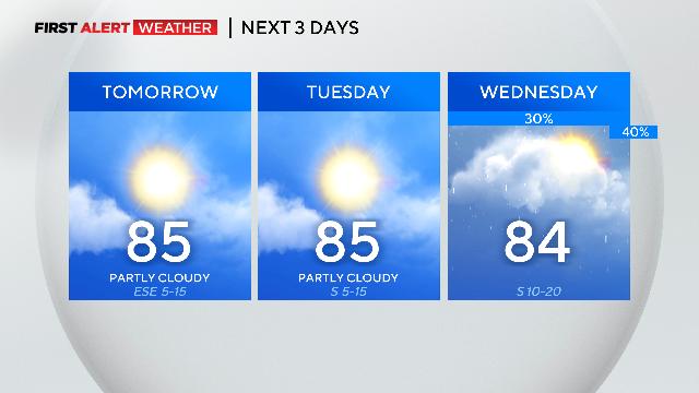
Monday and Tuesday look warm and storm-free. It will be breezy on Tuesday and a little more humid.
We are watching everything east of the I-35 corridor for severe weather development Sunday afternoon.

Flood Watch is in effect through tomorrow.
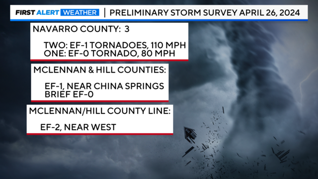
A final report could take additional days to finish if more surveys are "deemed necessary," the NWS said.