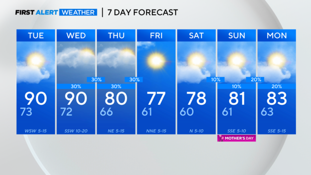
Sunny and warm Tuesday, scattered storms Wednesday

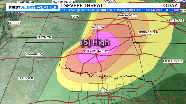
NORTH TEXAS — There are ongoing severe weather stretches through Oklahoma, Kansas, Nebraska, and Iowa Monday night.
The Storm Prediction Center keeps the rare High-level severe threat in place. There have been numerous tornado warnings and more are possible Monday night. In fact, all severe threats are possible.
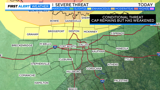
In North Texas, our severe threat was conditional since we had a cap in place throughout the day. While it weakened through the afternoon, there was enough convective inhibition that any showers that formed quickly dissipated.
Clouds clear through Tuesday leading to a sunny but warm day in the forecast. High temps are forecast to warm near 90° both Tuesday and Wednesday ahead of a stronger cold front that brings scattered showers and storms back to the forecast Wednesday.
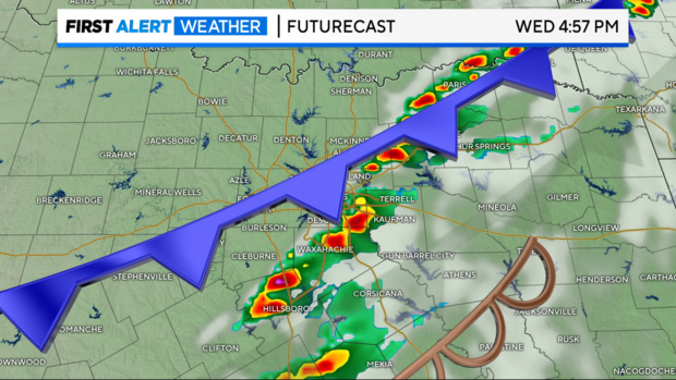
The setup Wednesday looks a bit better for the potential of the storms reaching severe limits with a large portion of North Texas under the slight risk of severe storms.
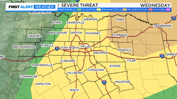
Strong winds and large hail look to be the biggest threats on Wednesday mainly east of the 35 corridor. A dry line ahead of the cold front helps initiation through the 3 p.m.-5 p.m. time frame.
Our high temps drop back to the upper 70s to low 80s Thursday into Friday.
Friday looks to be picture perfect with morning temps in the low 60s and highs in the mid to upper 70s. Mother's Day looks to be mainly dry but a few spotty showers can't be ruled out. High temps near May averages starting next week.