Tornado watch subsides ahead of possible isolated storms in North Texas
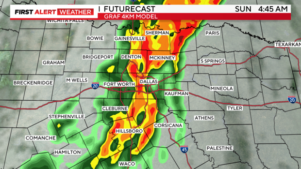
UPDATE, 9:15 A.M. : You may have been woken up by the storms that rolled through early this morning. They remained below severe limits as they crossed the Metroplex but brought heavy rain leading to flooding and flash flooding. Radar estimated rainfall around 4" in some spots across Tarrant, Dallas, Johnson, and Ellis counties.

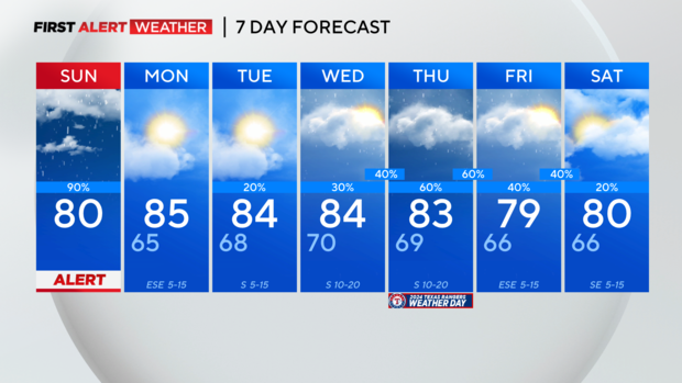
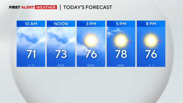
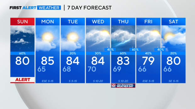
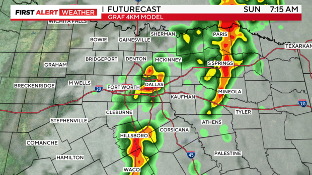
The line of non-severe storms continues to track east this morning and will dissipate around midday. Areas along and west of I-35 are already drying out and will see some sunshine this afternoon with highs near 80.
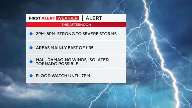
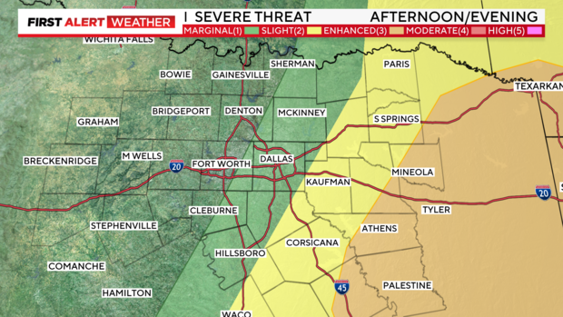
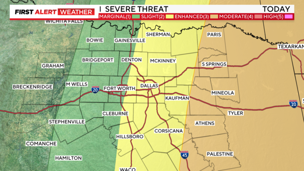
However, a Weather Alert remains in place today for the potential of some strong to severe storms east of I-35. This morning's round of storms has worked over the atmosphere, especially in western areas, but it may recover enough this afternoon for a few severe storms to develop in our eastern counties. The main concerns are flooding, damaging winds, hail and an isolated tornado can't be ruled out.

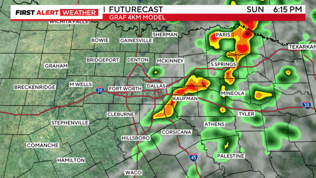
The severe threat has shifted further into East Texas for this afternoon and evening. The I-35 corridor is now a level 1 marginal risk with increasing risk as you head east.
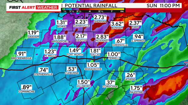
Flooding remains a concern with any additional development today. A flood watch remains in effect until this evening for portions of North Texas.

All the area will dry out overnight and enjoy a quiet Monday with partly cloudy skies and highs in the mid 80s. Rain and storm chances ramp back up Wednesday night into Friday and we are monitoring the potential for more severe storms.
NORTH TEXAS — A tornado watch is in effect until 7 a.m. for all North Texas. Quick spin up tornados are possible along the leading edge of thunderstorms moving through the area.

Quarter size hail and damaging winds to 60 mph are also possible. Storms will continue to head east through sunrise and end around mid-morning.
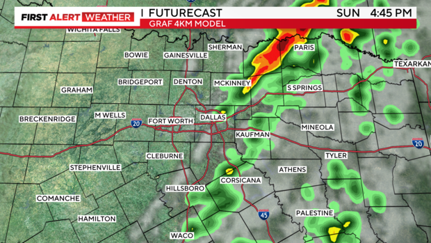
After a brief lull through the midday hours, scattered strong to severe storms are possible this afternoon mainly east of I-35. Large hail and damaging winds would be the main threats, but an isolated tornado can't be completely ruled out.
A flood watch remains in effect until 7 p.m. for the entire area as localized flooding and flash flooding are possible. Widespread rainfall totals of 1"-3" with 4"-6" possible locally.

We get a break from the storms tomorrow and into Tuesday, but another active period sets up Wednesday through Friday.