Tuesday heats up across North Texas
NORTH TEXAS — We're heating up and tracking a few more storms.
As we move through this Tuesday, expect partly cloudy to mostly sunny skies. Highs will warm into the upper 80s by the afternoon. Tonight, temperatures will be in the low 70s under mostly clear skies.
On Wednesday, heads up! We're tracking a chance for a few isolated strong to severe storms Wednesday afternoon and evening ahead of a dryline and cold front.
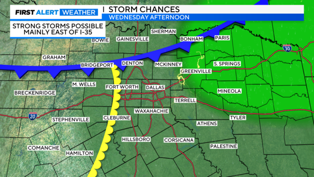
We're not expecting storms everywhere. In fact, communities east of I-35 and northeast of the Metroplex will have the greatest threat for severe storms.
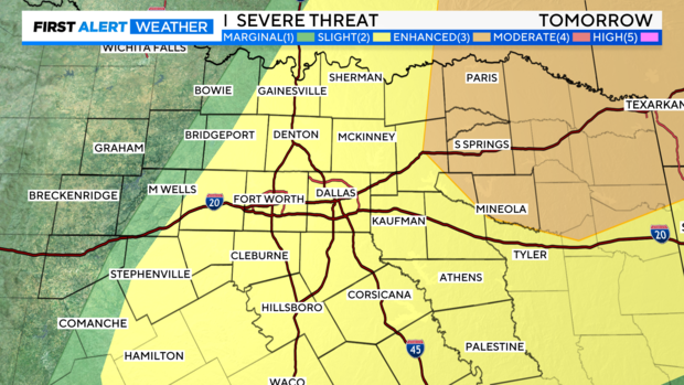
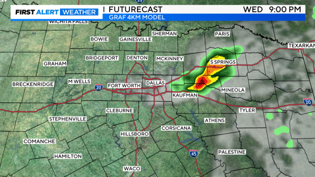
If storms fire up tomorrow, they could produce large hail and gusty winds. There is a low-end tornado threat. We'll keep watching the forecast models.
Otherwise, we'll see partly cloudy skies with high temperatures near 90 degrees.
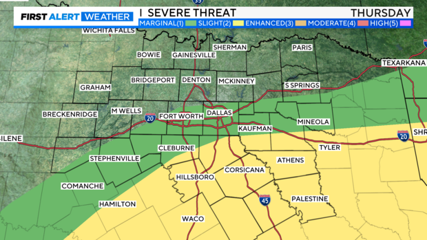
As the front slides south on Thursday, we could see a few more showers and isolated storms, especially south of I-20. High temperatures will be in the low 80s.
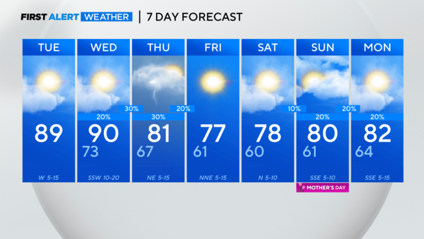
Dry weather is expected Friday with highs in the mid-70s.
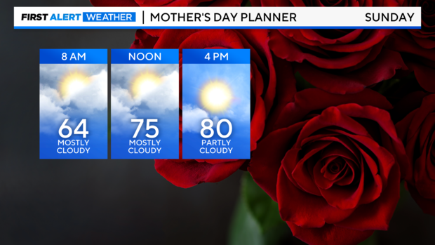
Mother's Day Weekend will not be a washout. In fact, Saturday will be dry with highs in the low 80s. An isolated shower or two could develop on Mother's Day this Sunday. Highs will be in the upper 70s to near 80 degrees.