Slight risk of strong storms in North Texas Monday

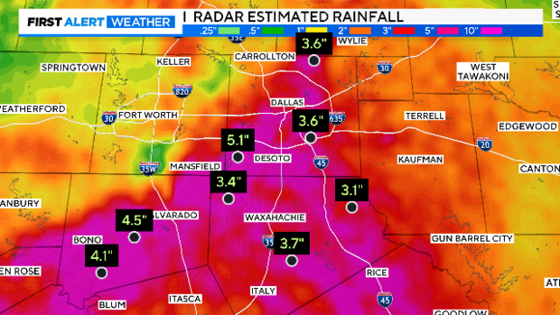
NORTH TEXAS — What a rain Sunday night/Monday morning! Some areas in Johnson and Ellis County reported over 3" of rain. Flash Flood Warnings continue overnight into the morning.
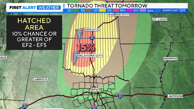
For most of North Texas, Monday will be storm-free. A significant tornado outbreak is possible Monday centered over Oklahoma and Kansas.
In North Texas, the atmosphere will be capped and could go the day with no storms forming. Patchy fog is expected in the morning.
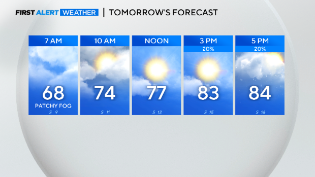
If the cap breaks, a small group of storms will produce monster hail and fierce winds. The energy in the atmosphere is extremely high.
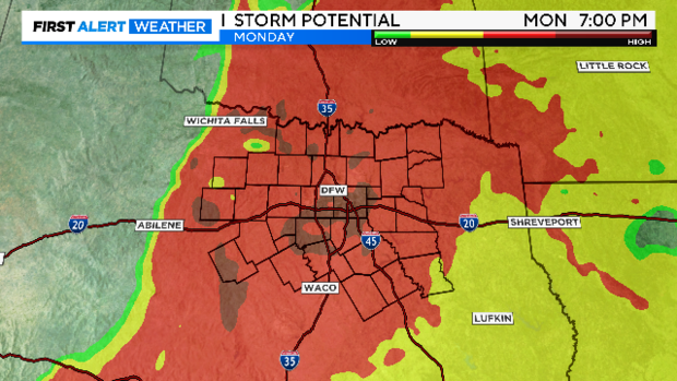
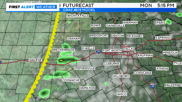
Our primary short-range model does show the cap breaking on Monday. The First Alert Weather Team will be in place watching the dryline to the west for storm development.
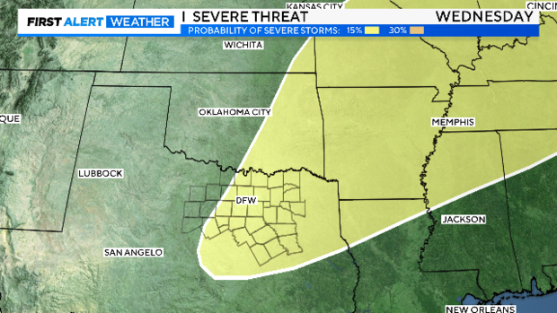
Monday is not the only day we are watching in the week ahead. Wednesday we have an approaching front that could push the dryline into the metroplex. Either one of the boundaries, the dryline or the cold front, could produce severe weather.
Rain coverage and overall storm chances this coming week don't compare with last week. We are five days into May, on average our wettest month of the year, and already we are well above pace.
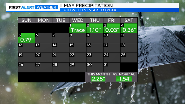
This is the sixth-wettest start to the year in the 125-year record, and it's the eighth-wettest spring.
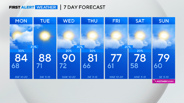
Here is your 7-day forecast. For now, it is looking like a mostly dry Mother's Day weekend.