"Bomb cyclone" winter storm moves east with snow squalls in the forecast
A powerful winter storm system moving across the Great Lakes and Northeast is bringing snow and ice, frigid temperatures and possible whiteout conditions.
Watch CBS News
A powerful winter storm system moving across the Great Lakes and Northeast is bringing snow and ice, frigid temperatures and possible whiteout conditions.
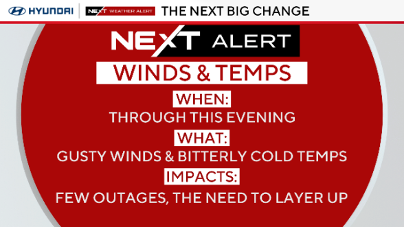
Strong gusty winds and colder temperatures will combine to keep wind chills in the teens and 20s around most of the region Tuesday.

Fog and rain showers will kick off the week in the Philadelphia area before gusty winds and an Arctic blast of air move in Monday afternoon.
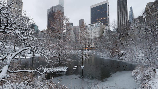
More than 51 million Americans live in areas under winter storm alerts stretching from northern Minnesota to the Eastern Seaboard.
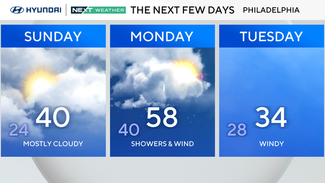
Rain and wind head toward the Philadelphia region after a dry start to Sunday.
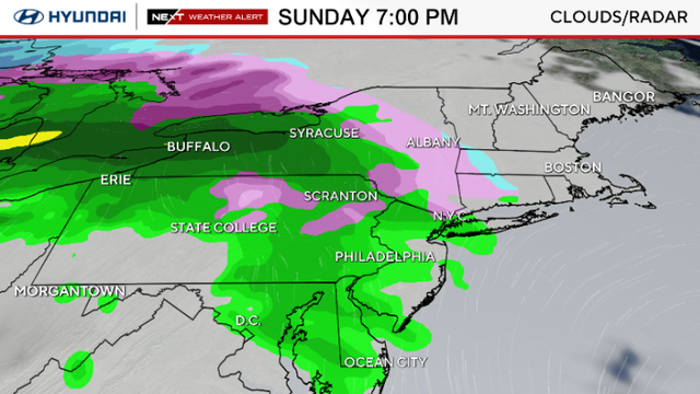
Dangerous travel conditions continue Saturday morning in the Philadelphia area. Here's the NEXT Weather forecast.
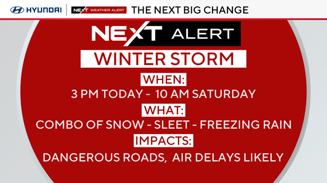
Snow and ice are expected around the Philadelphia area Friday night into Saturday morning.
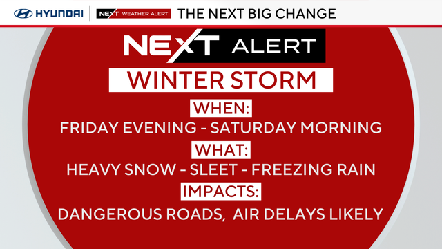
Snow and ice are expected around the Philadelphia area Friday night into Saturday morning.
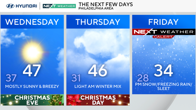
The Philadelphia region can expect a sunny and breezy Wednesday, and some precipitation is expected later this week.
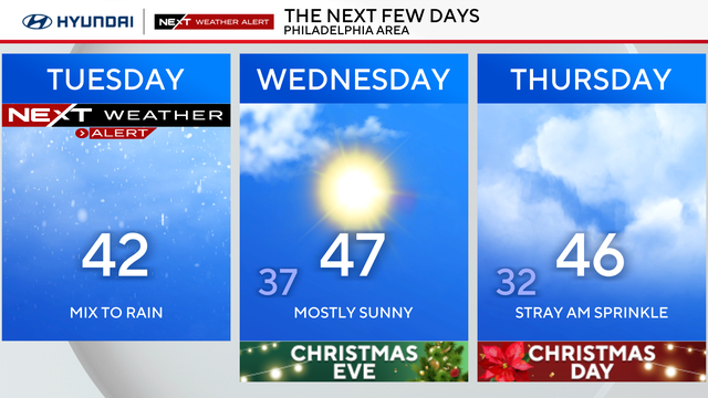
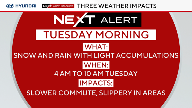
Any snow that fell Tuesday morning will melt once temperatures climb back above freezing this afternoon.
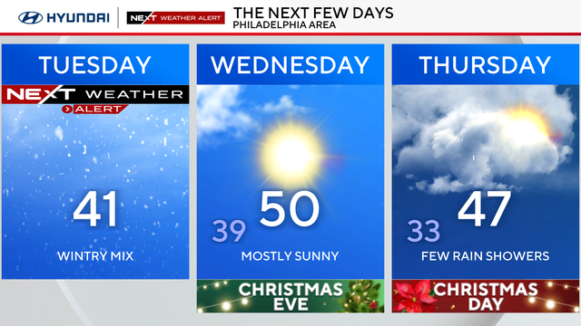
The Philadelphia area can expect cold weather Monday for the first full day of winter.
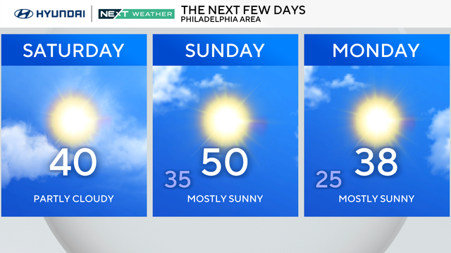
Sunday marks the official start of winter, but it'll actually feel more like fall with high temperatures in the upper 40s and even near 50 degrees.
The Philadelphia region will see a slight warmup heading into the holidays.
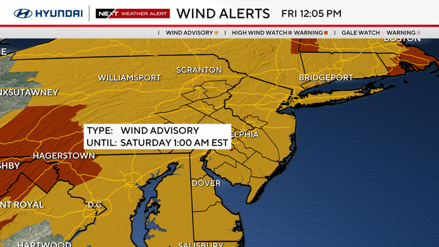
A NEXT Weather Alert is in effect Friday in the Philadelphia region, as temperatures plummet and the wind picks back up, leading to a colder but dry start to the weekend.
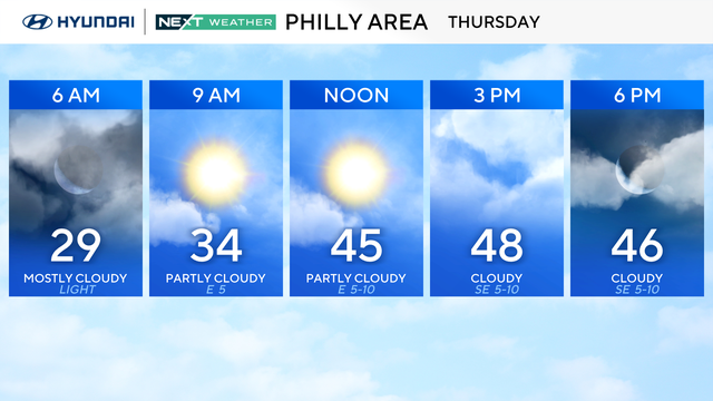
Thursday will be warmer in the Philadelphia region, but rain moves in at night, which will stretch into Friday and impact the morning commute.
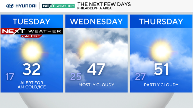
Tuesday will be the 19th consecutive day of below-average temperatures in the Philadelphia region.
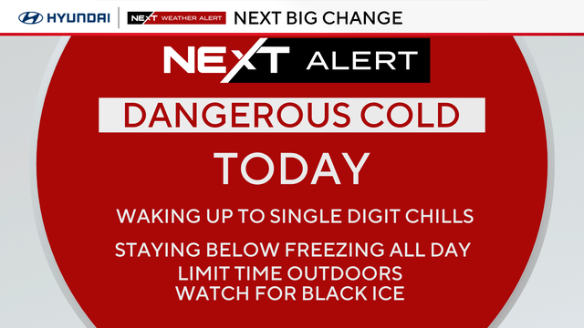
Monday marks the 18th consecutive day of below-average temperatures around the Delaware Valley, and wind chills will make it feel like the teens and single digits.

Sunday afternoon will turn extremely cold, with temperatures dropping into the 20s. Wind chills will make it feel like the teens and even single digits.
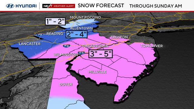
Snow is expected to begin Saturday night across the entire Philadelphia region.
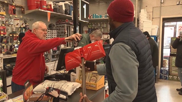
South Jerseyans are preparing for what could be a significant winter blast of snow this weekend.
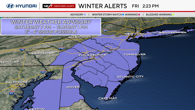
Philadelphia, South Jersey and parts of Delaware are anticipating seeing the first measurable snowfall since February.
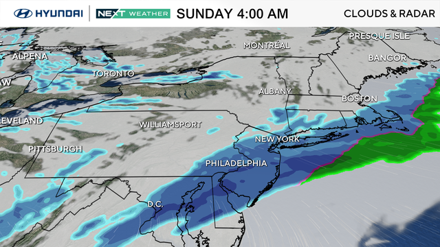
It's another day of jackets, gloves and hats as we continue in a cold winter pattern Thursday in the Philadelphia region.
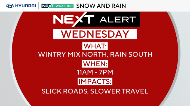
Wednesday in the Philadelphia region will be cloudy and chilly with rain showers in Philadelphia and rain and some snow in the Lehigh Valley.
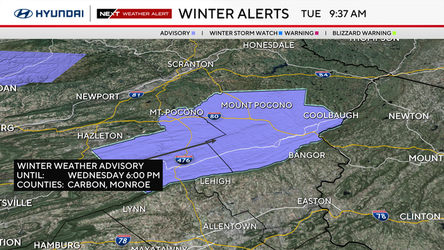
Temperatures are the coldest they've been since February Tuesday morning, with widespread teens and some windchills that dip into the single digits.
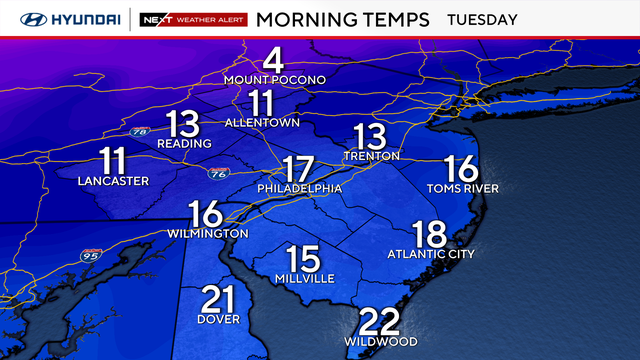
Heavy coats, gloves and scarves will be needed in Philadelphia on Monday and Tuesday as Arctic air hits the region.