Coastal System Brings End To Good Weather With Heavy Downpours
Beachgoers should beware and stay out of the ocean this Saturday due to increased risk of rough seas and rip currents.
Watch CBS News
Beachgoers should beware and stay out of the ocean this Saturday due to increased risk of rough seas and rip currents.

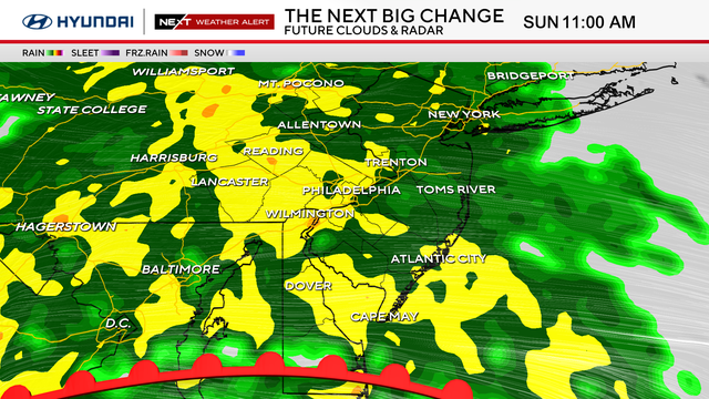
Showers will be abundant overnight Saturday into Sunday morning as the storm passes to the north.

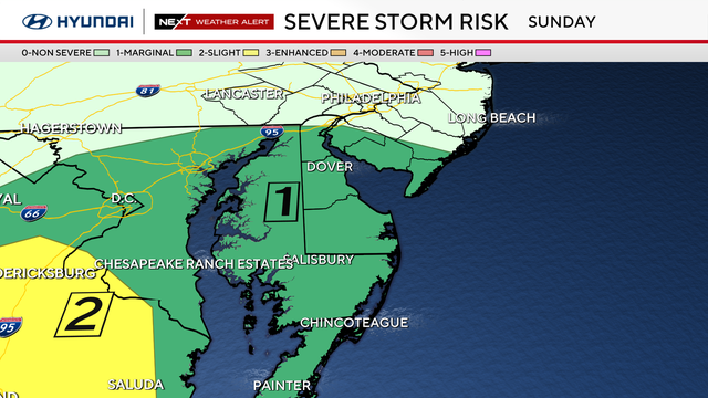
As always with thunderstorms, the lightning threat will be elevated across the region.

Sunday is expected to be the hottest day, but the heat will continue all the way into the upcoming week.
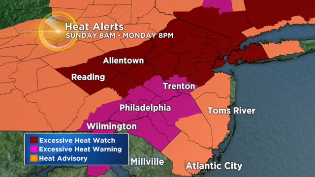
This higher heat and higher humidity make for a dangerous combination.

This heat can create health problems for some, so here are some tips that can be used to look out for during the first official heat wave of the summer.

Being present at my son's Commencement was a reminder for me that life is a series of beginnings and endings. The joy we find in the moments in between – this is the sweetness of life.


Areas north of Philadelphia, like the Lehigh Valley and Poconos will have the higher likelihood of staying dry today because they are farther away from the front.

It looks like the upcoming weekend is once more going to be the damp part of the forecast.

We will get to enjoy a much-needed lull in the action this afternoon.

Over the next 5-7 days, we are going to watch for drier weather overall, but a few spotty shower or thunderstorm chances will be in the mix from time to time.

As the Philadelphia and surrounding areas brace for more rain, we are prepping for chances of flooding as we head through the coming weekend.

The Philly Metro should brace for the storms in the 6-8PM time-frame, so the tail end of the typical evening commute is likely to be affected by the line of thunderstorms as they roll through.

The biggest threats at this time are going to be strong winds followed by a chance for some hail.

Most importantly, remember, when thunder roars -- go indoors!

By Wednesday we begin a summer-like 3-day stretch with highs in the 80s!

High pressure will dominate the forecast this weekend promoting bright sunshine.


A backdoor cold front will swing through with temperatures likely falling into the 40s by Sunday afternoon as an east wind takes over.

With all of this talk of cold air just remember to keep the t-shirts handy, you'll likely be able to break them out in just a few days!

We could finally see some temperature much closer to normal and eventually even close to 70°.

This year it is going to be a cold afternoon for baseball.

A messy start to April is on tap as another dose of Winter Weather makes its way ythrough the region starting on Sunday night and lasting through the morning hours on Monday.

The Calendar may say April, but Mother Nature does not agree. We are tracking a late-season snow on the way.