NEXT Weather: Gusty storms could bring heavy rain, isolated tornado to Philly region

PHILADELPHIA (CBS) -- Wednesday was pleasant, but a strong cold front will bring gusty storms and a subsequent cooldown Thursday. The morning commute on Thursday looks largely quiet, with clouds and some fog possible as we await the arrival of a strong cold front in the afternoon.
There will be some scattered showers on Thursday morning, but pre-frontal rain will likely start to pick up by midday especially north and west of Philadelphia, with stronger thunderstorms arriving by late afternoon and continuing into the evening.
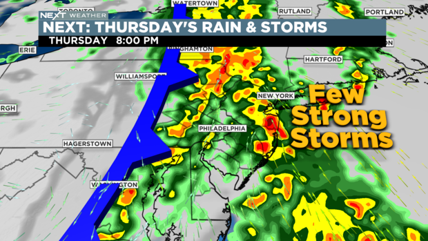
While conditions for severe weather are not optimal, there looks to be at least a brief window across parts of our area where wind shear and instability will be maximized, leading to the risk of severe thunderstorms.
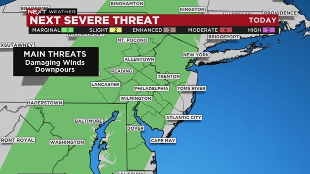
The greatest risk appears to be severe straight-line gusts in excess of 60 mph, but given the high level of wind shear near the surface, we cannot rule out a brief isolated tornado. We will also have to monitor the potential for heavy rainfall and possible flooding with this line of storms, especially since it appears that storms may for a time move in a south-to-north fashion, training over the same areas.
Please stay with the Eyewitness Weather Team as we track this period of potential severe weather developing for Thursday.
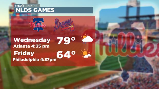
By Friday morning, thankfully, the sun is back and we are expecting great weather for the Phillies' return to Philadelphia and for the upcoming weekend, with highs in the mid-60s.


