WEATHER BLOG: Flakes Have Been Flying
An upper-level disturbance swinging through the atmosphere this morning will be responsible for bringing some areas (not all) a quick dusting or coating of snow.
Watch CBS News
An upper-level disturbance swinging through the atmosphere this morning will be responsible for bringing some areas (not all) a quick dusting or coating of snow.

It has been a messy March across the entire Northeast as 4 Nor'easters have pummeled the region from DC up to Boston.

Talk about coming in like a lion, March of 2018 has been relentless.

The time of peak snowfall today has been foretasted to be in the 1-5PM time frame

Tuesday will have a chance for a wintry mix of rain/sleet/snow in the afternoon hours.

As we get ready to start spring officially on Tuesday afternoon, we are also bracing for the potential of the fourth nor'easter of the month of March.

Beyond today, all eyes turn toward the potential for nor'easter #4 next week.

This weekend temperatures will remain on the cooler side.

We are continuing to keep a close eye on what will become our third nor'easter since the beginning of March.

There has been a lot of talk this week over a potential third nor'easter for our region.

The saying that March comes in like a lion has not been truer for Philly and much of Northeast United States than it has to start out the month in 2018.
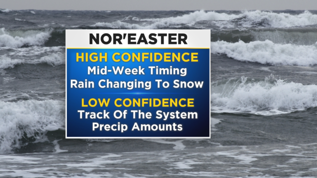
Even as we continue to deal with the aftermath of last week's system, there is no rest for the weary as another strong, albeit not quite as powerful system looks to push into the region as early as late on Tuesday.

March came in with a giant roar as a nor'easter brought howling winds, rain and a windswept snow to the region.

So far this week the forecast has really been to almost everyone's liking thanks to sunshine and the temperatures that have remained above normal.

The forecast remains on track as we prepare for some winter weather to arrive tonight.

Get ready for some Saturday snow!

Temperatures have been back and forth for the last week, with highs peaking yesterday in the 60s and then a chance for snow this coming weekend.

A mild, but very wet weekend is setting up for the Delaware Valley with a soaking rain on the way.

The rain has been mainly light/steady in nature, but some locations have dealt with pockets of moderate rain, especially south and east of the city.

When fans sit around and discuss playoff football, the inevitable conversation comes up of what kind of weather do we want for game time.

It was nice while it lasted but colder temperatures have now filtered back into the region and we could be watching a new system get ready to slide into the region early this week that could drop some snow over the region.

It was a frigid start to the month of January and we had almost a full 2 weeks in many areas where high temperatures in the afternoon never made it above the freezing mark.

Many roads are snow-covered, both in the city and in the suburbs, and multiple accidents have been reported on the roadways.

The bitter cold has taken over the Delaware Valley.

The temperature has fallen below the freezing mark this evening in Philadelphia and will not again surpass that threshold for more than 180 hours.