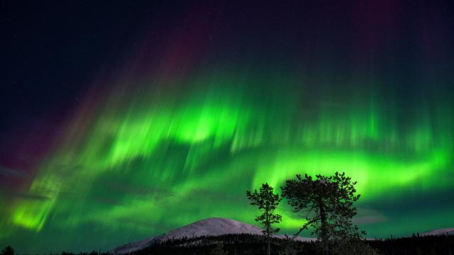
Fading chance to see Northern Lights in Philadelphia region Friday night
The Philadelphia region may get a glimpse of the Northern Lights, an amazing nature show, without leaving the United States.
Watch CBS News
The Philadelphia region may get a glimpse of the Northern Lights, an amazing nature show, without leaving the United States.
A dip in the jet stream over our area will keep us cooler than much of the country through Tuesday.

On the first weekend of January this year, I took part in the ritual countless others did across our land – the Great Closet Clean Out.
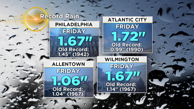
Philadelphia received 1.67 inches of rain, breaking the old record of 1.45 inches set back in 1942.
As temperatures continue to hover below normal for this time of year, one senior citizen organization is sounding the alarm.

The medical supply shelf was cleared of sterile gauze, needles and catheters; replaced with guacamole, hoagies and brownies. (Don't worry, we sterilized the shelf when we were done.)
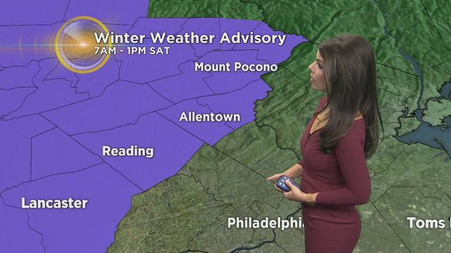
The best chance for any wintry precipitation remains in Berks County, the Lehigh Valley and the Poconos.

PennDOT crews are preparing for our first taste of wintry weather this season.

Conditions will be ripe enough for a threat of severe weather Tuesday.
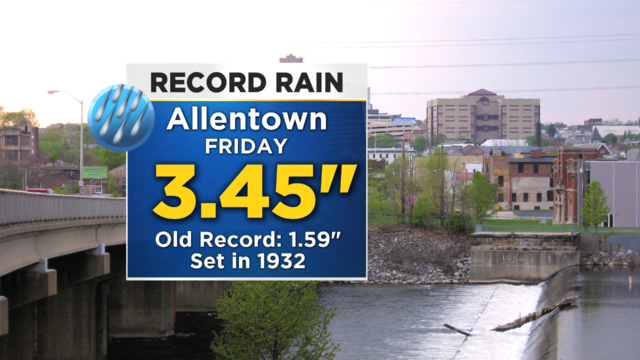
The old record was 1.59 inches set back in the 1930s.
As the month of November kicks off today we are looking at high temperatures that are 10 to even 15° above normal for the this time of year.
The good news is that it's not cold enough for snow.
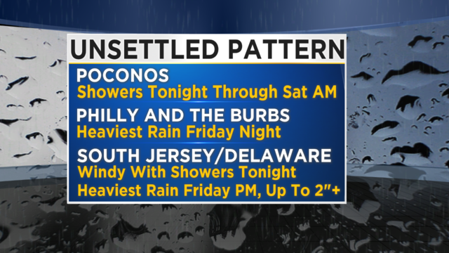
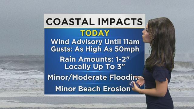
Most of this week has been focused around the colder than normal temperatures, but as we approach the weekend, our eyes will turn to a coastal system that will bring, the potential for heavy rain and strong winds to parts of the region, and yes even the chance for a few wet snowflakes to mix in, in some of the higher elevations.
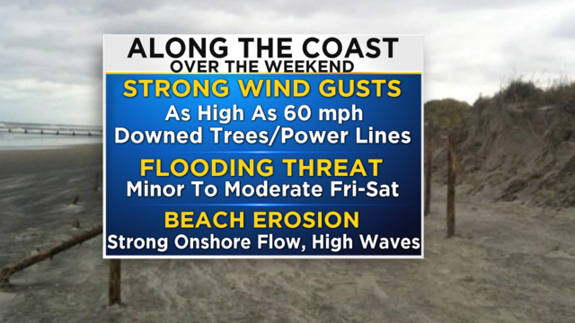
There is the chance for a strong storm system to develop and move up the coast and into the Mid-Atlantic this weekend.
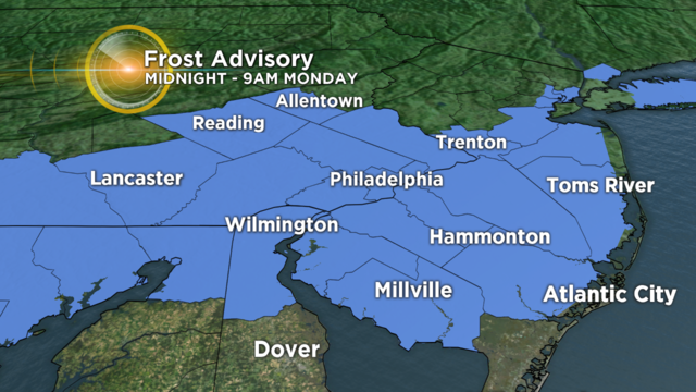
A Frost Advisory has been issued and goes into effect at midnight and will last through 9 a.m. Monday.
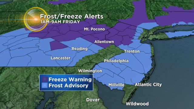
Thursday is going to go down as the coldest day so far this season and while it may get slightly warmer through Friday and at least part of the weekend, the late October chill is still going to be in the air as well as chance for some rain showers at times.

Layers will be a good idea this weekend as mornings will be cool and in the 50s.

On Wednesday, the high temperature will be climbing near the record of 98 set back in 1991.

My head will always miss Sean. My heart will miss him more. So maybe just acknowledging it is enough. For now.

Areas most susceptible to flash flooding are those that received rainfall Friday and as well as the I-95 urban corridor.

More frequent extreme rainfall events yield not only the threat of flash flooding but have a number of consequences on public health and safety including the degradation of water quality.

Any shower or storm that does develop will be capable of producing very heavy downpours.

All flood advisories and warnings are also expected to expire by this afternoon, but it's possible some may be extended due to runoff so watch for updates.

The saturated ground and higher river and creek levels will make the area more prone to flooding.

Beachgoers should beware and stay out of the ocean this Saturday due to increased risk of rough seas and rip currents.