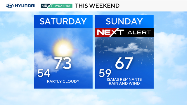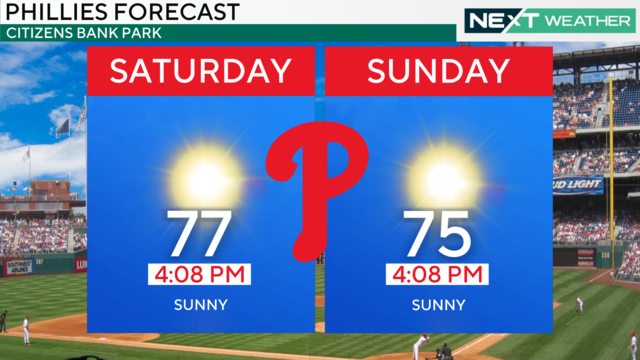
Chance of showers Friday afternoon in Philly ahead of beautiful weekend
Friday in the Philadelphia region will top out in the mid-upper 70s and set up a beautiful weekend.
Watch CBS News
Friday in the Philadelphia region will top out in the mid-upper 70s and set up a beautiful weekend.
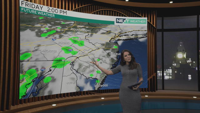
Thursday starts cloudy and turns sunny while Friday will do the opposite for us. Then we have a gorgeous, sunny weekend.
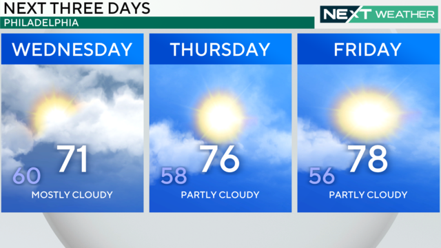
Sick of gray skies? Get ready, because cloud cover is going to break up to end this week and set the stage for gorgeous weekend weather around Philadelphia.
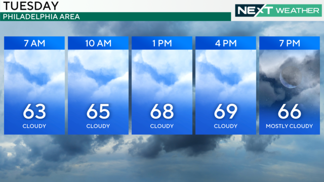
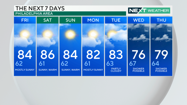
Gray skies and the chance for a stray shower will persist again Tuesday, but warmer temperatures and sunny skies are back in the weekend forecast.
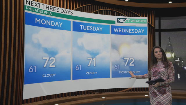
Skies will be mostly cloudy once again across the Delaware Valley and Philadelphia region Monday. A few breaks of sun are possible later in the day east of the city.
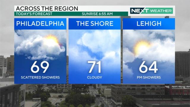
Sunday will be overcast with spotty showers throughout the morning and afternoon. A few steadier showers are possible overnight into Monday.
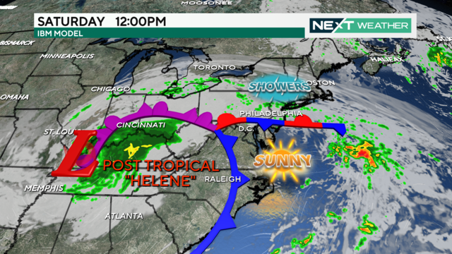
Saturday will be filled with gray skies and patchy fog with scattered showers. Temperatures sit in the mid-70s before dropping into the 60s later tonight.
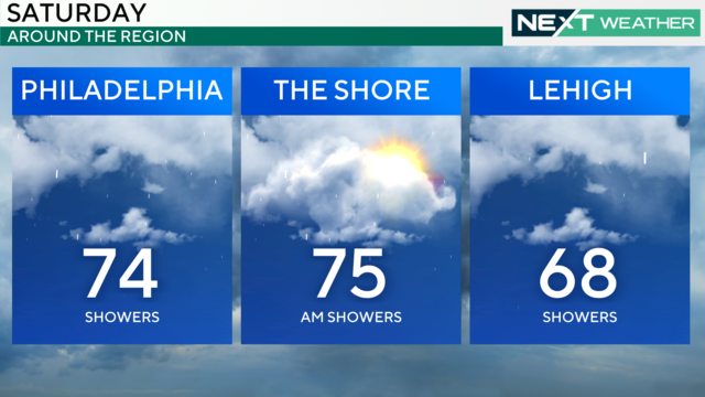
Mostly cloudy skies, off-and-on showers and humid conditions in Philadelphia on Saturday as the moisture from Helene heads this way.
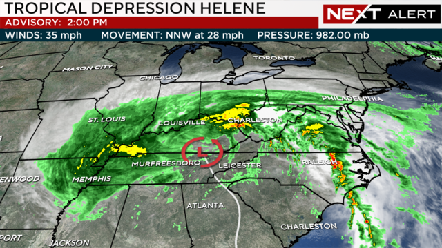
Friday morning fog has moved out before bands of showers from Tropical Depression Helene hit Friday night into Saturday.
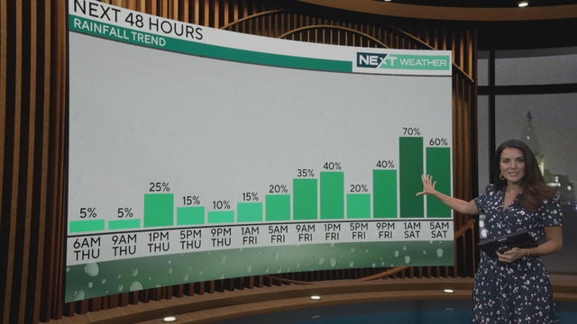
Expect some minor rain in the Philadelphia area, with more possible Friday into Saturday morning as Helene breaks up inland.
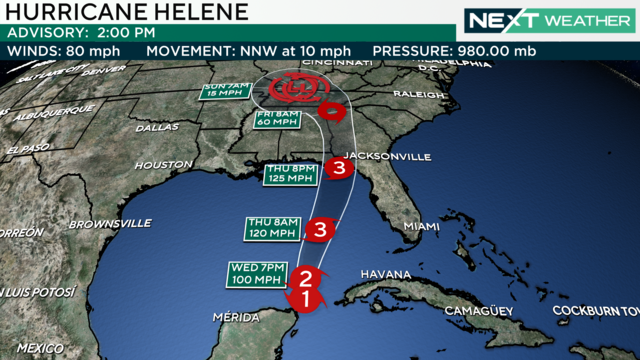
The Philadelphia region will get some much-needed rain on Wednesday and potentially even more this weekend as Helene breaks up inland.
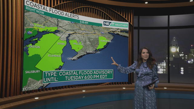
The forecast Tuesday is calling for cloudy weather and some chances for rain around Philadelphia, along with the possibility for coastal flooding.
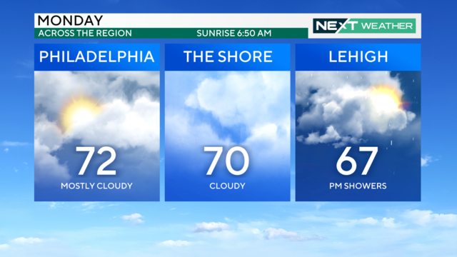
Mother Nature will make it look and feel like autumn, with highs in low the 70s over the next few days, and morning temperatures in the 50s and 60.
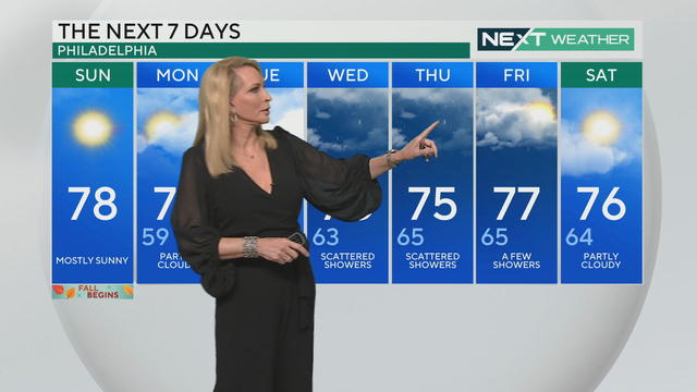
The first day of fall in Philadelphia will start out cloudy but turn sunnier as we head into the afternoon. Much-needed rain is also in the forecast for this week.
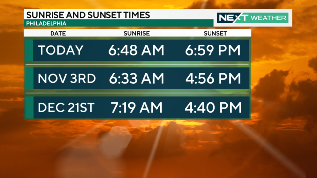
Goodbye 7 p.m. sunsets! That is until spring starts in March. If you've noticed the hours of daylight are shrinking faster as we transition from summer to fall, it's because they are.
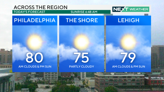
It'll be a very nice last day of summer across the area on Saturday with high temperatures in the low 80s followed by scattered showers and cloud coverage this evening.
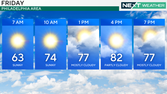
The Philadelphia region can expect mostly dry weather this weekend with some chances for light rain.
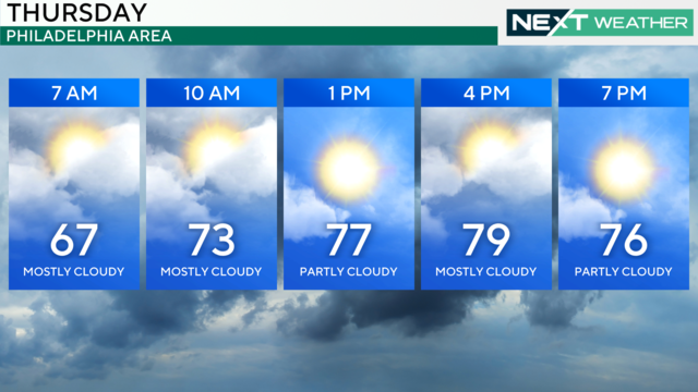
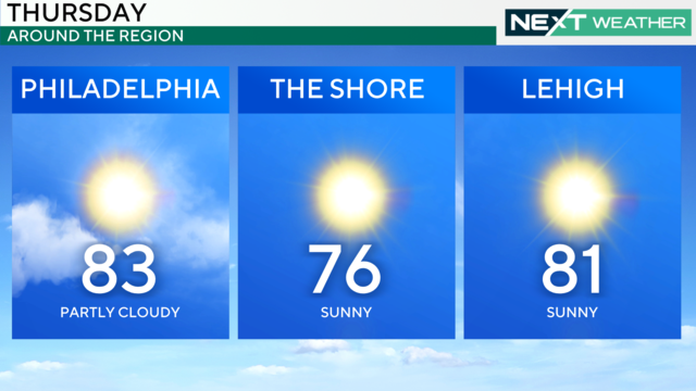
The region will see on-and-off cloud cover Thursday morning before the sun breaks through in the afternoon. Showers look to stay away Friday and into the weekend.
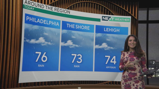
After what has been the driest start to September in almost 20 years, a little rain has returned to the Delaware Valley.
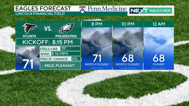
After a long, dry stretch of September weather, rain returns to the Philadelphia region this week.
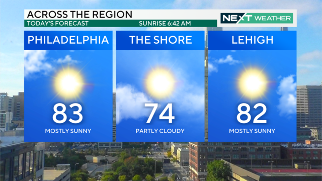
Once some patchy morning fog clears out, the Delaware Valley will have mostly sunny skies with high temperatures in the low 80s.
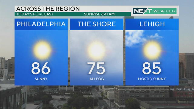
Philadelphia's weekend is headlined by warm and sunny days with comfortable nights. There was dense fog across South Jersey and Delaware this morning but the skies are cleared and temperatures are rising.
A NEXT Weather Alert has expired in the Philadelphia region because of dense fog expected during the morning commute.
After periods of locally dense and patchy fog across much of Delaware, South Jersey and parts of Bucks and Delaware counties, sunny and dry weather returns to region.
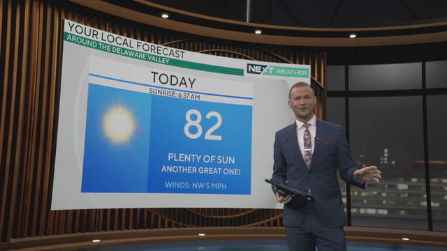
After another relatively chilly start, Tuesday will feature plenty of sunshine as temperatures make their way back into the low 80s in Philadelphia.