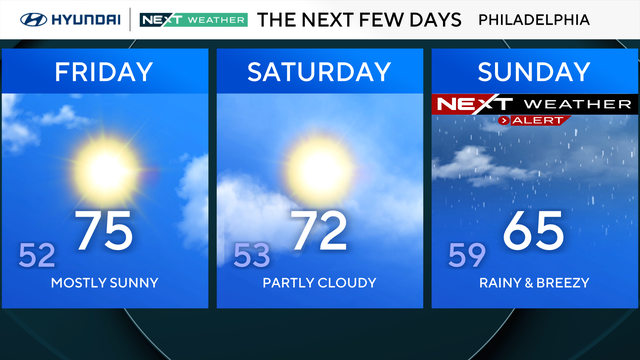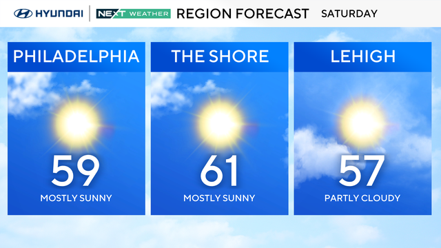
Dry, seasonably mild weekend ahead for the Philly region
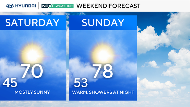
Welcome to the weekend everyone! Temperatures around the 60s and lows in the mid-upper 40s.
Watch CBS News
Welcome to the weekend everyone! Temperatures around the 60s and lows in the mid-upper 40s.
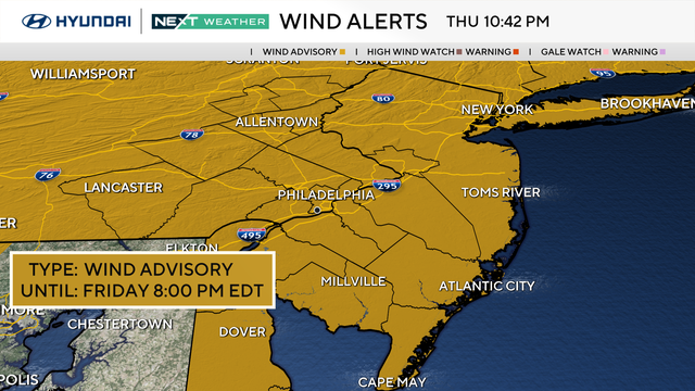
Get ready to really secure those decorations and costumes for the kids Friday night, as it will be a blustery Halloween in the Philadelphia region.
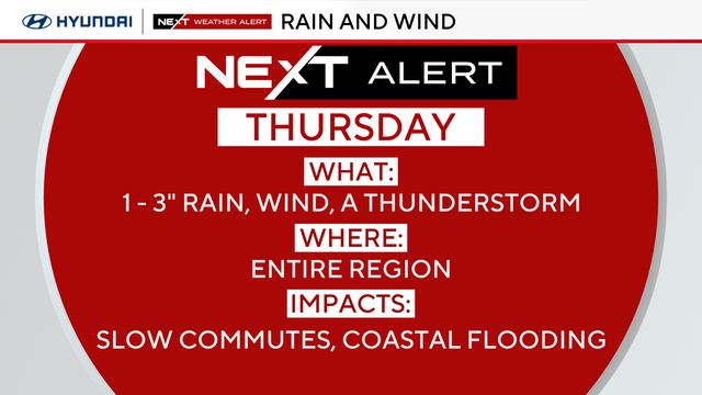
Rain, wind and thunderstorms are expected in the Philadelphia area Thursday.
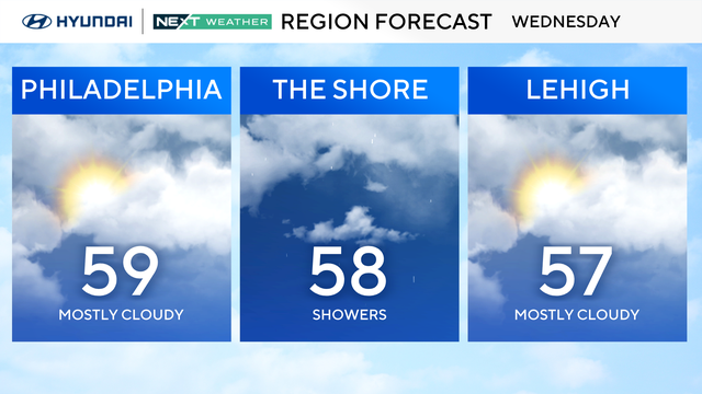
Wednesday in the Philadelphia region will be breezy, and storms will arrive at night to bring widespread wind and rain to the Delaware Valley.
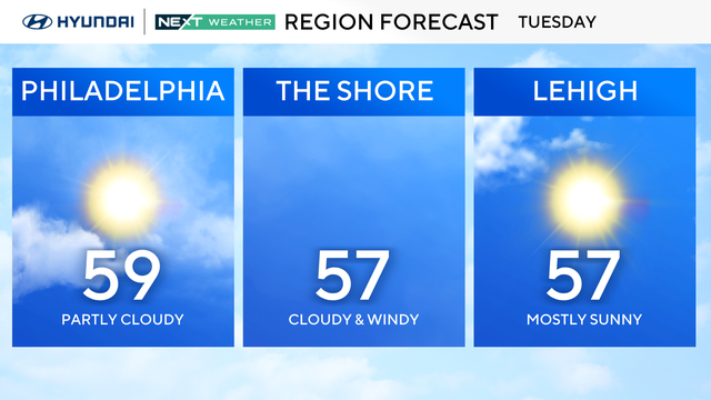
The Philadelphia region can expect some clouds and temperatures in the 50s Tuesday.
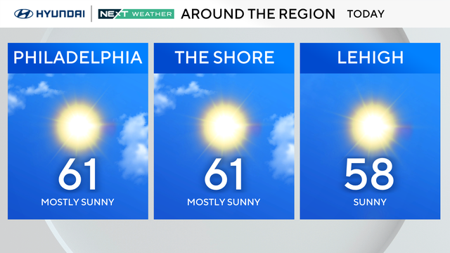
Skies will be mostly clear across the Philadelphia region, with more clouds lingering farther south.
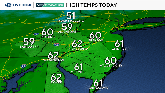
Expect a pleasant and seasonable Sunday with sunshine returning by the afternoon and highs in the upper 50s to low 60s.
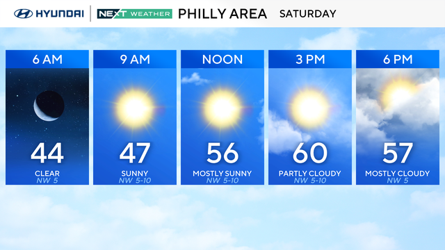
The weekend is trending dry and cool, great fall football weather ahead for the Eagles game on Sunday.
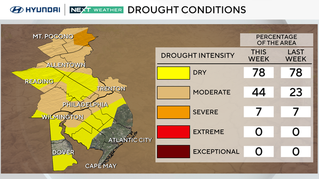
The Philadelphia area can expect a dry, cool weekend, but drought conditions are worsening.
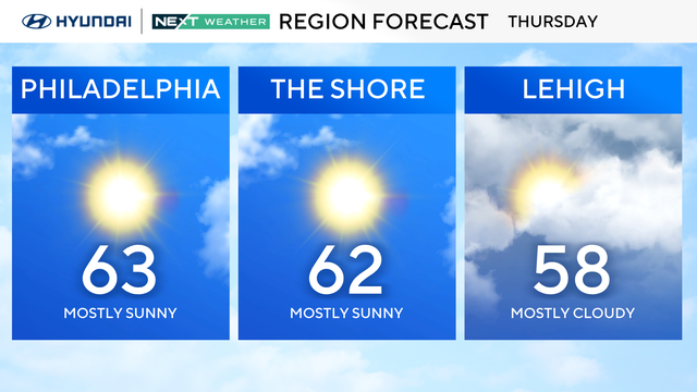
Thursday in the Philadelphia region will be mostly sunny and cool with a high of 63 degrees, and colder weather is on the way.
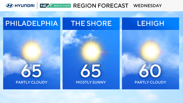
Wednesday in the Philadelphia region will be sunny and breezy with wind gusts that could reach 30 mph.
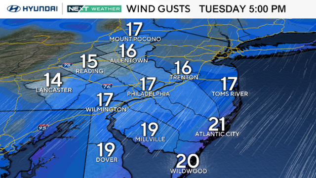
The Philadelphia area can expect a sunny Tuesday with temperatures near 70 degrees.
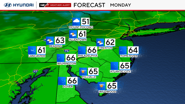
Overnight storms have moved out, making way for cooler air across the Philadelphia area this week.
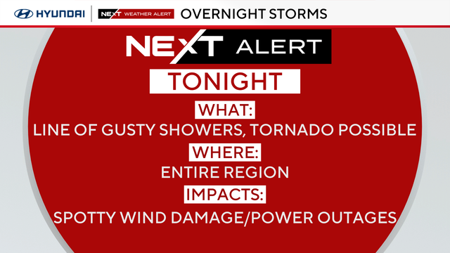
A NEXT Weather Alert is in effect as a line of showers with some isolated gusty and damaging storms could move through the region Sunday night.
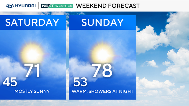
With mostly sunny skies and above-average temperatures in the Philly region, Saturday is a perfect day to get your fix of autumnal fun by heading to a pumpkin patch or fall festival.
Friday in the Philadelphia region will be similar to Thursday, but it will be a bit colder across the Delaware Valley.
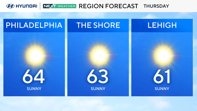
Thursday in the Philadelphia region will start out chilly, with a high of 64 degrees under sunny skies.
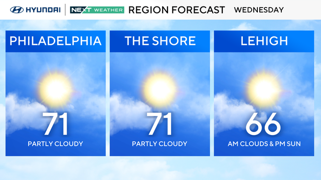
With the powerful nor'easter drifting further out to sea, the weather conditions in the Philadelphia region will improve dramatically over the next several days.
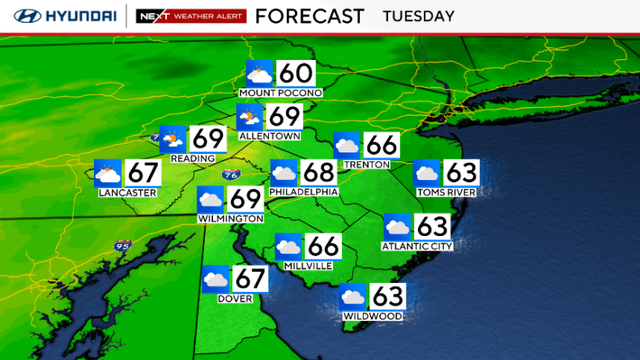
Tuesday will be cloudy and breezy in the Philadelphia area with highs in the 60s.
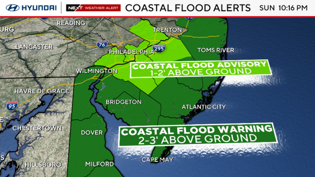
The significant coastal storm continues to impact the Philadelphia region and Jersey Shore on Monday.
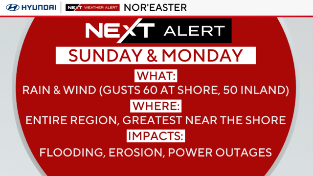
Rainy and windy Sunday, especially closer to the coast. Coastal flooding is expected at high tides.
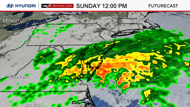
We're looking ahead to two NEXT Weather Alert Days on Sunday and Monday as a weekend storm is set to bring heavy rain, strong winds, and possible flooding.

We're looking ahead to two NEXT Weather Alert Days on Sunday and Monday as a weekend storm will begin to form from a coastal low.
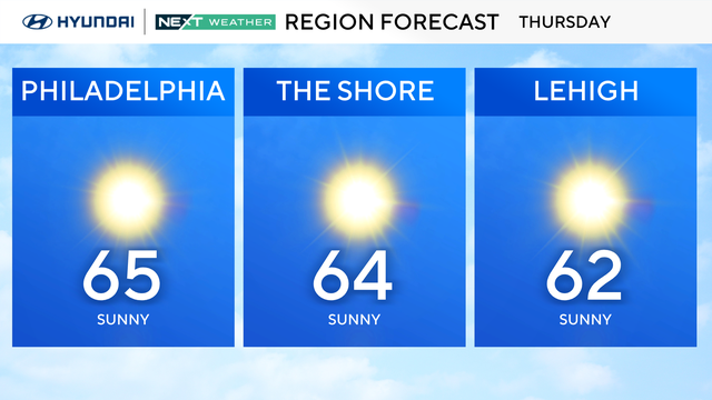
After a wet morning Wednesday in the Philadelphia region, the rest of the week looks dry and cool, thanks to high pressure building back in.
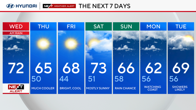
After a morning with pockets of rain, skies will clear and sunshine is likely by the afternoon hours in the Philadelphia area.