
Increasing humidity, rain later on in Twin Cities Thursday
Thursday will bring increasing humidity and a chance of rain to the Twin Cities.
Watch CBS News
Thursday will bring increasing humidity and a chance of rain to the Twin Cities.

Most of Minnesota is in for a beautiful day on Wednesday, though northern Minnesota is still under an air quality alert.
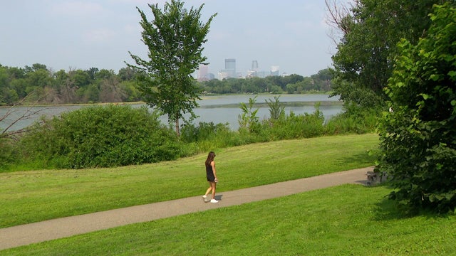
After an air quality alert expires Tuesday afternoon, the Twin Cities will be in for a nice couple of days.

An air quality alert remains in effect for the entire state of Minnesota on Monday.
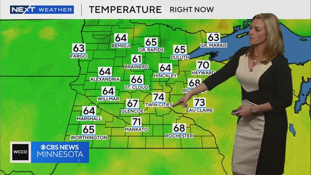
Smoke is set to return to Minnesota, bringing unhealthy air and possible storms across the northern part of the state.
With severe weather now out of the Twin Cities and surrounding areas, we're in store for calmer and slightly cooler afternoon temperatures on Saturday.

After the morning round, the Twin Cities will get some dry time before the rain returns in the evening.
Though the hazy skies will continue to clear in the Twin Cities on Tuesday, northeastern Minnesota is still dealing with air quality concerns.

The air quality in Minnesota will continue to improve on Monday as wildfire smoke moves out of the state.
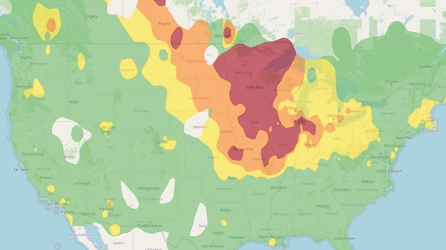
The state of Minnesota is entering another in a long string of summer days marred by air quality alerts. Poor air quality will continue through Saturday with lingering wildfire smoke from Canada.
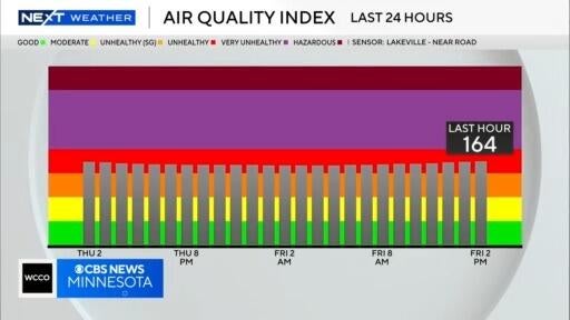
The air quality alert in effect for all of Minnesota has been extended to noon on Monday, according to Next Weather meteorologist Mike Augustyniak.
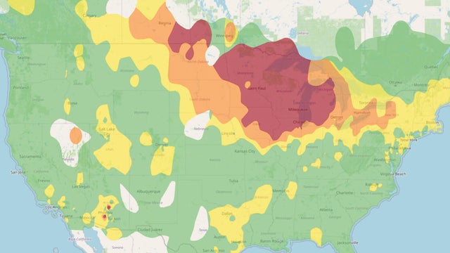
An air quality alert covering the entire state of Minnesota continues on Thursday, marring otherwise fairly ideal weather conditions.

The entire state of Minnesota is under an air quality alert for the next few days, coinciding with a stretch of cooler, quieter weather.

Minnesota is headed for a much-needed break from the intense heat and humidity, but air quality concerns will linger over the state through the weekend.
After a long stretch of heat and humidity, temperatures are expected to be below average for a bit.

Minnesota is at risk for widespread wind damage, hail damage, and the potential for tornadoes and flash flooding on Monday evening into the overnight hours. WCCO meteorologist Joseph Dames has the latest details about what to expect and when it may hit your home.
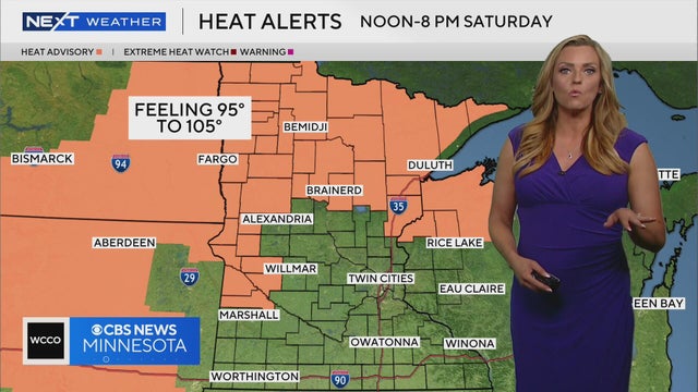
A heat advisory will be in effect from noon to 8 p.m. on Saturday for northern and western Minnesota, according to Next Weather Meteorologist Lisa Meadows. The Twin Cities could see a similar advisory on Sunday.
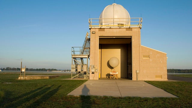
If you're frustrated about the quick-changing weather this summer, you're not alone, and WCCO's NEXT Weather team of meteorologists is warning things may be even more unpredictable in the future.
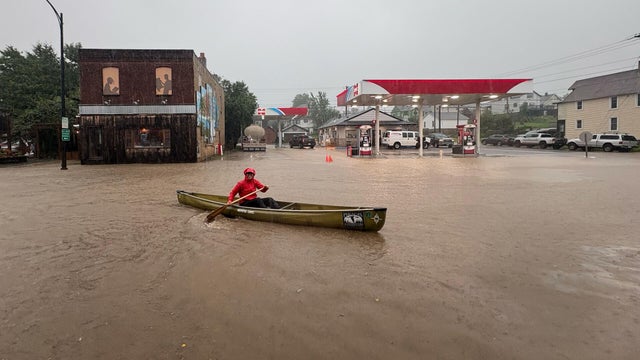
Parts of Minnesota will once again be under a heat advisory on Wednesday, and more storms are in the pipeline, too.
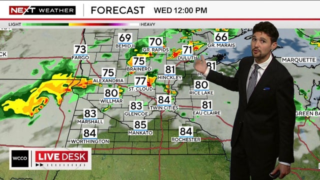
Minnesotans will have to be on the watch for a mix of weather conditions Wednesday, including a flood watch in northern Minnesota, heat advisory in the metro area and storms that will roll through in the afternoon. A NEXT Weather Alert is in effect.
Heat and humidity return to Minnesota on Tuesday, and parts of the state are in for scattered thunderstorms.
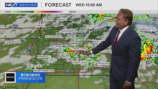
Rain and storms will be off and on starting Tuesday and going through Thursday, Next Weather meteorologist Chris Shaffer says.

Scattered storms will move through Minnesota Monday morning, and a surge in heat and humidity is not far off.

Wednesday will be a wet one in the Twin Cities, with showers and storms continuing through the morning and another chance for moisture in the afternoon.
The advisory will be in place for Anoka, Carver, Dakota, Hennepin, Ramsey, Scott and Washington counties from noon to 8 p.m. as feels-like temps approach 100.