Spectacular weekend weather across South Florida, with low rain chances
The NEXT Weather Team is tracking a spectacular weekend across South Florida.
Watch CBS News
The NEXT Weather Team is tracking a spectacular weekend across South Florida.
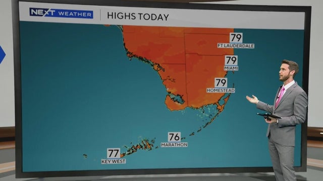
A slight warmup is expected for Friday afternoon as highs climb into the upper 70s.
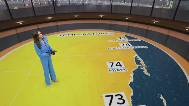
Thursday morning across South Florida is comfortable with lows in the 70s and some showers.

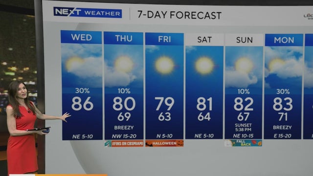
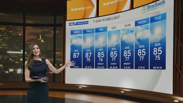
South Florida's midweek chill is fading, with temperatures gradually warming back to the 80s by the weekend under mostly sunny, breezy, and mainly dry conditions.
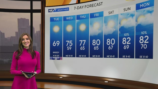
This is the coldest morning in Miami since Jan. 25, when lows dropped below 50 degrees.

A strong cold front impacting South Florida could send temperatures into the 40s Tuesday morning, and leave cold-stunned iguanas falling from trees.
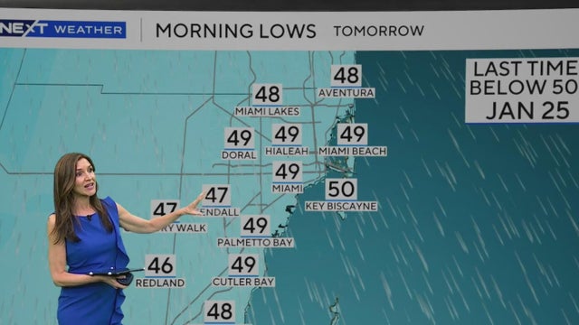
The CBS Miami Next Weather team is tracking a strong cold front set to usher in arctic air and chilly temperatures Monday night into Tuesday morning.
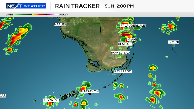
The NEXT Weather Team is tracking a rainy afternoon across Southeast Florida.
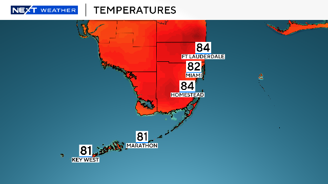
There is a slight chance of storms popping up on Saturday, early afternoon through early evening.

South Florida will see a warm, mostly dry weekend before a strong cold front early next week brings windy conditions and temperatures dipping into the 50s.
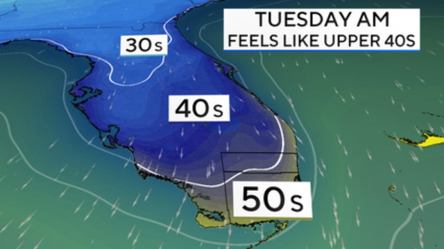
Temperatures could dip into the 50s by Tuesday morning as a strong front pushes through.
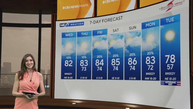
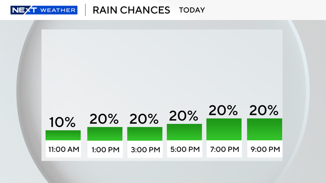
The breeze will build out of the east 10 to 15 mph, with gusts as high as 20 mph. This will lead to a few stray showers, but the chance of rain is low.
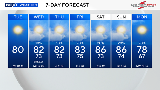
A coastal flood statement remains in effect until 9 am as minor coastal flooding will be possible due to the higher-than-normal king tides.

The NEXT Weather Team is tracking rain showers moving into South Florida late Sunday afternoon and into the evening.
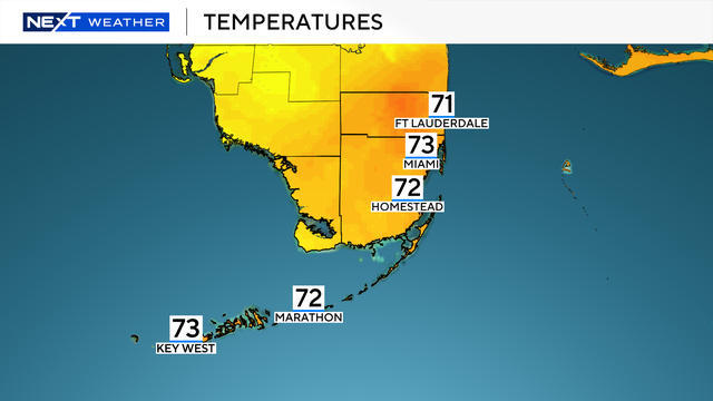
After a chilly start to the morning with temperatures in the low 60s, the sun will warm up the region to the upper 70s and low 80s. The early morning cool temperatures will stretch through next week.
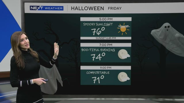
It was a treat to wake up Friday morning with temperatures dipping into the 50s.
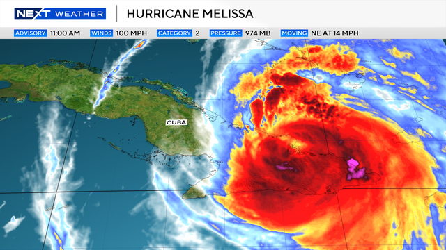
Hurricane Melissa is the 13th named storm in the Atlantic of the 2025 hurricane season.
A coastal flood statement remains in effect for the Florida Keys through late Wednesday.
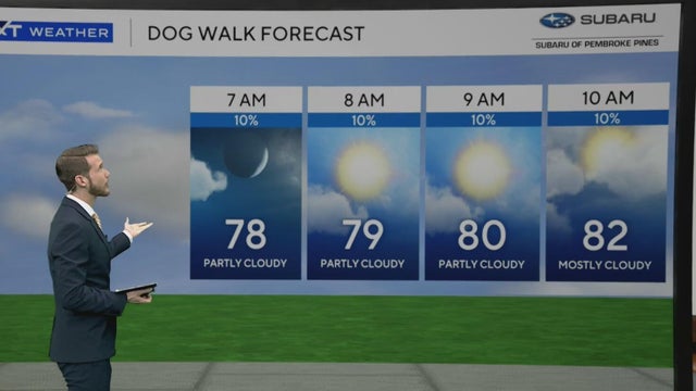
The first cold front pushes through the area later Tuesday and will bring a 30% chance for showers and isolated storms in the afternoon.
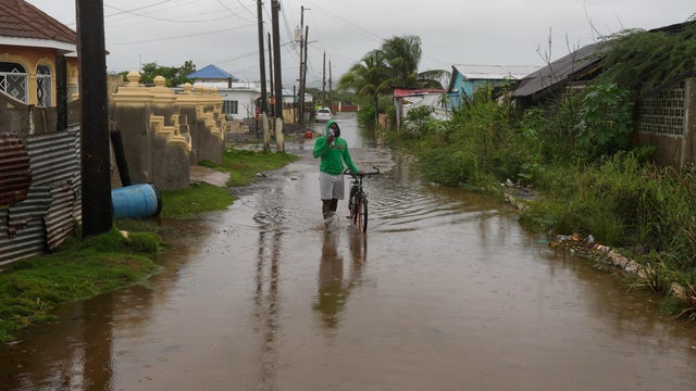
Hurricane Melissa strengthened into a Category 5 storm on Monday, unleashing torrential rain and threatening to bring catastrophic flooding to the northern Caribbean.

The amount of rain that fell over the weekend is not expected to be repeated; however, any additional rain over saturated Broward County could result in flooding.
The NEXT Weather Team is tracking Hurricane Melissa as it spins through the Caribbean this weekend.
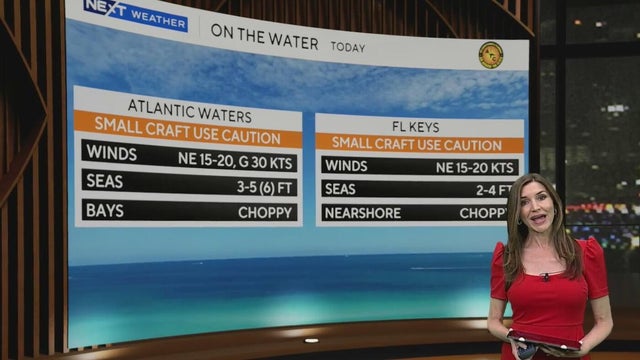
There is a dangerously high risk of rip currents along the Atlantic beaches.
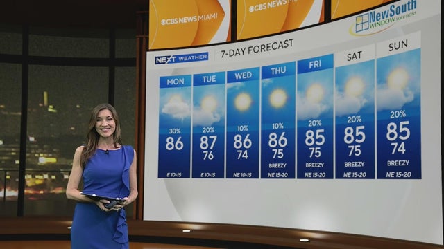
Scattered showers will be possible on the breeze, but the chance of rain is not high.
There is a moderate risk of rip currents along the Atlantic beaches. There are no alerts or advisories for boaters along the Atlantic or Keys waters.