It will stay muggy, humid as scattered showers move across South Florida
The warmth and humidity, with highs rising to the upper 80s, are forecast in the afternoon under mostly sunny skies.
Watch CBS News
The warmth and humidity, with highs rising to the upper 80s, are forecast in the afternoon under mostly sunny skies.
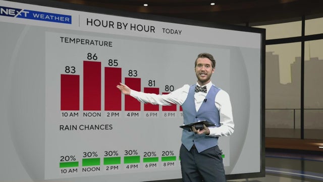
The NEXT Weather Team is tracking the potential for scattered showers and isolated storms to close out the weekend and kick off the beginning of the upcoming workweek.
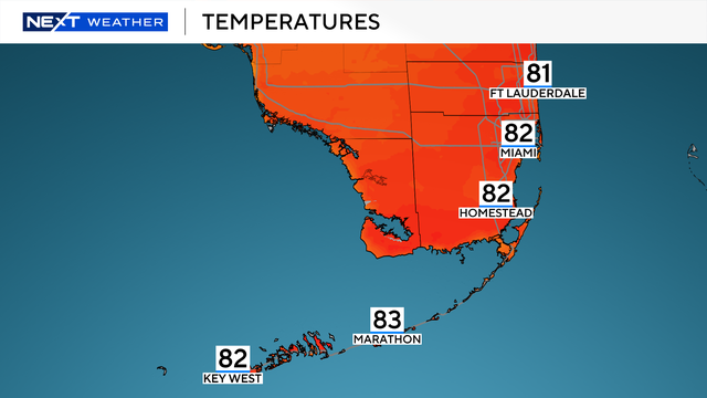
The NEXT Weather Team is tracking a spectacular Saturday across South Florida.
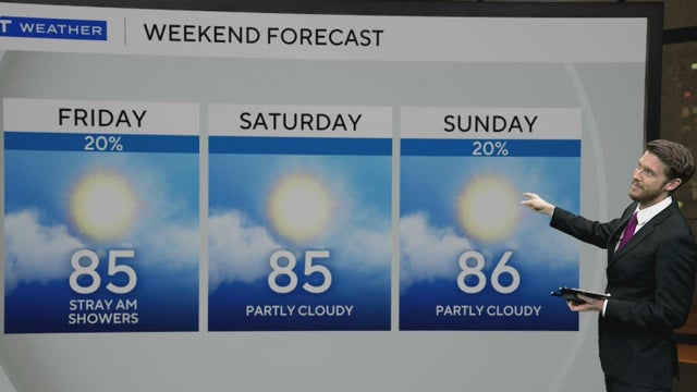
Rain chances linger Friday morning, but drier and breezier conditions arrive for the afternoon.
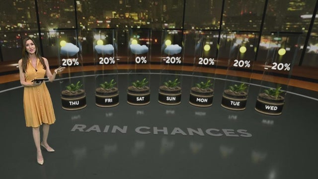
The morning started comfortably, with temperatures in the low to mid 70s. Highs will climb to the mid to upper 80s this afternoon.
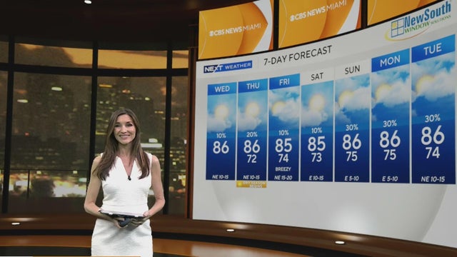
The strong winds are leading to hazardous beach and boating conditions. There is a high risk of dangerous rip currents along the Atlantic beaches.
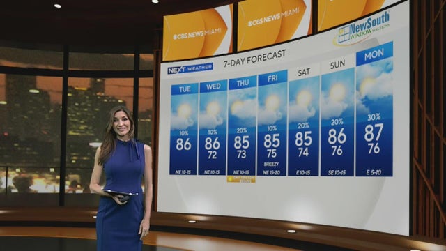
There is a high risk of rip currents along the Atlantic beaches. It is not safe to go swimming in the ocean.
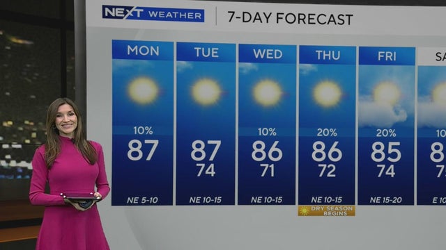
South Floridians can expect lower humidity, plenty of sunshine, and warm highs in the mid-to-upper 80s.
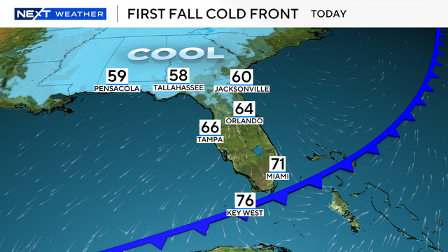
The NEXT Weather Team is tracking a much drier day and work week after a front moved across South Florida.
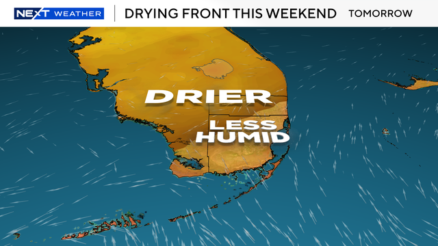
The Next Weather Team is tracking the first fall front as it arrives in South Florida.
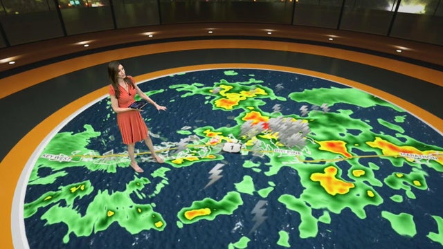
Heavy showers and thunderstorms are drenching South Florida Friday, causing localized flooding before a weekend cold front brings cooler nights.
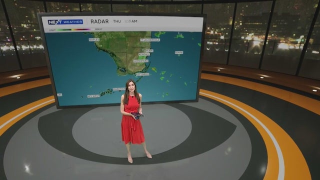
The Weather Prediction Center has put Broward and Miami-Dade under a level 1 risk of flash flooding since heavy downpours and localized flooding will be possible.
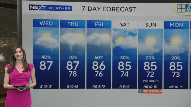
A coastal flood advisory continues through 8 p.m. Thursday, Oct. 9.
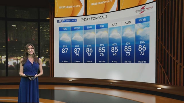
A coastal flood advisory continues through Wednesday, Oct. 8, due to the higher-than-normal king tides.
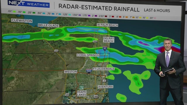
Temperatures climb into the upper 80s Monday before a few storms develop and push through metro areas.
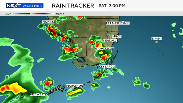
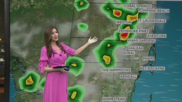
The largest rain accumulations this weekend are expected near The Hammocks, Kendall and Pembroke Pines, the NEXT Weather reports.
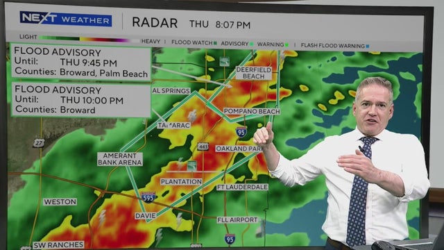
Rain totals for parts of South Florida are expected to reach 2 to 4 inches broadly, with up to 6 inches in some areas.
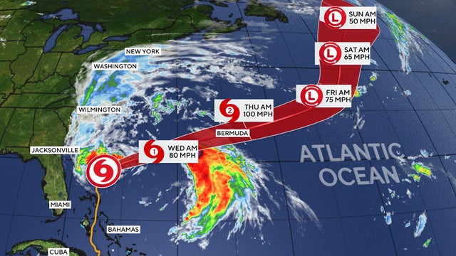
Imelda, the ninth named storm of the 2025 Atlantic hurricane season, has weakened to a post-tropical storm after lashing Bermuda with wind and rain.
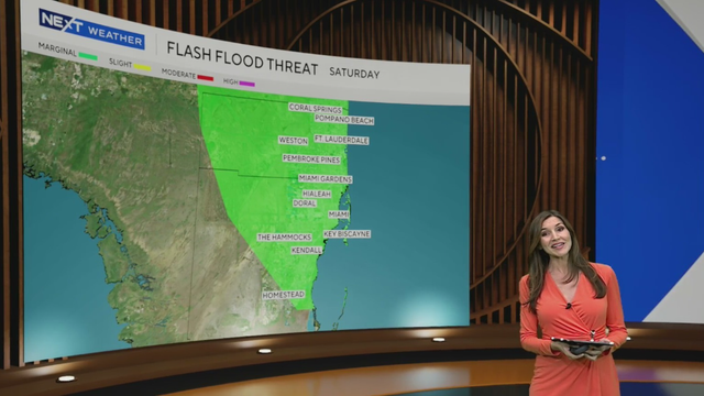
On Friday, the wet weather will move in earlier in the morning with scattered showers and storms around throughout the day
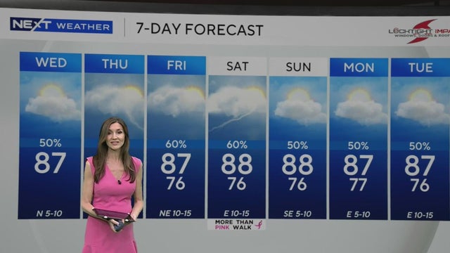
The Weather Prediction Center has placed Broward and Miami-Dade under a level 1 risk of excessive rainfall and flash flooding Thursday.
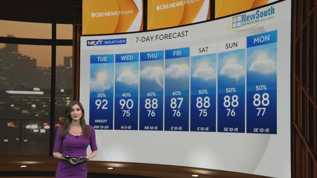
Gusty winds up to 25 mph or stronger will be possible as Hurricane Imelda remains close enough to Florida.
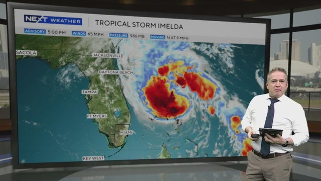
A Tropical Storm watch and a small craft advisory are in effect for the Atlantic waters.
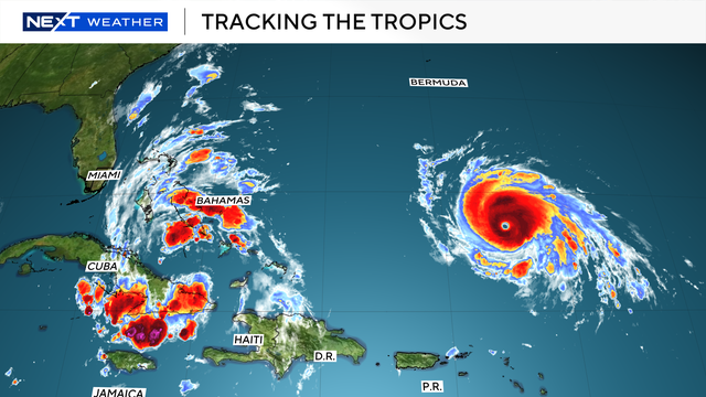
Tropical Depression Nine, which is dropping a significant amount of rain on The Bahamas, was upgraded to Tropical Storm Imelda on Sunday afternoon.
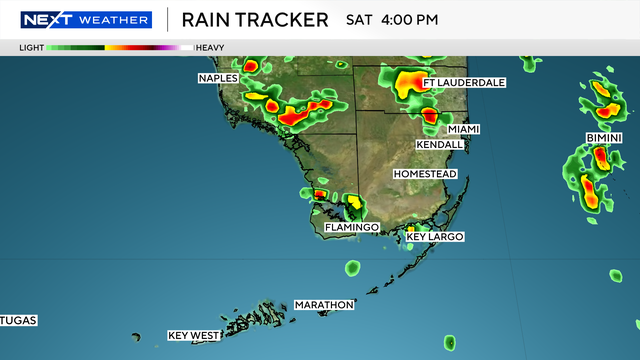
The NEXT Weather Team is tracking both Saturday afternoon storms and two systems in the Tropics.
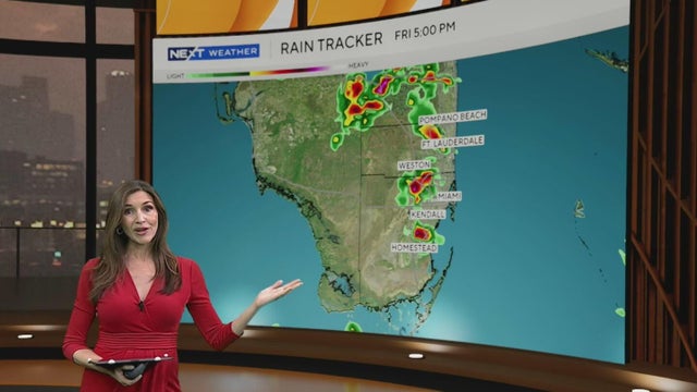
Friday morning was mostly quiet across South Florida but later in the day, scattered storms will develop.