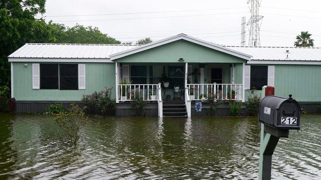
Arthur, 2026's first tropical storm, weakens but still poses flooding threat
Arthur, the first named tropical storm of the 2026 Atlantic hurricane season, weakened to a post-tropical cyclone after making landfall.
Watch CBS News
Arthur, the first named tropical storm of the 2026 Atlantic hurricane season, weakened to a post-tropical cyclone after making landfall.
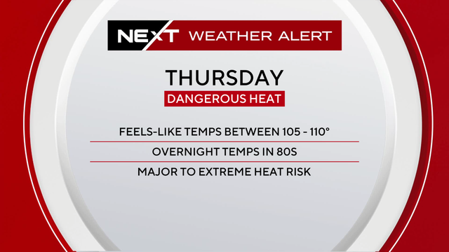
While South Florida is no stranger to heat, Thursday's heat comes during a stretch of hotter-than-normal days, with little overnight relief and fewer afternoon storms expected to cool things down.

The NEXT Weather Team is tracking a hot and humid day across South Florida.

Residents will see sunny skies, with real temperatures in the upper 90s from Fort Lauderdale to Key West.

Temperatures across the metroplex will top out in the mid-80s.
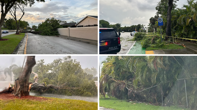
Meteorologist Nic Merianos said 1.5 to 3 inches of rain had fallen over the area over a two-hour window, enough to produce urban and poor-drainage street flooding.

May comes to a humid and hot end, but today's a great day to stay cool.

We'll see similar patterns increasing everyday through next weekend.

Communities likely to experience heavy rain, reduced visibility, and ponding of water on the roads include Fort Lauderdale, Pompano Beach, Hollywood, Aventura, and nearby coastal communities.

Keep an eye on the rip current risk because it will be high at the beach!

The NEXT Weather Team is tracking another hot and humid day across South Florida on this Sunday Funday. The high humidity and extensive sunshine will make it feel like it is in the mid- to upper-90s across the metroplex and the lower Keys.

We could see small, pop-up showers throughout the holiday weekend.

Temperatures are jumping up in South Florida this weekend. Stay hydrated for all outdoor plans for Memorial Day weekend, and keep the rip current risk in mind!

The rain will continue through Wednesday, with a short break on Thursday and Friday.

South Florida is expected to see hot and humid conditions through Mother's Day, with feels-like temperatures reaching the upper 90s before rain showers return.

Temps are in the 90s across South Florida, so be aware of heat risks and ensure everything and everyone is out of the car when you head out. Here's the forecast.

The entire region is under a Level 1 Flash Flooding advisory. We can expect to see some minor street flooding in urban areas.

Rain chances roll back in on Sunday, but we dry out later in the week.

Patchy dense fog is reducing visibility inland Monday morning, with scattered afternoon storms expected before a hotter, drier pattern settles into South Florida later this week.

Be mindful of a high rip current risk if you're planning a beach day!

Spotty showers will move through South Florida on Easter Sunday with a midday break, before a wetter pattern brings heavier rain and possible storms later this week.

The region will see more than an inch of rain over the next two days, with most of it falling in inland parts of Broward County.
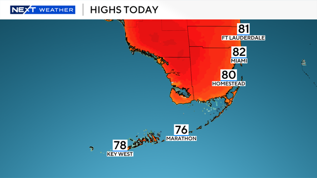
Temperatures start mostly in the upper 50s and lower 60s but will eventually climb into the lower to mid-80s for Sunday afternoon.

The dry stretch will last through Thursday when a front moves through and brings rain back to South Florida.

After setting a record-high minimum temperature in Fort Lauderdale on Friday, temperatures will be in the low 80s, which is higher than normal for this time of year.