Another record high likely Tuesday before a strong front knocks us back into winter
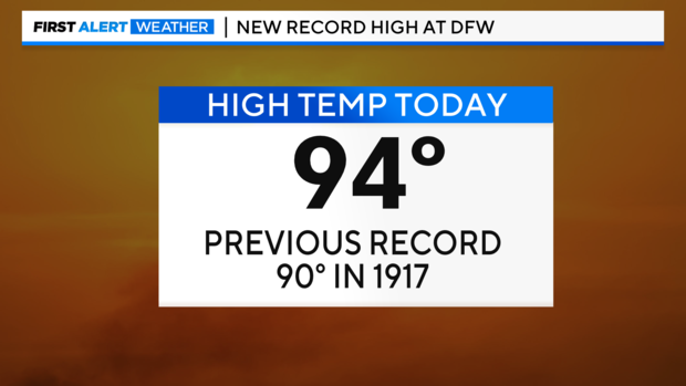
NORTH TEXAS - We did it, you guys! DFW hit 94° this afternoon - a new record for February 26!
We've got another record-high forecast for Tuesday. The current record sits at 85°, set back in 1918. Why not break another 100+ year record before Mother Nature reminds us she's in charge and knocks us back to winter temps by midweek?
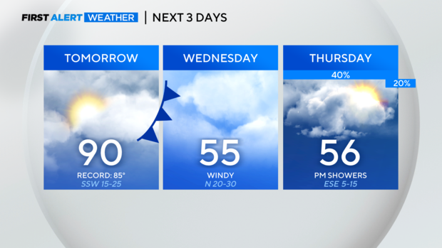
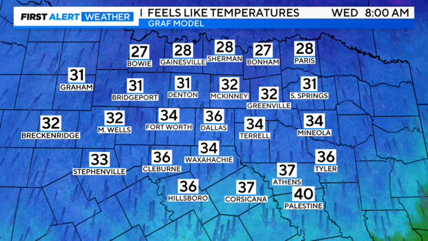
Not only will Wednesday be much cooler, but it'll be windy. Wednesday morning could have wind chills in the upper 20s for some and 30s for most others.
Once we get to Thursday, we're expecting scattered showers to return to North Texas. The rain should generally be light, but clouds and rain will keep temperatures on the cooler side.
By Friday and into the weekend, temperatures warm back to the 70s and 80s. What a start to March!
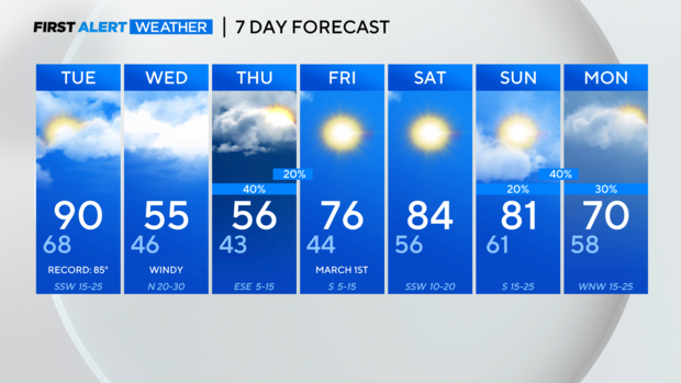
We'll watch for some showers and storms Sunday night into early Monday morning. By Monday afternoon, it should be mostly sunny and pleasant with highs back to near 70°.


