Morning storms, temperature drop expected on Saturday's First Alert Weather Day
This is the weekend we turn the clocks forward. We lose an hour of sleep, but nighttime holds off until later on Sunday.
Watch CBS News
This is the weekend we turn the clocks forward. We lose an hour of sleep, but nighttime holds off until later on Sunday.

Saturday is a First Alert Weather Day due to the chance of storms and a near 30 degree drop in temperatures.

On Saturday, a cold front brings rain and an isolated strong-to-severe storm threat.

More than 350 residents had to be evacuated from two apartment buildings in the city.

A weekend cold front will bring rain to the region on Saturday, with below-average temperatures for the weekend.
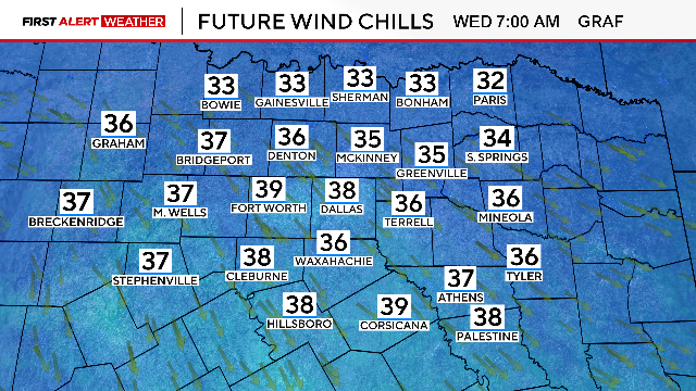
On Wednesday, the winds will be blowing but not as hard.
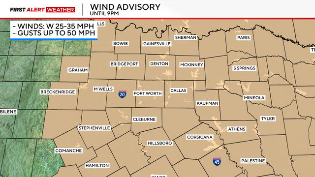
A First Alert Weather Day is in effect Tuesday due to the strong, severe storms followed by a windy afternoon.
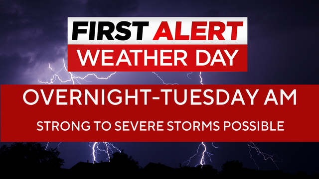
Strong to severe storms are expected over North Texas in the early morning hours Tuesday, sparking a First Alert Weather Day.

A First Alert Weather Day is issued for the Monday overnight hours heading into the Tuesday morning commute.
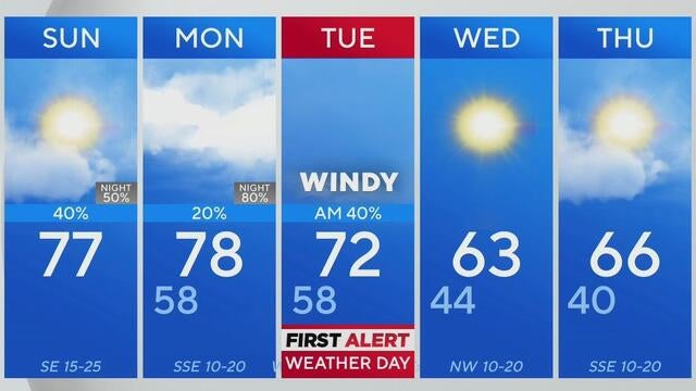
After a cloudy start, North Texas will see a sunny Sunday afternoon ahead of showers and severe storms late Monday into Tuesday.
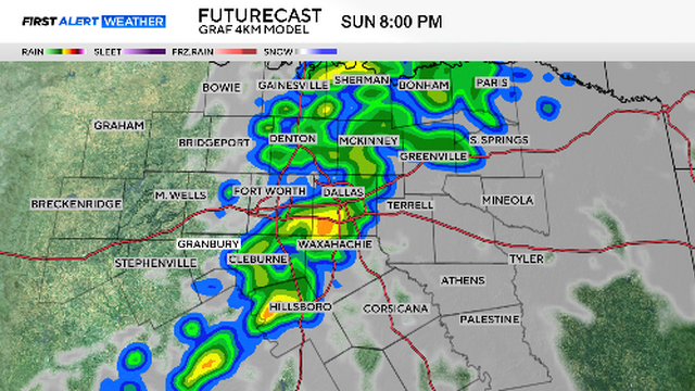
Expect a very windy day on Tuesday, with fire danger statements and wind advisories likely to be issued.

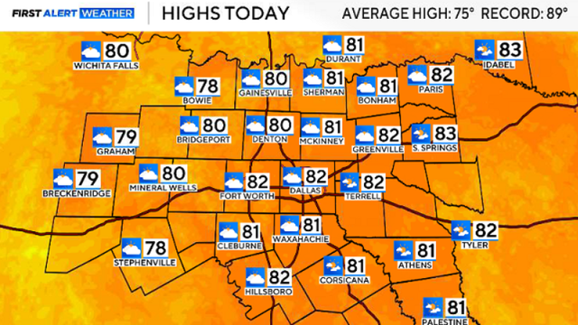
North Texas is enjoying lots of sunshine this Saturday, with temperatures climbing into the upper 70s.
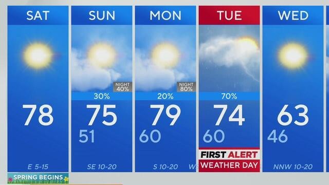
Spring weather is here in North Texas, bringing beautiful blooms and mild temperatures.
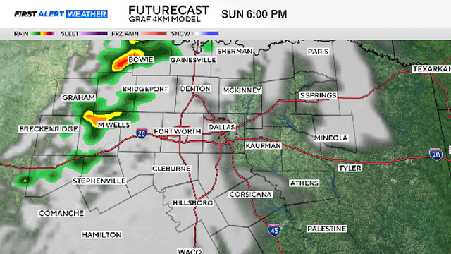
First Alert Weather Day for Tuesday: Risk of damaging winds and large hail in the first half of the day.

North Texas will enjoy a beautiful Friday with abundant sunshine and warm temperatures in the upper 70s — but rain chances will increase by Sunday.
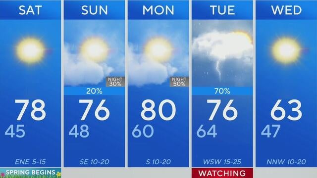
Enjoy a bright, pleasant Friday in North Texas with temperatures reaching 78 degrees and light winds to close out February.

After spotty showers and a cold front, North Texas will enjoy nice weather Thursday, with temperatures warming to the upper 60s and low 70s.

North Texas will experience a warm, sunny day before a cold front brings increasing clouds and a slight chance of rain.
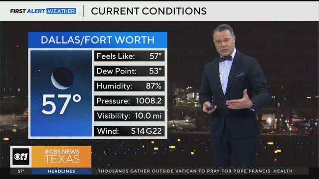
North Texas sees mild temps and sunshine Wednesday, with highs reaching into the upper 70s before a cold front brings a slight chance of rain.

A dense fog advisory has been issued for half of North Texas for Tuesday morning, including Dallas County.

A weak disturbance brings morning rain to the Metroplex, but clearer skies and warmer temperatures are on the way.
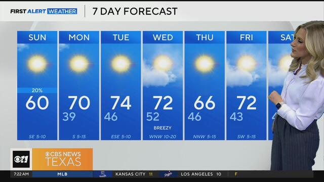
Light rain exits the Metroplex by late Sunday morning, making way for sunnier skies and rising temperatures.

After a chilly start, North Texas will see plenty of sunshine and warmer temperatures this weekend, with highs reaching the 60s.
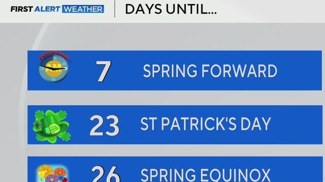
After a freezing Saturday morning, temperatures will gradually warm up across North Texas.

The Metroplex will see afternoon highs in the mid-30s on Friday afternoon.