Cloudy, windy, warm Monday kicks off week with potential for multiple storms in North Texas

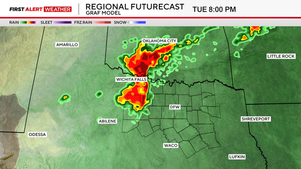
On Monday, winds will be breezy, gusting up to 30 mph, pumping more moisture into the region, which will ultimately aid in shower and storm development Monday evening.
We also have a dryline, currently sitting in West Texas, which will help provide some of the lift necessary for thunderstorms to fire up Monday evening and night.
If storms do initiate, they will likely be very strong and could contain large hailstones. The Storm Prediction Center has issued a level 3 out of 5 threat for severe storms Monday night for counties northwest of North Texas and pushing to the east overnight.

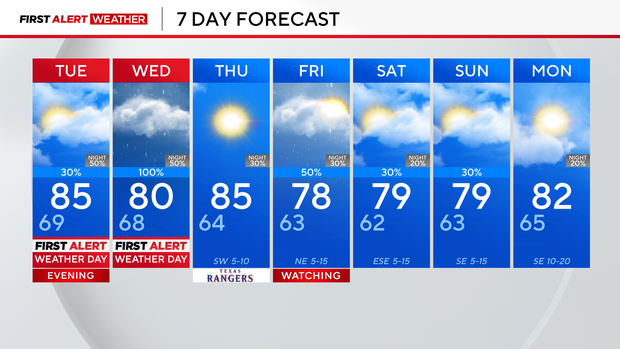
In addition to Monday's risk, First Alert Weather Days are in place for Tuesday evening and Wednesday for the risk of severe storms and flooding. We look to remain dry most of the daytime hours on Tuesday, with another round of thunderstorms developing Tuesday evening and night.
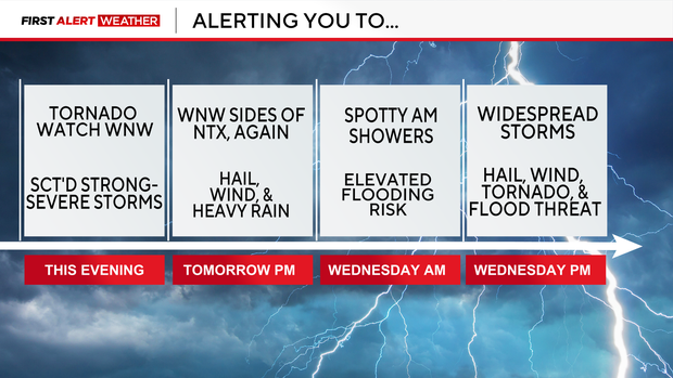
The SPC issued a slight risk for Tuesday night northwest of the metroplex, indicating scattered severe storms will be possible.
By Wednesday, we'll be looking at scattered showers during the morning, with an isolated rumble of thunder.
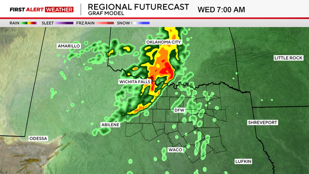
The strongest storms will be in the afternoon through the evening.
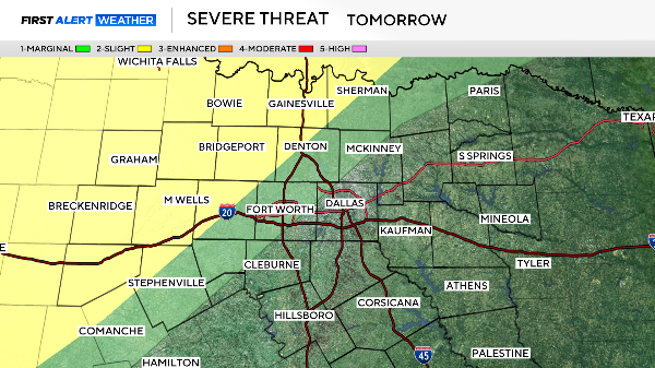
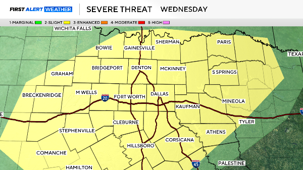
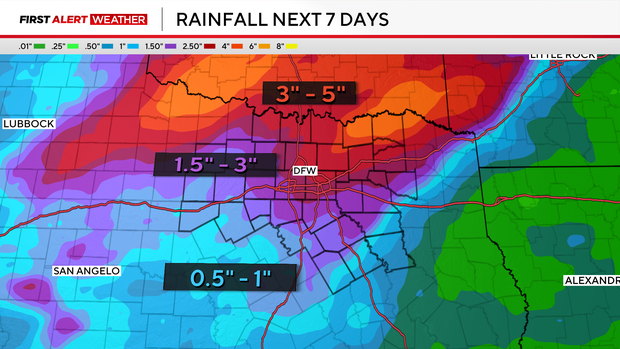
The Storm Prediction Center has all of North Texas under a 2-out-of-5 risk for severe storms, with all threats on the table. We'll also be dealing with an elevated flood risk by this point, with heavy rains falling on soggy soils.
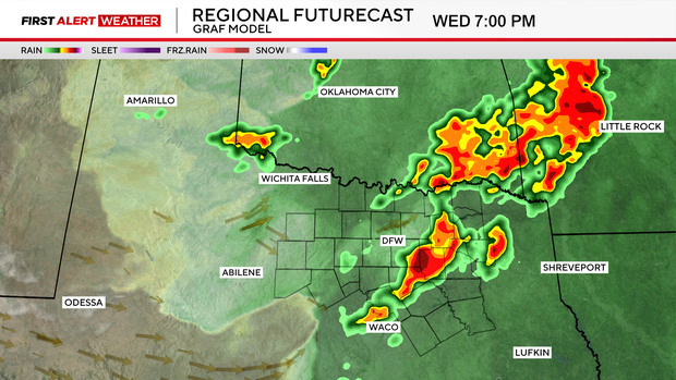
The main concern is large hail, damaging winds and heavy rain leading to flooding. However, there is a possibility for a tornado or two, especially on Wednesday.
We get a brief break Thursday, with sunshine and highs in the mid-80s. We'll then be looking at scattered storms once again Friday, followed by isolated storm threats into the weekend.
Make sure you're staying weather aware the next several days, and the First Alert Weather team will bring you up to speed as things shake out.