Warm and humid in North Texas before storms arrive overnight

High pressure dominated our forecast in North Texas on this Monday, giving us a sunny and fairly seasonable day.
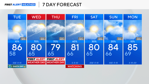
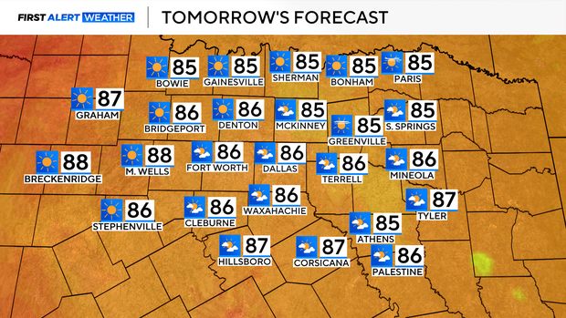
By Tuesday, our southeasterly flow is going to work to transport more moisture into the region, which helps to bring the threat for some fog and low-level cloud coverage during the morning, which should lift into the late-morning and afternoon. It will also give us a more humid feel, sending temperatures into the mid-80s on Tuesday afternoon.
We'll see a good bit of sunshine during the afternoon, then clouds return during the evening and overnight as a dryline starts to approach the area.
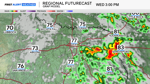
This brings the threat for a few thunderstorms overnight and into Wednesday morning, weakening as it travels close to and east of I-35.

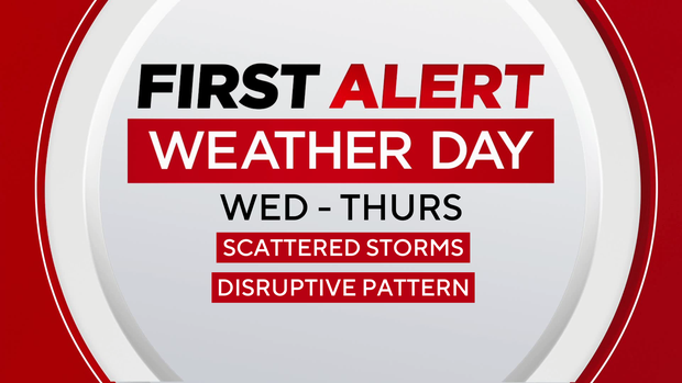
This marks the beginning of an active weather period in North Texas. We'll see near-daily thunderstorm chances, with the greatest coverage looking to be Wednesday and Thursday.
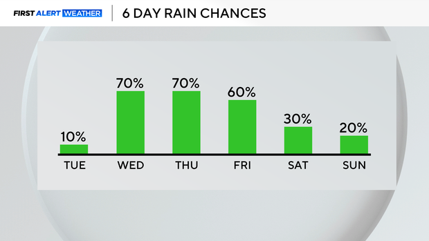
Scattered storms are expected on both days, with isolated chances for severe weather, primarily for wind and hail. Because of the disruptive weather, we have issued First Alert Weather Days for Wednesday and Thursday, although widespread severe storms are not expected.
Rain chances lower as we head into the weekend, with just isolated shower chances for Saturday and Sunday. Temperature-wise, we remain close to normal for this point in the year.